Search Results
277 results found with an empty search
- “Jellyfish Truly Embody Being Stressful, Fun, Therapeutic, Work, & Rewarding All At The Same Time!”, An Interview With Cnidarian Aquarist & Water Quality Monitor Jeffrey Dotzler III
Recently, we were extraordinarily fortunate to interview Jeffrey Dotzler the III, a Cnidarian Aquarist & Water Quality curator, for a short interview about his work on Jellyfish! Jeffrey Dotzler is a curator of Cnidarians & monitor of water quality at the Cabrillo High School Aquarium, located in Lompoc California. The Cabrillo High School Aquarium is an entirely unique facility, run out of Cabrillo High School, with a volunteer staff of 200 dedicated & passionate high schoolers. In today’s interview, we sit down with Jeffrey to discuss his experience with Jellyfish, his advice for people looking to begin their journey in taking care of jellyfish, & his observations in taking care of them. Before delving into today’s interview, please note everything said has been edited for clarity, & that the opinions of our interviewee do not necessarily reflect the opinions & values of our organization. With that being said, let us delve into the contents of the interview! The Contents Of The Interview Questions About His Passion: 1. What sparked your passion for marine biology and aquariums, & is there any particular thing, such as a person, place, book, or franchise, that sparked your passion? When I got to Cabrillo, I had always heard about the Aquarium program, as they do many tours for grade levels from TK up to 8th grade. When I was younger, I went on a tour of Cabrillo High School Aquarium, & did a lab activity, & it was amazing! It can be a very big moment in someone’s life to get to see these animals up close, & many people don’t have that opportunity to connect with the ocean in this way. 2. When did you begin your work at the aquarium? So I began my work in my junior year, when I joined our Introduction to Aquarium Sciences class, as the majority of freshmen are not allowed to take the class. It’s a highly interesting job working as a student & running an aquarium, we do so many different things. We do everything from feeding the animals, prepping the food, monitoring the water quality, & maintaining the aquariums, which includes the tanks themselves, the substrate, & everything in between. 3. What is your favorite animal, & what is your favorite cnidarian? My favourite animal overall is not an animal from the aquarium, it is based on an experience that I had when I was younger. I was taking a walk down Carpinteria beach when I was younger, which is a beautiful beach by the way. We were walking down & I was simply messing around, as children do, when I saw a plastic bag in a drainage ditch. I went over to pull it out of the water because you don’t want that in the ocean, & noticed something colourful inside. That colourful thing turned out to be a Spanish Shawl inside the bag, wrapped around a piece of rebar. We put the nudibranch inside a cup, & carried it over to a Tide Pool which was further out, & placed it there. Ever since then, they have been my favourite creature. A flamboyant Spanish Shawl nudibranch gliding along the ocean floor contentedly searching for food. Credit to the photographer Jerry Kirkhart. My favourite Cnidarian to work with so far has been the Moon Jelly, Aurelia aurita. For a while I would give tours of our Jellyfish tank, & learned a bit about them in the process, They are such fascinating creatures! Questions Regarding Your Work: 4. How did you begin your work on cnidarians? I did not begin my work on Cnidarians until my Junior Year when I began giving tours. The position of a Cnidarian Curator, or a curator of any kind, is earned through hard work in our aquarium. It is not only earned through the quality of your work & quantity of your hours, but it is also earned through an interview process with our staff advisors. When I applied for the position of Curator, the position of Cnidarian Curator had not been created yet. We had Jelly curators of course, however not anyone specializing in Cnidarians broadly. I find the entire phylum of Cnidaria to be intensely fascinating, because you have your true jellyfish, your box jellyfish, your corals, & your anemones. We got our gorgeous tropical reef exhibit in my junior year, which has a very large coral reef. It is a beauty of a tank. It can be some more work, as it is warm water which is slightly different then water which we are used to, but with the work these students have been putting in, it is well worth it. Now we are installing our tropical fish gallery, we have many new tanks coming in courtesy of the Monterey Bay Aquarium. It has been quite the journey. Anyway, Cnidarians are highly interesting to me, which is why I pursued the title of Cnidarian Curator. 5. How many cnidarians do you have at the aquarium, & what are their habitats? Our Cnidarians at the aquarium range from our corals to our anemones, to our jellyfish. We currently have 2 jellyfish display tanks on our main floor, containing our South American, Sea Nettle, & Pacific Sea Nettles. Our corals are located in our tropical reef exhibit, which is a large rectangular tank housing a variety of tropical species. Our anemones are housed in our touch tanks which are quite fun, & don’t require as extensive cleaning but that's another story. We also have them in our wave tank, which is a tank that mimics an intertidal zone by having a large wave come through on a timed setting. It showcases the push & pull that intertidal animals deal with. Those are the main Cnidarians in our aquarium, sadly I don’t have an exact number of species or individuals. We have also had a highly interesting project going on this last year, of strobilating jellyfish, headed by Gavin Rodriguez. We have been strobilating moon jellies for the last few months in-house, which recently moved into our tanks from our marine biology laboratory. It will be interesting to see the long-term results The life cycle of jellyfish begins when two adult Medusae release their gametes, sperm & eggs, into the water around them. These gametes will then meet, & form a larva. This larva will implant itself into the sediment, & form a polyp. A polyp strobilates when it begins to segment, then pop off into several discs, known as ephyra, which will then grow into adult medusae. 6. Jellyfish are a fan-favorite at the aquarium, what is your caretaking experience with them, & what advice do you give those looking to learn more about jellyfish? My personal experience with Jellyfish has been a bit of a journey because there was a learning curve due to their extremely delicate nature. With many other tanks you have animals which tend to stray away from you during cleanings, & caretaking of the tank, however, jellyfish behave differently. First of all, Jellyfish are floating around you, & will not move away from you, meaning that you have to be extremely attentive. You have to be careful not only with your tools, but with the formation of air bubbles, as air bubbles can cause severe damage to the jellies. Even the slightest touch can form a tear in their outer membrane, so we have to take careful diligent care when working with them. For anyone looking to learn more about them, I highly recommend visiting one at your local aquarium which may be difficult in some parts of the country. Go find these jellies, & learn a little bit about them from your local aquarists. 7. For those who don’t have much experience with Jellyfish, how would you describe them? For those who don’t have much experience with jellies, I would describe them as very jelly-like. They are very beautiful, it just depends on how one is viewing them. I have had the amazing experience of seeing jellies out in the ocean, it’s a lot different to see them in the ocean than it is in an aquarium. They can be truly breathtaking. I also find their way of moving through the water to be rather captivating, it’s mesmerizing. 8. If you could summarize your experience with the caretaking of jellyfish in 5 words; what would those words be? The first word that comes to mind is definitely stressful, they can be extremely stressful. However, they can also be quite fun, & therapeutic in a way. Work also comes to mind, they can be very rewarding. Although all of these words might seem contradictory, they truly embody being stressful, fun, therapeutic, work, & rewarding all at the same time. 9. Do you have any final words regarding the aquarium, jellyfish, & your experience taking care of them? I’m so thankful for the program, & for the opportunity to be a part of it. I’m very thankful that you (Our Head writer!) came out to be a part of the community, & to share this message with the world. It has been an honour. Directories / Credits https://www.cabrillohighschoolaquarium.org Strategic Partnerships Reel Guppy Outdoors SharkedSkooler Marine Enthusiasts Podcast Cash Daniels Tides of Tomorrow Our Loyal Patrons P. R. Ochoa
- The History Of The Swaraj Dweep / Havelock Island, India - An Island of Beauty
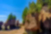
A brilliant photograph of a resort on Havelock Island, specifically at Radhanagar Beach. Credit to Seashell Hotels. This month's article series will be discussing the beautiful & esteemed Havelock Island of India’s Andaman Sea. Havelock Island is approximately 324.26 nautical miles (373.151744 miles, or 600.52952 kilometers) off the coast of the mainland country of Thailand. Havelock Island gets its name from Sir Henry Havelock, was British Major-General who served in India. Havelock Island is a part of the Ritchie Archipelago, in the Western Central Andaman Sea. It is important to mention that the Andaman Sea is located in the eastern Bay of Bengal. Due to its location, the island's primary language is Bengali. The island was recently renamed to Swaraj Island, but for this article, we will refer to it as Havelock Island. Havelock Island is most well known for its beautiful beaches, forests, & exquisite marine life. The island is surrounded by coral reefs, which are incredibly biodiverse. The thickly wooded forests on the island clash with the sandy beaches, which create a beautiful & unique environment. These coral reefs are fringing, & can be seen by all who roam the beaches. Snorkelling & Scuba diving are extremely popular for this reason, so much so that this island is widely considered a small slice of paradise. In addition to the island having beautiful oceans & forests, the island has interesting hillsides. The island's highest point of elevation is 167 meters (547.9 feet) high, & is called Yulutang. The island has a population of approximately 6,351, 84% of which are literate. With 92.2 square kilometers (35.59862 square miles) of land, the island has a population density of 68.88286334056399 people per kilometer (178.4057921346389 people per square mile). The majority of the people on the island live in the largest town on the island, which is Govinda Nagar. The government of the Nicobar Islands does have a website, which is http://andaman.nic.in/ . This website is for the entire administrative region, not just the island itself. The website is in English. In this article, we will discuss the history of Havelock Island, the documented aboriginals of Havelock Island, the Most Destructive Man-Caused & Natural Disasters affecting Havelock Island, & the Economic state of Havelock Island. With that being said, let us delve into the history of Havelock Island. The Documented History Of Havelock Island Before Colonization The first people to live on the island were the Onge, & Jawara Aboriginals. Both of these Aboriginals placed a heavy emphasis on connection with nature & the land. These tribes cultural influence can still be seen around the island in various ways. After Colonization By The British Historical Events From The 1800s Havelock Island was discovered by the British, & was made a British Colony along with the rest of the Andaman Islands. A nearby island known as Ross Island had a penal colony established on it, which impacted the economic & infrastructural growth of Havelock Island. The British created roads, buildings, & water supply on the Island. Historical Events From The 1900s Starting in the early 1900’s, the island began building an economy on tourism. The islands coral reefs, beautiful forests, & fantastic beaches attracted many tourists. The government recognized the potential of this, & began building government hotels, restaurants, & resorts. The rest of the historical events from this century will be under the subsection “After Indian Independence”, as India gained its freedom in 1947. After Indian Independence On August 15th in 1947, India gained its independence from British Rule. This helped the local government have more autonomy, & which in turn caused more infrastructure to be built. Aside from the tourism industry growing, very little else has happened for the small Havelock Island. The Aboriginals Of Havelock Island The Onge Tribe Of Aboriginals The Onge are a group of Andamanese Islanders who are native to the Nicobar & Andaman Islands. Unfortunately, very little of their once-thriving villages are left as the majority of them were destroyed in the 1940s. Before the British & Indian occupation, they were the only natives on Havelock Island. Their population is currently estimated at 120, a far cry from their once prosperous population of 670. They called Havelock Island, “Goubalambabey”. The majority of this population lives on a small reservation at Dugong Creek. Their diet largely consists of wild boar, wild fish, & various kinds of plants. They also collect honey in the forests, for both consumption & artistic purposes. Currently, they are extremely dependent on the Indian government for food rations, medical, & hygienic supplies. As a part of their culture, they chew bark to turn their teeth red, & they use white & ochre clay to paint themselves in a beautiful artistic tradition. There is no traditional Onge religion, & the majority of Onge today are not religious. They do, however, believe in spirits, & worship nature. Additionally, as a population, they lack medical resources, & have a high infant mortality rate. Unfortunately, the Onge culture is at risk of extinction as a result.. Hopefully, they can navigate these perils, & are allotted better resources & rations. The Most Destructive Man-Caused & Natural Disasters To Affect Havelock Island Disaster No. 1: 2004 Indian Ocean Earthquake & Tsunami On December 26th of 2004, a 9.1 magnitude earthquake struck off the Northern coast of Sumatra, Indonesia. This event was caused by a rupture along the Burma & Indian tectonic plates. This caused a massive tsunami, which destroyed parts of the harbour on the island, as well as affecting some coastal housing. The tsunami destroyed the mangroves temporarily, & caused many families to be displaced. Unfortunately, there are no statistics as to how many injuries or deaths occurred as a result of the tsunami & earthquake. This event was without a doubt, the worst natural disaster to affect Havelock Island in recent years. A photograph of the destruction immediately following the 2004 Indian Ocean Earthquake & Tsunami, taken in mainland India. Credit to World Atlas. The Economic State Of Havelock Island The economy of Havelock Island is extremely tourism-based. There are a few horticultural products that are exported, such as betel nuts, but they are exported in very low quantities. Generally, Havelock island is a middle-class island, & is not extremely poor, however, it is not very rich either. The island’s products are slightly expensive compared to mainland India, because the island has no production means of its own. Everything on the island is imported to Port Blair, the administrative capital of the Nicobar Islands, & then is shipped to the Island. Directories / Credits Citation No. 1: “Brief Overview of Havelock Island's location and significance”, Written by Unknown, & Published at an Unknown Date. Published by the Andaman Islands. Retrieval Date: November 17th, 2023. https://www.andamanislands.com/content/about-havelock-island Citation No. 2: “Havelock & Neil Islands”, Written by Unknown & Published at an Unknown Date. Published by India A2Z. Retrieval Date: November 17th, 2023. https://www.india-a2z.com/havelock-and-neil-islands.html Citation No. 3: “The Onge” Written By Unknown & Published at an Unknown Date. Published by Survival International. Retrieval Date: November 17th, 2023. https://www.survivalinternational.org/tribes/onge Citation No. 4: “Havelock Island” Written by Unknown & Published at an Unknown Date. Published by Yatra. Retrieval Date: November 17th, 2023. https://www.yatra.com/amp/india-tourism/havelock-island/people Citation No. 5: “The Onge” Written By Ajita & Published on September 26th of 2022. Published by Medium. Retrieval Date: November 17th, 2023. https://medium.com/the-collector/the-onge-62a525e35fb9 Strategic Partnerships Reel Guppy Outdoors SharkedSkooler Marine Enthusiasts Podcast Cash Daniels Tides of Tomorrow Our Loyal Patrons P. R. Ochoa
- Marine Biological Hall Of Distinction: Prerana Gawde
A gorgeous photograph of Marine Biologist, Maritime Heritage Specialist, Zoologist, Fisheries Biologist, & Conservationist Prerana Gawde next to the coastline, smiling brilliantly. Credit to The Interview Portal & Prerana Gawde. This article is part of our collection known as the Marine Hall of Distinction. In this special collection, we will discuss marine biologists who have served marine biology and oceanography the most. We do this to commemorate these marine biologists and show gratitude for everything they have contributed to our oceans. Today's marine scientist is Prerana Gawde. Prerana Gawde is an Indian Marine Biologist, Ecologist, & Ph.D. student at Stanford University. She is an emerging scientist who is known for her own at the Dakshin foundation in India, a foundation primarily dedicated to environmental research & social justice related to the ocean. In today's article, we are going to be discussing Prerana Gawde’s formative years & education, her personal life & career, & finally her achievements, honors, & awards. With that being said, let us plunge into today's article! Bottlenose Dolphins, a kind of Inshore Dolphin, which Prerana Gawde is conducting research into. Credit to The Marine Mammal Center. Her Formative Years & Education Prerana Gawde was born in the late 1980s or early 1990s, in Mumbai, India. As a juvenile, she kept to herself, & would often find herself lost in contemplation. Her parents drove her to be an independent, self-sufficient, liberal young woman, & pushed for her to get an education as possible, not only in an academic sense. She dove into non-fiction books as a hobby, & swam throughout her neighbourhood in freshwater pools. In addition to this, her mother would impart her adoration & appreciation of nature onto her. Both would serve her well in her future career. Of all of these things, one specific interaction with her 8th-grade Science Teacher set her on her track towards biology. One day, after receiving her biology paper back from her then biology teacher Ms. Selvaraj, she noticed a written note saying “Very Good!”. It was this small piece of praise which inspired her to explore biological sciences, & so to speak, catapulted her into a sea of science. In addition to this, she began taking a course with the University of Mumbai’s Department of Extra Mural Studies, a center for extra courses that the general populace can take to learn more about various interesting subjects, for a certificate. This course introduced her to new people from a diversity of backgrounds, & introduced her to scientists, zoologists, & naturalists across disciplines. It is also one of the key factors that pushed her to become a marine biologist, & naturalist. After completing her High School education, she began studying Zoological & Biological Sciences at the University of Mumbai in 2009, Her time was filled to the brim with lectures, coursework, & exam preparation, however, she felt unfulfilled. She had 5 continuous years of rigorous studying in a formal setting discussing everything there was about Zoology, however, very little field experience. This itch to get hands-on experience in the field led her to become PADI-certified as a Scuba Diver, her first step into the underwater world. This certification landed her a position as a Scuba Diving Instructor in the Andaman & Nicobar Islands, & helped formally spark her interest in the field of Marine Science. After her time as a Scuba Diving Instructor, she decided to pursue her Master’s degree, & as such, began pursuing a Master’s Degree in Marine Sciences at James Cook University in Australia in 2016. She realized that its proximity to the Great Barrier Reef would allow her to learn more about the ocean, & leapt at the opportunity. She would go on to graduate in 2018. She is currently pursuing her P.h.D at Stanford University in California, studying interdisciplinary research frameworks to study maritime heritage within marine ecosystems, which studies human cultural, & historical interactions with the ocean as it relates to marine ecosystems. This includes studying historical fisheries & their impacts on marine ecosystems, historical mariculture, cultural fishing tactics, & marine animals as cultural symbols. A photograph of Prerana Gawde on a diving expedition near the Andaman & Nicobar Islands of India, with small reddish grey fish schooling around it. Credit to Prerana Gawde. Her Career & Personal Life In her interval between her Master’s Degree & P.hD, she found herself in an odd situation of not being a student, yet yearning for more field experience. So, she began sending emails to professors all around India, until one fateful interview led her to Professor Kartik Shanker of the Indian Institute of Science, & Dr. Naveen Nambroothi of the Dakshin Foundation. The Dakshin Foundation is a nonprofit organization dedicated to conserving India’s environment, & environmental justice. A large part of environmental justice revolves around exploring human relationships with the environment, something Prerana was already interested in. Seeing potential in her, Professor Shanker offered her a volunteer role at ANET however her family was hesitant to allow her to go. Finally, her sister explained that she should be allowed to forge her path in the world, & her parents accepted this opportunity & encouraged her to take the position. After finishing her volunteer role at ANET, she was inspired by a fellow researcher, Mahima Jaini, to stay in the Archipelago. She worked odd jobs as a receptionist & as housekeeping staff for a resort, before becoming a divemaster for a Scuba Diving Agency. This role would give her the experience necessary to return to India after her Master’s Degree in Australia, & finally begin her work with the Dakshin Foundation. Beautifully, the project which she returned to work on was initiated & managed by the very researcher who inspired her to stay, Mahima Jaini. In her studies, she specifically studied small-scale pole & line tuna fisheries, a prominent source of income in the local economy. She studied a specific kind of bait fish, a fish used to bait large predatory fish such as tuna, as the stock of bait fish must be sustainable for the tuna fishery to be sustainable as one depends on the other. She studied the stock of bait fish, developed protocols to help locals ensure sustainability in bait fish stocks, & assisted in the creation of a bait fish map to assist local fishermen & ensure that no one population was being targeted. This helped strengthen her interest in studying human relationships with the ocean, an often destructive & sadly understudied topic. Prerana Gawde is currently studying for her P.hD at Stanford University in Southern California, studying interdisciplinary research frameworks for maritime heritage within marine ecosystems. An incomplete chart of Prerana Gawde’s career journey, beginning with her time at Mumbai University, & ending with her work at the Dakshin Foundation. This chart does not include her current work at Stanford University, any of her volunteer work, or any of her recent publications. Full Credit to Rukhmabai Intiatives, Pragya Solanki, & Sanjana Chevalam. Her Awards, Achievements, Accomplishments, & Honorables She earned the Best Researcher Award for her work in Maritime Heritage at the International Research Data Analysis Summit. She did valuable work on small-scale fisheries in the Andaman Islands with the highly esteemed Dakshin Foundation. She is pursuing a P.hD at one of the most prestigious universities on Earth, Stanford University of Stanford, California. She has 4 scientific publications as of now, including a publication in the prestigious International Journal of Historical Archaeology. During the COVID-19 Pandemic, she worked with multiple organizations to assist with delivering food, transportation, water, & medicine to coastal communities & families across India, including the HelpAge India Foundation. Directories / Credits Citation 1: “Ms. Prerana Gawde | Maritime Heritage Ecology | Best Researcher Award”, Written by Unknown, & Published at an Unknown Date. Published by the International Research & Data Analysis Summit. https://researchdataanalysis.com/prerana-gawde-maritime-heritage-ecology-best-researcher-award-2861/ Citation 2: “Marine Biologist Interview”, Written by Shyam Krishnamurthy, & Published on October 30th, 2024. https://theinterviewportal.com/2024/10/30/marine-biologist-interview-5/ Citation 3: “Prerana Gawde”, Written by Unknown & Published in September of 2024. Published by Stanford University. https://oceans.stanford.edu/people/prerana-gawde Citation 4: “Exploring the depths: The adventures of a marine biologist”, Written by Sanjana Chevalam and Pragya Solanki, & Published on September 18th, 2023. Published by the Rukhmabai Intiatives. https://rukhmabai.com/adventure-driven-young-researcher-in-stem/ Strategic Partnerships Reel Guppy Outdoors SharkedSkooler Marine Enthusiasts Podcast Cash Daniels Tides of Tomorrow Our Loyal Patrons P. R. Ochoa
- The Oceans Surrounding Havelock Island, India
This month's article series will be discussing the beautiful & esteemed Havelock Island of India’s Andaman Sea. Havelock Island is approximately 324.26 nautical miles (373.151744 miles, or 600.52952 kilometers) off the coast of the mainland country of Thailand. Havelock Island gets its name from Sir Henry Havelock, was British Major-General who served in India. Havelock Island is a part of the Ritchie Archipelago, in the Western Central Andaman Sea. It is important to mention that the Andaman Sea is located in the eastern Bay of Bengal. Due to its location, the island's primary language is Bengali. The island was recently renamed to Swaraj Island, but for this article, we will refer to it as Havelock Island. Havelock Island is most well known for its beautiful beaches, forests, & exquisite marine life. The island is surrounded by coral reefs, which are incredibly biodiverse. The thickly wooded forests on the island clash with the sandy beaches, which create a beautiful & unique environment. These coral reefs are fringing, & can be seen by all who roam the beaches. Snorkelling & Scuba diving are extremely popular for this reason, so much so that this island is widely considered a small slice of paradise. One of the beaches with the most coral is Elephant Beach, which is located in the northwestern area of the island. Thankfully, the island is not very polluted, so the coral can be seen from the shoreline. Many creatures ranging from small crustaceans to large cuttlefish can be found roaming the shallower areas, & even more can be found in the deeper ends. These beaches & reefs are not only a source of beauty on the island, though, they are a source of great economic prosperity. One of the island's main economic sectors is eco-tourism. Eco-tourists are not just interested in the reefs, though; they are interested in the beautiful, lush forests of Havelock Island. A lovely photograph of a white sand beach along the shores of Havelock Island. Credit to Andaman Island. In this article, we will discuss the Discovery & Life, the Mating Procedures, Practices, Cycles, Tactics, & Strategies, the Distribution, & the Scientific Detailings of the Broadclub Cuttlefish. With that being said, let us delve into this sleepy little island. The Tides, Temperatures, Salinity, Marine Geography & Basic Information Of The Oceans Surrounding Havelock Island Unfortunately, the Salinity of the water surrounding Havelock Island has not been measured as of 2023. Though we do not know the salinity of the waters directly surrounding the island, we do know the salinity of the Indian Ocean. The average Salinity in the Indian Ocean is 34.5 parts per thousand, & can range from 32 to 37 parts per thousand. It is unclear if there are any salt deposits, but more than likely, there are not. Salinity is measured in 1,000-gram water samples. For every 1000 grams of water, there will be a certain number of grams that are pure salt. This is the way that salinity is currently measured. The oceanic temperature charts can be found on a plethora of websites, including but not limited to: https://seatemperature.info , https://seatemperatures.net , & https://www.watertemp.org . The average yearly temperature is 28.966666666667 Celsius (84.1400000000005548 Fahrenheit). For diving in this temperature, there is no wetsuit recommended, & the majority of people can swim in regular swimming suits. The tidal charts can be found on similar websites, which include: https://tideking.com , & https://www.worldbeachguide.com . The tides & surf are not extremely high, & usually do not go over 3.3 meters tall (10.8268 feet). The island does not seem to have any bad currents or riptides that would be dangerous to swimmers. The primary reason for there being a lack of currents is that the coral provides a natural boundary, & softens the effects. The island does not have dangerous levels of oceanic pollution, & is perfectly safe to swim, snorkel, scuba dive, or do oceanic activities in. Unfortunately, we are unable to find any oceanic maps that show the depth of the waters surrounding the island or what the marine geography is like. Some of the highest ranked beaches on the island are considered to be: Elephant Beach, Raghanagar Beach, Vijay Nagar Beach, Govind Nagar, Kala Pathar Beach, Radha Nagar Beach, & Nemo Beach. The Most Prominent Marine Ecosystems Of The Oceans Surrounding Havelock Island Ecosystem Type No. 1: Fringing Coral Reefs The coral reefs nearby are usually within 30 feet of surface level & are directly against the coastline. They are absolutely beautiful & attract millions of dollars in tourism each year. These areas serve as a home, a habitat, & a hunting ground for many creatures. Not to mention that the coral itself is alive. The types of coral reefs around Havelock Island are known are fringing coral reefs instead of barrier reefs. Unfortunately, coral is extremely susceptible to ocean acidification, as well as negative human activity. As of 2025, there are an estimated 179 species of coral in the Andaman Sea, distributed amongst 61 genera. Ecosystem Type No. 2: Seagrass Meadow There are small seagrass meadows found off the coast of Havelock Island. Approximately 7 species comprise these areas. Seagrass meadows are popular areas for breeding, fish spawning, mollusc spawning, & hunting. These seagrass meadows are usually in underwater mudflats, though they occasionally may be growing in sandy intertidal areas. Usually, seagrass meadows are not too close to the coast, as it is extremely difficult for them to grow in shallow waters. The Documented Marine Flora Of Havelock Island Unfortunately, the exact species of seagrass that grows around Havelock Island is unclear. Aside from seagrass, the oceans surrounding the island are known to have large algae blooms, which cause the water to temporarily turn green. There are mangrove trees around the island, the main species being Rhizophora Stylosa (Spotted Mangrove) & Bruguiera Gymnorhiza (Large Leafed Orange Mangrove). There are at least 10 species of mangrove, 7 species of seagrass, & 61 species of algae across all genera. The Documented Marine Fauna Of Havelock Island It is very hard to keep track of the marine life that are found around Havelock island specifically, because the majority of the creatures will frequently migrate between the islands. The islands share coral reefs, which enables these creatures to travel very easily. There are at least 1,200 species of fish, & 1,000 marine molluscs. How Ocean Acidification & Rising Ocean Temperatures Have Affected Havelock Islands Coral Reefs Ocean acidification is caused by increased levels of carbon dioxide in the atmosphere. Atmospheric carbon dioxide levels have increased, largely because of human-caused burning of fossil fuels, & deforestation, for the past 150 years. When carbon dioxide contacts seawater, it forms carbonic acid. Carbonic acid gives off positively charged hydrogen ions, which causes increased oceanic concentrations of positive hydrogen ions & decreased oceanic pH. When the ocean has decreased pH, it effectively acidifies. This can stress out coral & cause them to expel their zooxanthellae. Zooxanthellae are a small species of algae that live on coral, conduct photosynthesis, such that coral can reap the oxygen from, & provide coral with its bright pigmentation. When the coral becomes stressed & expels the zooxanthellae, the coral bleaches & eventually dies. Additionally, the general rising temperatures have caused the coral to be stressed out. If this continues, the robust reef system could be depleted by a large amount. This should be monitored closely, so that conservationists know when to act, & how to act. A gorgeous photograph of a fringing coral reef next to Havelock Island, Andaman Sea, India. These reefs are coming under increased pressure due to rising ocean temperatures & oceanic acidification. If we do not act, we run the risk of losing these foundation species, & all the animals that they support along with it. Credit to underwater photographer, Francis J. Taylor. Directories / Credits Citation No. 1: “Wetsuit thickness and temperature guide, Written by Mark Evans, & Published on April 24th, 2023, at 3:05 PM. Published By Scuba Divers Magazine. Retrieval Date: November 16th, 2023. https://www.scubadivermag.com/wetsuit-thickness-and-temperature-guide/#Scuba_diving_wetsuits Citation No. 2: “Best Beach In Havelock Island (2023 Edition)”, Written By the Go2andaman Editorial Staff, & Published on February 12th of 2021. Published by Go2Andaman. Retrieval Date: November 16th, 2023. https://www.go2andaman.com/best-beaches-in-havelock/ Citation No. 3: “Marine Flora of Nicobar Group of Islands in Andaman Sea”, Written By T. G. Jagtap, & Published on March 21st, 1991. Published by the National Institute Of Oceanography, Dona Paula. Retrieval Date: November 16th, 2023. https://drs.nio.res.in/drs/bitstream/handle/2264/2965/Indian_J_Mar_Sci_21_56.pdf?sequencey Strategic Partnerships Reel Guppy Outdoors SharkedSkooler Marine Enthusiasts Podcast Cash Daniels Tides of Tomorrow Our Loyal Patrons P. R. Ochoa
- Ode to Oceanography: An Antique Nautical Map Of The Northern Caribbean, Windward Islands, & Jamaica
Today’s map in the Ode to Oceanography series is a gorgeous, nearly century-old map of the Caribbean by mapmaker J. W. Norie. This chart covers the entirety of the northern Windward Isles, Haiti, the Dominican Republic, and parts of Cuba. It covers a very large part of the Gulf of Mexico and its surrounding areas, covering approximately 64,395 square miles (166,782 square kilometers). The map is in extraordinary condition, with every line as clear & crisp as the day that it was made. It includes a tremendous amount of information, both oceanic & topographic. It is approximately 37 inches from top to bottom, & 49 inches from side to side. In today’s article, we will discuss the map itself, & analyze this antique nautical map. With that being said, let us delve into the exquisite Windward Isles! An illustration of Santo Domingo, one of the oldest continuously inhabited cities in the Caribbean. It is prominently featured on the chart. The Map Itself An excellent map of the Northern Caribbean region covering the Greater Antilles in great detail. Credit to Maps of Antiquity. As mentioned above, this chart includes a tremendous amount of information. This chart includes all coastlines in high definition, along with water depths, & eleven compass roses littered around the map. Not only this, however it includes semi-detailed topographic information in addition to the highly detailed oceanic information. It is incredibly accurate, & near-flawless, with no blemishes or discolouration except one blotch towards the center. An Analysis Of The Map This chart was designed & illustrated in 1836 by John William Norie, a highly esteemed British Hydrographer & Cartographer of the 19th Century. He is most famous for his works “Epitome of Practical Navigation”, & “A Complete Set of Nautical Tables”. The map was likely made in London, in his primary cartographic office. After it came into possession of Maps of Antiquity, it was re-backed with blue paper, & restored to its full condition. The map is incredibly accurate for its time, although the spelling of Haiti has changed, the topographic features may have changed, & the coastlines are far more developed. The chart was made for civilian sailors use, & was not intended to be used in strategic comba, or by the British Navy. As the map was produced in 1836, it was likely made using Lithography. Lithography is a method of printing that arose in the 1820s, & remained the most popular method of printing in both color & grayscale until the early 1930s, when more efficient methods became available. In the lithographic method, the artist will draw directly onto a printing surface, such as zinc or copper, until they are satisfied with the drawing. After this, the surface will be covered with a chemical etch, which will bond it to the surface. With this process, the blank areas will attract moisture to the plate & repel the lithographic ink, while the areas that are drawn on will hold the ink. Water is then wiped onto the unpainted areas to help prevent the ink from deviating. After the map is inked, the paper is laid over it & covered with a tympan, & the tympan is pressed down. Finally, these materials pass through the scraper bar of the litho press. Afterward, an exact copy of whatever was supposed to be printed is revealed. Directories / Credits All credit for this map analyzed today goes to Maps Of Antiquity, a wonderful New England map shop. To purchase this map, any other maps, or any other cartographic objects, please visit mapsofantiquity.com . To be clear, this is not an advertisement for Maps of Antiquity, as we do not have a partnership with them. Strategic Partnerships Reel Guppy Outdoors SharkedSkooler Marine Enthusiasts Podcast Cash Daniels Tides of Tomorrow Our Loyal Patrons P. R. Ochoa
- The Broadclub Cuttlefish Of Havelock Island, India (Sepia Latimanus)
This month's article series will be discussing the beautiful & esteemed Havelock Island of India’s Andaman Sea. Havelock Island is approximately 324.26 nautical miles (373.151744 miles, or 600.52952 kilometers) off the coast of the mainland country of Thailand. Havelock Island gets its name from Sir Henry Havelock, was British Major-General who served in India. Havelock Island is a part of the Ritchie Archipelago, in the Western Central Andaman Sea. It is important to mention that the Andaman Sea is located in the eastern Bay of Bengal. Due to its location, the island's primary language is Bengali. The island was recently renamed to Swaraj Island, but for this article, we will refer to it as Havelock Island. Havelock Island is most well known for its beautiful beaches, forests, & exquisite marine life. The island is surrounded by coral reefs, which are incredibly biodiverse. The thickly wooded forests on the island clash with the sandy beaches, which create a beautiful & unique environment. These coral reefs are fringing, & can be seen by all who roam the beaches. A gorgeous photograph of Radhanagar Beach, Havelock Island. Credit to Visa To Explore, Snorkelling & Scuba diving are extremely popular for this reason, so much so that this island is widely considered a small slice of paradise. A strange creature that roams these reefs is the Broadclub Cuttlefish. The Broadclub Cuttlefish is a species of cuttlefish found in the western Indian & Western Pacific Oceans. They have been observed breeding off the coast of Okinawa, as well as Guam. This species may also be found off the coast of Madagascar, but scientists widely regard sightings off the coast of Madagascar as misidentifications. This species of cuttlefish is found most commonly in coral reefs. It is the second-largest cuttlefish species on earth. This creature is brown & white or yellow, with spots. During breeding, though, the males may change in colouration to a darker brown. Additionally, they may change in depth, as they can manipulate their skin to create bumps to blend in with rocks. In this article, we will discuss the Discovery & Life, the Mating Procedures, Practices, Cycles, Tactics, & Strategies, the Distribution, & the Scientific Detailings of the Broadclub Cuttlefish. With that being said, let us delve into this Cambrian-like creature. The Discovery & Life Of The Broadclub Cuttlefish The Broadclub Cuttlefish was discovered in 1832. It was discovered by Jean René Constant Quoy, a French naval surgeon & zoologist, & Joseph Paul Gaimard, a French naval surgeon & naturalist. The Broadclub Cuttlefish's mantle can be up to 19.685 pounds (50 centimeters) long, & can weigh up to 22.0462 pounds (10 kilograms). They grow for their entire lives, & don’t stop until their death. Unfortunately, we cannot find any information on the lifespan of this creature, but the majority of cuttlefish do not live for over 2 years. Cuttlefish are extremely intelligent among ocean creatures. They are a part of the cephalopod class, which is known as one of the smartest classes of oceanic animals. Unfortunately, they are not as smart as octopi, but are smarter than squids. They can learn patterns & skills, such as lifting objects or pressing buttons. They also can exhibit emotions, & affectionate behaviours. Their memory is superb, as they can remember what they have eaten even hours later. It is unknown how long this species has existed for exactly, but the first cuttlefish appeared in the Miocene Epoch, about 23 million years ago. The reason for there being such poor documentation on this species is that soft-bodied animals cannot fossilize easily. Cuttlefish are not dangerous to humans or aggressive, unless provoked. They may be defensive towards their eggs. Though they do have venom used for hunting, the venom is not dangerous to humans, & does not affect humans very much. They will rarely choose to interact with humans, as they are very timid creatures. Even in captivity, it may take days or occasionally weeks for a cuttlefish to eat in front of the aquarium caretaker. This species is not usually territorial, except during mating season when the males will defend their breeding territory. These territories are usually near the shallow parts of coral reefs. They are very solitary aside from mating, & migrating to the shoreline. Occasionally, groups of cuttlefish will migrate to the shoreline. They can communicate with one another by changing the patterns on their skin, which is extremely remarkable. These cuttlefish swim by shooting water out from their guts, & using the fins that span their entire mantle to steer. They are extremely agile, & can maneuver efficiently as well as make rapid movements. Unfortunately, no scientist has measured how fast they can swim. Buoyancy is controlled by a shell inside the cuttlefish, which is similar to that of a swim bladder. Like the majority of cephalopods, they sleep by turning parts of their brain off, while remaining half awake to fend off predators. Their main diet consists of small fish, bivalves, worms, & occasionally other cephalopods. They are diurnal hunters, & hunt by confusing their prey with their skin. They flash patterns on their skin in strange ways to distract the animal, then inject it with a neurotoxic venom. They may be cannibalistic, but this is not confirmed. Cuttlefish see prey by feeling ripples, & by sight. It is unclear how much they eat per day, but cuttlefish tend to eat much more than their squid counterparts. Their metabolism is very fast, as they need to swim constantly. Their main reef predators are Dolphins, Sharks, Seals, Waterfowl, & Possibly other Cuttlefish. In the reef, they are constantly changing colour & depth, so they don’t have on uniform colour & shape. The IUCN has assessed their population, but unfortunately, there was not enough data to categorize them as anything. For this reason, they are not actively being monitored by conservationists. A gorgeous photograph of a vibrant Broadclub Cuttlefish, just above a reef. Credit to underwater photographer Kristina Vackova. The Mating Tactics, Procedures, Practices, Cycles, & Strategies Of The Broadclub Cuttlefish The Broadclub Cuttlefish produces via sexual reproduction. This species is not hermaphroditic, & has two distinct sexes. Their breeding system is polyandrous & they complete the breeding ritual by external fertilization. The males will pass away shortly after they copulate, though the females may live long enough to copulate a second time. The females will fully mature between 10 & 16 months, & the males in 12 to 18 months. They do have a particular breeding season, which is from Early January to Late May. The gestational period for this species is between 38, & 44 days long. The females will alert the females that they are ready to breed by making their skin dark grey, extending their tentacles, & making their mantle harder. The males will also display a light grey skin colour. Once he sees a female he desires to breed with, he reaches his tentacles out in the water towards her. He will curl the tips of his tentacles, & caress the female to get her attention. If she responds, they will continue, & if she doesn’t, he will swim around her. Once the ritual has been initiated, the males will insert their tentacles into the female to inject their sperm. The males have a special tentacle called a hectocotylus, which is used to store sperm sacs. The female will store these sacs in her egg sac, & will then look for a suitable place to lay them. She will lay them against some kind of hard surface, such as a large rock or a coral reef. After this, the females may go on to mate again, or they will pass away. After the second time, the females will promptly pass away upon the hatching of their eggs. The parents have no part in the children’s lives, & the children have to fend for themselves as soon as they are born. Between 10 & 30 eggs will be laid for each egg group. An adorable photograph of a red Broadclub Cuttlefish, swimming just above the coral reef. Credit to Shawn Miller of Okinawa Nature Photography. The Distribution Of The Broadclub Cuttlefish The Broadclub Cuttlefish is primarily found in the Indian, & Western Pacific Oceans. It is unclear how far west in the Indian Ocean they are found, & they may be found farther than Mauritius. Reefed areas tend to attract them as these areas are the most as these areas have the most prey. They rarely migrate, unless it is to the shoreline. In Egypt, the Maldives, Indonesia, Thailand, & Myanmar, divers have compiled a list of places where this animal is most commonly found. The link to this list is as follows: https://www.notroublesjustbubbles.com/marine-life/broadclub-cuttlefish . The Scientific Details of the Broadclub Cuttlefish By far, the most interesting thing about the Cuttlefish is its ability to change the depth & colour of its skin at will. The Broadclub Cuttlefish can do this by having a few specialized kinds of skin cells found in cephalopods, known as Chromatophores, & Iridophores. Chromatophores work by absorbing certain wavelengths to create colour, & are controlled by contracting muscles. Chromatophores are located just above the Iridophores. The Iridophores work by scattering light, & are controlled directly by the nervous system. This species does produce venom, but it is not toxic to humans. Cuttlefish do not have teeth, they instead, like all cephalopods, have a beak at the base of their tentacles. This beak is used for snapping the skeletons of fish & exoskeletons of crustaceans. Unlike their fellow cephalopods, they cannot fit in very tight spaces due to their inner shell. Cuttlefish have a total of 3 hearts, much like Octopi or Squid. They have 2 branchial hearts which pump blood to their gills. At this point, the blood will take in oxygen & be sent off to the systemic heart. After this, the systemic heart will pump the blood all over the body. Their blood is also blue instead of red. The reason for this is due to a copper-rich protein known as Hemocyanin existing in their blood. The existence of this protein in their blood causes their blood to be blue. This is very similar to the iron in Hemoglobin in human blood. This blue blood exists in all cephalopods. If used properly, this blood can be used as a pigment or a dye. Cuttlefish also have superb intelligence, & can learn things from their caretakers. They can distinguish one human from another, & to express curiosity, affection, & anxiousness. Cuttlefish have one of the largest brain-to-body ratios of all oceanic creatures, which is one of the primary factors contributing to their intelligence. In addition to their intellect, they have a strong long-term & short-term memory, being able to recall events from weeks before. Their phylum is known as Mollusca. Mollusca is the 2nd largest phylum, just behind Arthropoda. Mollusca is, however, the largest marine phylum as it comprises approximately 23% of all documented marine species. The three most commonly found features defining modern species categorized under molluscs are the following: a mantle with a significant cavity used for breathing & excretion, the presence of a radula, and the structure of the nervous system. Their class is Cephalopoda. This class includes almost all species of cuttlefish, octopi, squid, & nautilus. Their Order is Sepiida, which is the order of all Cuttlefish. All Cuttlefish have an inner shell, known as a cuttlebone, which is used to control buoyancy. Their family is Sepiidae, which is one of the largest families of cuttlefish. Their Genus is Sepia. This genus contains some of the most well-known Cuttlefish, & encompasses cuttlefish with an ellipsoid shape. Their binomial name is Sepia latimanus. Directories / Credits Citation No. 1: “Sepia Latimanus”, Written By Hannah Markowitz, & Published at an Unknown Date. Published by Animal Diversity Web. Retrieval Date: November 15th, 2023. https://animaldiversity.org/accounts/Sepia_latimanus/ Citation No. 2: “Broadclub Cuttlefish”, Written By Unknown & Published at an Unknown Date. Published by Oceana. Retrieval Date: November 15th, 2023. https://oceana.org/marine-life/broadclub-cuttlefish/ Citation No. 3: “Broadclub Cuttlefishes, Sepia Latimanus”, Written by Unknown & Published at an Unknown Date. Published by the Marine Biological Conservation Society. Retrieval Date: November 15th, 2023. https://www.marinebio.org/species/broadclub-cuttlefishes/sepia-latimanus/ Citation No. 4: “Cephalopod chromatophores: neurobiology and natural history, Written by B. Messenger, & Published in November of 2001. Published by National Library of Medicine. Retrieval Date: November 15th, 2023. https://pubmed.ncbi.nlm.nih.gov/11762491/ Citation No. 5: “The Best Kind Of Aging Brain”, Written By Kathrine J. Wu, & Published at an Unknown Date. Published By the Atlantic. Retrieval Date: November 15th, 2023. https://www.theatlantic.com/science/archive/2021/08/old-cuttlefish-have-great-memories/619785/# Strategic Partnerships Reel Guppy Outdoors SharkedSkooler Marine Enthusiasts Podcast Cash Daniels Tides of Tomorrow Our Loyal Patrons P. R. Ochoa
- The Dugong Of The Isle Of Pines, New Caledonia, French Territory (Dugong Dugon)
This month’s article series will discuss the Isle of Pines, belonging to the French territory known as New Caledonia. New Caledonia is in the South Pacific, just north of Brisbane, Australia. It is south of the country of Vanuatu, with its capital being “Noumea”. The Isle of Pines is south of mainland New Caledonia, & it has an approximate population of 2,000. It is approximately 26.91 nautical miles (30.967475 miles or 49.83732 kilometers) from mainland New Caledonia, 793.87 nautical miles (913.56928 miles or 1470.24724 kilometers) from Australia, & 3,784.67 nautical miles (4355.3204536 miles or 7009.20884 kilometers) from the mainland country of Malaysia. The island is famed for its beautiful coral reefs as it is surrounded by the New Caledonian Barrier Reef. It is also known for its beautiful forests of pine trees, which contrast with the sea to make a beautiful landscape, which is the reason for its name. It is located in the commune of L'Île-des-Pins, which encompasses many islands, with the Isle of Pines being the largest. This Island has many interesting land, & marine flora, mainly due to its proximity to the New Caledonian Barrier Reef. Not only that, but the island has lush mangroves that directly connect lagoons & forests. The New Caledonian Barrier Reef attracts many strange & interesting species from around the globe, one of which is the Dugong. The Dugong is a strange species of large marine sirenian that looks vaguely like a manatee; however, they are very different. Though they are distantly related to manatees, they are far closer to the Steller's Sea cow. They are currently believed to be the direct descendants of the Steller's Sea cow. It is the only living member of its family, as all other species of its family were killed off. Dugongs are extremely large creatures that are enormous, yet they only eat marine plants. Though they may look frightening, they are perfectly harmless & the worst that they can do to somebody is damage their boat by going too close to the propeller. They are extremely curious creatures, & will most likely look you over if you get near them. They are extremely lazy, so you can most likely find a few of them napping in the afternoon in the lagoons. The Isle of Pines is the place with the third largest population of dugongs in the world, which is why they can be seen so often around the Isle. In this article, we will discuss the Discovery of the Life Of the Dugong, The Mating Tactics, Procedures, Cycles, & Practices of the Dugong, The Distribution Of The Dugong, & Finally, the scientific details of The Dugong. With that being said, let us delve into this gentle beast of a creature. A photograph of a Dugong surrounded by yellow tropical fish. Credit to the World Wildlife Foundation. The Discovery & The Life Of The Dugong The dugong was first described in 1765 in a novel called “Histoire Naturelle”; however, it was officially classified in taxonomic terms by Otto Friedrich Müller, a Danish naturalist, taxonomist, & scientific illustrator. It is unknown how he first heard of it; however, it can only be assumed that it was by returning sailors. It was officially classified in 1776 under the name Trichechus Dugon. Both Sexes in Dugongs will usually grow a maximum length of 13 feet. Dugongs also weigh a maximum of 595 pounds, which does not differ between sexes. Females tend to outweigh males by a small margin, & measure longer than males by a small margin, which means they do display a small amount of sexual dimorphism. They have a life span of 70 years usually, & this does not differ between sexes. The oldest living Dugong was approximately 73 years old & was female. Dugongs are Sirenians, meaning that they are sea cows. Sea cows, of all the ungulates, are hypothesized to be the least intelligent. Of all mammals, the manatees & dugongs have the lowest brain-to-body mass ratio. Since there are very few other ways to measure intellect, they are most likely the most simple-minded of all ungulates. Although dugongs' diets are extremely poor as they are vegetarians, there may be a correlation between their diet & their brain size. Sirenians have existed since the Eocene, or 50 million years ago, from 4-legged ungulates, similar to Pakicetus. They did not diversify into the species we now know until the Oligocene epoch & Miocene epoch. The dugongs are great communicators despite their small brains. They will often communicate through clicks, barks, & various vocal sounds. Their clicks can be between 3 & 18 hertz, & up to 60 milliseconds long. They are very social creatures, & spend the majority of their lives in pairs, or alone. They do occasionally join herds; however, they may go their entire lives without a herd. A herd can be up to 200 dugongs, all in one area. These herds are sometimes unstable, though, & are prone to collapsing off into subgroups. It is uncommon to see herds as seagrass beds are not able to support a large group of dugongs for extended periods, due to there simply not being enough & there needing time for more seaweed to grow. They are not territorial creatures in terms of land, but the males are territorial over females during mating season. They are actively being observed by scientists. They have also been captured as a species before, & there are a total of only 3 dugongs kept in aquariums worldwide. Additionally, they are not aggressive towards humans at all, but occasionally they may accidentally bump into humans, & due to their massive size, they may bruise the person on accident or capsize their vessel. They truthfully are not aggressive creatures, & are gentle behemoths. They are semi-migratory creatures & will migrate approximately 150 to 500 miles in search of food, but will generally stay in the same area their entire lives. The dugong swims by throwing its tail in an up & down motion to propel, & steering with their flippers. They are also able to propel with their flippers, though they don’t do that very often. Their average speed is approximately 6.21371 miles per hour (9.999996906 kilometers per hour). Dugongs don’t sleep in the general way we think of it, they simply close their eyes halfway, & they sleep on the bottom of the sea to avoid predators. Because they breathe air because they are mammals, they are only able to slip in short bursts before getting breaths. They are occasionally the victim of shark attacks, & killer whale attacks because they are large & make good eating, but their size also puts them at an advantage. Due to how massive they are, sharks are often not able to consume them properly due to the constraints of their jaw. They are unfortunately extremely susceptible to boat accidents, as they will approach vessels out of curiosity & which will cause them to be struck by the hull or the propeller of the vessel. They only consume oceanic vegetation, & cannot consume meat. They are not cannibalistic in any way, shape, or form. They are not strictly nocturnal hunters, & they will consume food both day & night. They consume on average 30.00000968 kilograms (66.1387 pounds) of seaweed in one day. Dividing the average weight by the average amount of food they eat per day, they need approximately 0.111157479 pounds of seaweed per pound of dugong. They locate food by using the bristles on their snout to help find it. Their metabolism is extremely slow because they move slowly, & are rather sedentary creatures. The Dugong is a large animal, greyish brown, with a flattened fluked tail, like that of a dolphin. Their skin may change depending on the age of the They are distinct in that they have no dorsal fin, & paddle-like flippers with a distinctive downturned snout. Compared to a manatee, it is obvious that it is a dugong due to its snout being so flat, & due to their lips hanging off the side of their snout, similar to a bloodhound. They also have a distinct shape, unlike manatees, which are very blob-like. They also have small tusks that protrude from their snout occasionally. The IUCN Red List states that they are vulnerable to extinction, which means they are classified as vulnerable. The Mating Tactics, Procedures, Cycles, & Practices Of The Dugong Dugongs breed via sexual reproduction, & cannot breed via asexual reproduction. They are not monogamous creatures & mate with various creatures throughout their lives. Their official mating system is classified as polyandrous. They are also not hermaphroditic in any way, & cannot change sexes, though genetic anomalies can occur in which a dugong is intersex. Dugongs sexually mature at 6 years for females, & up to 12 years for males. The gestation period for a dugong is approximately 12 months or one calendar year. However, it can be up to 14 months, depending on the dugong. It is unknown at what age a dugong is most fertile for either sex. This species has no specific breeding month, & mating is a year-round event. This species does lactate, & the females will nurse the calves while they are young. They will give birth every 2.5 to 7 years, & they have no upper limit on what age they can give birth. However, after the sixth calf, a female usually stops having babies. They only give birth to one calf at a time due to how large a calf is, & virtually never have twins. The exact mating ritual in dugongs does differ depending on the exact location, so for this article, we will be discussing specifically the mating ritual most common in Australia & Oceania. To breed, they will all gather in a massive group called a lek, where the males will compete for mates. The males will compete in sparring, & various other aggressive activities to attract the females. The males will do their best to defend this lek territory & be the toughest dugong. After this, the first stage of the actual ritual will occur, which is known as the following stage. This is a stage in which a group of 5 to 10 males will follow a singular female around. After this comes the fighting stage, in which the males will all fight each other, lunge at one another, & thrash their tails at one another. After this phase, the mounting stage will occur. This stage is the stage in which copulation occurs. What will happen is that a male will mount the female from below, & the other males will all try to reach that position. Several males will mount the female during this time. Once the mating ritual is completed, the father will swim off, never to be seen again. The testicles of the male are not located externally, so this complicates breeding slightly. After the gestational period is over, the mother will give birth to one calf. At birth, calves average 66.1387 pounds (30.00000968 kilograms), & 3.93701 feet (1.200000648 meters) long. Additionally, the skin of the calf will be a pale cream color. Calves will nurse from their mothers until 18 months, at which time they will begin consuming solid foods. They will continue to nurse from their mother until after they begin consuming solid foods. Calves can often be seen riding on their mother's backs, as mothers cannot have their children stray far. The calves will mature at 5 to 12 years, after which they will go off to have children of their own. The Distribution Of The Dugong Dugongs are found in the coastal & warm waters of the Indian Ocean, & the Western Pacific. They are found on the coast of Australia, throughout Oceania, & on the west coast of Africa, as well as the northern coast of Madagascar. They are also found on the western coast of India, but surprisingly not on the eastern coast of India. Strangely enough, it is also found in the Persian Gulf. These populations of Dugongs usually stay in the same areas their entire lives, which makes it so that different populations have different practices in things like mating. Usually, these practices don’t get spread across the different dugong populations, & stay in their enclosed location. There are no dugongs in the Atlantic or anywhere near Hawaii. They stay in coastal waters, usually because these have the most seagrass for them to consume. Usually, they can be found at a depth of 33 feet (10.0584 meters), though they can travel as deep as 121 feet (36.8808 meters) while in search of deep-sea seagrasses, such as Halophila spinulosa (Fern Grass). Currently, dugongs are found in approximately 37 countries & territories. At this time, they have no subspecies. The Scientific Details of The Dugong By far the most interesting thing about the Dugong would have to be their uniquely shaped snout. Their snout is downturned at a sharp angle, making them look rather intimidating. The reason for this interesting shape is that this shape helps them uproot seagrass more easily. Dugongs are herbivores, which makes their tooth shape extremely strange. Their teeth are thick & dull, with a large split down the center of their tooth, with two large dents pointed inwards on the tooth. Dugongs have, on average, 36 teeth with 2 rows of teeth used for grinding up marine vegetation. These teeth are made of bone & are extremely tough. Plaque will form on them as well as they do on human teeth. They usually have their tusks pierced out of their face later in life, near the time they sexually mature. Only males will ever see their tusks, while females will be tuskless. This species is a vertebrate, & has approximately 57 to 60 vertebrae. A dugong has an extremely wide ribcage as well as a straight spine into the tail. It also has finger bones that have been hidden underneath its thick skin. The specific population of dugongs near Australia & New Caledonia that we are discussing has a big issue with parasites & disease. During the lifetime of a dugong, there are many different kinds & ways for a dugong to get an infection or a parasite. Once the dugong has a parasite, they are incredibly hard to get rid of. The most common kind of parasites in dugongs are helminths (Parasitic worms). Now these parasitic worms usually are looking to live in the gastrointestinal system of the Dugong, making it even harder for them to be gotten rid of because they can’t be flushed out. For this reason, approximately 30 percent of all the deaths since 1996 in the Australian & New Caledonian population of dugongs have been due to a parasite or infection from parasites. Unfortunately, we have no exact way of determining this, so 30 percent is not entirely exact. Their phylum is Chordata, meaning that they developed these 5 characteristics. All species under the phylum of Chordata develop 5 similar characteristics either in adulthood or as juveniles. The characteristics that they develop include, a notochord, dorsal hollow nerve cord, endostyle or thyroid, pharyngeal Slits, & a post-anal tail. Their class is Mammalia. Mammalia is classified by the production of milk by the mother for their child to nurse, a neocortex which is a region of the brain, some capacity for fur or hair, & three middle ear bones. There are currently 6,400 species categorized under the class of Mammalia. Mammalians also tend to be self-aware & able to use tools, no matter the species. Their order is Sirenia. This is an order that holds the majority of all manatees & dugongs as they are closely related. A defining characteristic of this order is the fact that they are all fully herbivorous & they all grow to be incredibly large. Their family is Trichechidae. All surviving species in this family are classified as manatees. There are several extinct genera classified under this family; however, they do not count for this. There are currently 8 species under this family. Their Family is Dugongidae, which has only 1 surviving species, the dugong. This family has many fossils under it as well, with several extinct genera. Their genus is Dugong, of which they are the only species. Their Binomial name is Dugong Dugon. Directories / Credits “Dugong Dugon” was Written by Unknown, & Published on an Unknown Date. Published By the Society for Mammal Mammalogy. Retrieval Date: June 19th, 2023. https://marinemammalscience.org/facts/dugong-dugon/ “Facts About Dugongs” Written by Unknown, Published at an Unknown Date. Published by World Wildlife. Retrieval Date: June 19th, 2023. https://www.worldwildlife.org/species/dugong “Dugong” Written by Unknown, Published at an Unknown Date. Published by Thai National Parks. Retrieval Date: June 19th, 2023. https://www.thainationalparks.com/species/dugong “Morphology & Organ Weight Of Dugongs (Dugong Dugon) In Thai Waters” Written by Kajana Adulyanukosol, Phaothep Cherdsukjai, & Pantaruk Boukaew, January 2011. Published by Research Gate. Retrieval Date: June 19th, 2023. https://www.researchgate.net/publication/50390430_Morphology_and_organ_weight_of_dugongs_Dugong_dugon_in_Thai_waters “Natural History Of the Dugong Dugon”, Written by Unknown & Published at an Unknown Date. Published by the Center for Biological Diversity. Retrieval Date: June 19th, 2023. https://www.biologicaldiversity.org/species/mammals/Okinawa_dugong/natural_history.html “Dugong”, Written By Unknown & Published at an Unknown Date. Published By The Great Barrier Reef Foundation. Retrieval Date: June 19th, 2023. https://www.barrierreef.org/the-reef/animals/dugong-facts “Observations of the mating behavior in the dugong (Dugong Dugon)” Written by Anthony Preen, August 2006. Published By Research Gate. Retrieval Date: June 19th, 2023. https://www.researchgate.net/publication/230339484_Observations_of_mating_behavior_in_dugong_Dugon_dugon “Dugong Dugon: dugong” Written By Nicole Macdonald, Unknown Date. Published by the Animal Diversity Web. Retrieval Date: June 19th, 2023 https://animaldiversity.org/accounts/Dugong_dugon/ Strategic Partnerships Reel Guppy Outdoors SharkedSkooler Marine Enthusiasts Podcast Cash Daniels Tides of Tomorrow Our Loyal Patrons P. R. Ochoa
- The Wolf Eel Of Vancouver Island, Canada (Anarrhichthys Ocallatus)
A Juvenile Wolf Eel sitting on a rocky reef, Credit to Derek Holzapfel. This month's article series will discuss Vancouver Island, Canada! Vancouver, Canada, is an extremely southern Island of Canada, very close to the border with Washington State. It is the world’s 43rd largest Island, & it belongs to the country of Canada. It is across the Strait of Georgia from the metropolitan area of Vancouver. Its capital is Victoria, which resides on the southern tip of the island, in the administrative district known as the “Capital Regional District”. It has an approximate population of 864,000. The highest elevation on the island is the Golden Hinde Mountain, in the Vancouver Island Ranges. It is approximately 7,201 feet (2,194.865 meters) in height. The island itself is approximately 10.73 Nautical Miles (12.347863 miles or 19.87196 kilometers) from the nearest mainland area, that area being Washington State. The island is famed for its untamed beaches, beautiful rainforests, & fascinating wildlife. The island has a stunning mountain range that blends in with the coastline, & the temperate rainforests, creating a unique clash of terrain. Additionally, its proximity to both Washington State, & Canada makes it so that creatures from both can migrate over from each area quickly. This creates a strange ecological environment, which can attract some of the strangest species. One of these species is the Wolf Eel. The wolf eel is a rather peculiar-looking creature that lives in the cold waters surrounding Vancouver Island. It hails from the monotypic genus of Annarrichthys. It is one of the few species of eel that is monogamous. It is technically not a true eel, as it does not belong to the order of Anguilliformes, the order of all true eels. It is a sculpin, which is extremely strange. As juveniles, they are extremely identifiable, as when they are young, they are a bright orange color with a purple pattern on them. Occasionally, they get itchy, & can be seen swimming upside down & in other strange ways along rocks, to scratch themselves. In this article, we will discuss the Discovery & Life of the Wolf Eel, the Mating Cycles, Tactics, Strategies, Practices, & Procedures of the Wolf Eel, the Distribution of the Wolf Eel, & the Scientific Detailings of the Wolf Eel. With that being said, let us delve into the rather peculiar Wolf Eel. The Discovery & Life Of The Wolf Eel The Wolf Eel was first described in 1855 by the Connecticut-born ichthyologist, William Orville Ayres. The type locality, first given when it was discovered, was San Francisco Bay, located in California. It is unknown how exactly he discovered it. The Wolf Eel can reach up to 8.2 feet (2.49936 meters) long. Additionally, it can reach up to 41 pounds (18.5973 kilograms) in weight. Neither of these changes is based on the sex of the individual eel. The average life span for a Wolf Eel is approximately 25 years in the wild, & 20 years in captivity. They can be trained for hunting purposes, which shows a certain level of intelligence. Aside from that, very little is known about the intelligence of the Wolf Eel. Unfortunately, since the Wolf Eel is not a true eel, we cannot accurately estimate how long the species has existed. Additionally, we cannot confidently say that any species of Wolf eel evolved. Since Wolf Eels have a cartilaginous skeleton, they have known fossils. They are not often social with one another, aside from mating, & are quite shy. They tend to live in solitude until meeting a lifelong mate. They are not aggressive towards humans, unless provoked, & are allegedly quite friendly towards divers. Due to their powerful jaws, they can inflict a painful bite wound on those who provoke them. They have been captured by humans before & are currently being kept in many different aquariums. As a species, they are undoubtedly being monitored or observed by independent or public scientific institutions. The speed at which it is capable of swimming has never been measured. They swim by moving their tail through the water, which propels them forward. They effectively slither through the water, like a sea snake. It is unknown how Wolf Eels sleep as a species, but what is known is how regular eels sleep, which is presumably similar to how this species sleeps. Eels sleep by resting only part of their brain so that they can softly rock back & forth, & open their mouth to get water across their gills. They don’t migrate in the typical sense, as they tend to stay in the same area for their entire lives. As they age, they will migrate deeper & deeper into the ocean, which is why the closer to the surface you go, the younger nearby Wolf Eels typically are. Their diets largely consist of crustaceans, sea urchins, mussels, snails, abalones, clams, & various small fish species. Their powerful jaw is made for puncturing the exoskeleton of crustaceans, & the shells of clams. They are not cannibalistic in any form. They seem to be diurnal hunters, though they may hunt in the night as well. Their metabolism seems to be similar to most other fast-moving eel species. Since they have fairly good eyesight, they will hide in rocks, & then whenever they spot prey, they go darting after it. It is currently unclear how much they eat per day in the wild. The main predators of adult Wolf Eels are Harbour Seals, various shark species, & a few large fish species. The Adult Wolf Eel has a very stony face, which helps it blend into the rocks. They are a dark purple or grey color, with a thick slime coating on their skin. The males are slightly lighter than the females. They are extremely skinny creatures as well. Their lips are certainly very large & hang down & off their face slightly. They have a large dorsal fin that goes down the full length of their body. The Mating Cycles, Tactics, Strategies, Practices, & Procedures Of The Wolf Eel Wolf Eels breed via sexual reproduction, & cannot breed via asexual reproduction. They are monogamous, & usually mate for life when they find a partner. They are also not hermaphroditic in any way, & cannot change sexes, though genetic anomalies can occur in which a Wolf Eel is intersex, or just has no determinable sex. They usually pair with one another at 4 years old, & then breed when they are 7 years old. They will usually find a cave together to lay their eggs in. After this, they will engage in the actual mating ritual, though the contents of the ritual itself are unclear. After this, the female may lay up to 10,000 eggs at once. Then, the female will wrap herself around the eggs to protect them, & the father will wrap himself around her. The female will occasionally writhe against the eggs to send oxygenated water around them. The eggs will then gestate for 13 to 16 weeks (2.99178 to 3.68219 months). After this, they will hatch, & go off into the ocean on their own. When they hatch, they will be approximately 1.6 inches (4.064 centimeters). They will first eat zooplankton, then work their way up to bigger animals. They will live on the surface of the ocean for 2 years to have access to more oxygen. They tend to reproduce from October to the end of Winter. This species is not able to lactate because it is not a mammal. It is unknown at what age they are most fertile. It is unclear at what age they stop having children, but no matter what, they stay together for the rest of their lives. The Distribution Of The Wolf Eel Wolf Eels are found all around the Pacific Ocean, from Kodiak Island, Alaska, to Baja California, Mexico. They are also found much less prominently in the Sea of Japan. They are usually found in colder, rockier waters, as these are best suited for the specific prey of the Wolf Eel. Populations of Wolf Eels tend to stay in the same area their entire lives, & not migrate often. They also tend to stay in areas with deeper oceans. They usually will not go deeper the 741 feet. At this time, there are no subspecies of Wolf Eels. The Scientific Details of The Wolf Eel The most interesting thing by far about the Wolf Eel is its crushing jawbone. Their jaws are lined with multiple rows of teeth that are mainly used to crack the shell of any clam or the exoskeleton of any crustacean. They have 3 rows of teeth on their upper jaw & 2 rows of teeth on their lower jaw. Their skeleton is not bone, like most other fish; it is instead cartilaginous, meaning made of cartilage. Their spines are small, thin, & fragile, & connected to their compacted spinal cord; on average, they have 239 spines. At their maximum length of 8.2 feet, they have approximately 200 spinal vertebrae. Their phylum is Chordata, meaning that they developed these 5 characteristics. All species under the phylum of Chordata develop 5 similar characteristics either in adulthood or as juveniles. The characteristics that they develop include, a notochord, dorsal hollow nerve cord, endostyle or thyroid, pharyngeal Slits, & a post-anal tail. Additionally, all mammalian species are known to lactate. Their class is Actinopterygii, which means that they are ray-finned fish. This also means that their actinopterygian fin rays attach directly to the proximal or basal skeletal elements. Their order is Perciformes. This order contains approximately 41% of all bony fish, & encompasses approximately 10,000 species. It has species in the majority of marine ecosystems. The majority of the species in this order have ctenoid or comb-like scales, although occasionally they may be cycloid, or smooth. Their Family is Anarhichadidae. This is the group of Sea Wolves or Wolf-fishes. There are approximately 5 species in this Family. A defining characteristic of this family is having cycloid or smooth skin. Their genus is Anarrhichthys, which is monotypic. Their binomial name is Annarhichthys Ocellatus. Directories / Credits Citation No. 1: “Wolf Eel: The Eel That’s Not An Eel”, Written by Unknown & Published at an Unknown. Published by the Seattle Aquarium. Retrieval Date: July 19th, 2023. https://www.seattleaquarium.org/animals/wolf-eel Citation No. 2: “Face To Face With A Wolf Eel”, Written By Caitlin Grover, Published at an Unknown Date. Published by the British Broadcasting Company. Retrieval Date: July 19th, 2023. https://www.bbcearth.com/news/face-to-face-with-a-wolf-eel Citation No. 3: “How Do Wolf Eels' 'Wolf' Down A Meal?!” Written By Alexandria Feltes, & Published on the 22nd of September, 2021. Published by the Birch Aquarium, Scripps Institution Of Oceanography, UC San Diego. Retrieval Date: July 19th, 2023. https://aquarium.ucsd.edu/blog/how-do-wolf-eels-wolf-down-a-meal Citation No. 4: “ Wolf-eel”, Written by Unknown & Published at an Unknown Date. Published by the Monterey Bay Aquarium. Retrieval Date: July 19th, 2023. https://www.montereybayaquarium.org/animals/animals-a-to-z/wolf-eel Citation No. 5: “Inside The World Of The Wolf Eel, The Grotesque Yet Friendly Sea Monster Of The North Pacific” Written By Marco Margaritoff, Edited by Erin Kelly, & Published on July 24th, 2021. Published by All That’s Interesting. Retrieval Date: July 19th, 2023. https://allthatsinteresting.com/wolf-eel Citation No. 6: “Annarhichthys Ocelltus Aryes, 1855.” Written By Unknown, & Published at an Unknown Date. Published By Fishbase. Retrieval Date: July 19th, 2023. https://www.fishbase.se/summary/3813 Strategic Partnerships Reel Guppy Outdoors SharkedSkooler Marine Enthusiasts Podcast Cash Daniels Tides of Tomorrow Our Loyal Patrons P. R. Ochoa
- The Hawaiian Day Octopus Of Lahaina, Hawaii, USA
A Hawaiian day Octopus leisurely strolling through a coral reef, Credit to Brendan Heenan. This month's article series will discuss Lahaina, a sleepy town in Hawaii! Lahaina is a beautiful town on the western end of the island of Maui. Maui is one of the 8 islands of Hawaii. The island of Maui is approximately 2,132.00 Nautical Miles (2453.462 miles or 3948.464 kilometers) from mainland America, specifically California. Lahaina has a fascinating history, which can still be seen in the town today. Lahaina is a popular resort town, as its Front Street was extremely famous for its jewelry & clothing lines. They were also famous for their Wharf, which is right next to the water. Unfortunately, due to the catastrophic wildfires of 2023, the Wharf, & their beautiful stores were reduced to nothing but Ash. This has greatly affected the tourism in the town as well, which is terrible as Lahaina’s main sector is tourism. The town is also a prime location for fishing, as they are extremely biodiverse. Many fishing charters depart from their port each day, to Lanai, & other areas around Maui. Lahaina’s waters have beautiful coral reefs that creep up onto the shore. Along every beach, dead coral lines the sand, & sprawling reefs can be seen very clearly in the water. One of the most interesting creatures in these reefs is the Hawaiian Day Octopus. The Hawaiian Day Octopus is a cephalopod that lives off the coast of Lahaina. The first specimen of this species was captured off the coast of Australia, & currently rests in the London Museum of Natural History. They can often be seen sprawled out across the coral & rocky reefs, hunting fish. These coral reefs can be anywhere from 1 to 100 meters deep, giving them a wide range of habitats. They are also found in seagrass beds, though not as commonly. This species is rather distinct, as it has blue-ringed markings across its skin. In this article, we will discuss the Discovery & Life of the Day Octopus, the Mating Procedures, Practices, Tactics, & strategies of the Day Octopus. With that being said, let us delve into this tropical cephalopod. The Discovery & Life Of The Day Octopus The Hawaiian Day Octopus was first described in 1849 by British Zoologist John Edward Gray. The first specimen was discovered off the coast of Australia, & that was its original type locality. The mantle reaches about 16 centimeters (2.645547 inches) & the arms reach at least 80 centimeters (31.4961 inches). They range between 200 to 6,600 grams (0.440925 to 14.55051 pounds, or 0.2 to 6.6 kilograms), & an average weight of 1,200 grams (1.2 kilograms, or 2.645547 pounds). Their lifespan is very average for an octopus, being approximately 1 year. Cephalopods in general are incredibly smart. They can distinguish between the emotions of & other octopi. They can feel affection & even love for certain humans. They have been witnessed exhibiting signs of enjoying being pet. They are also able to distinguish between humans. At one point, an octopus was seen to use the past actions of multiple caretakers to make decisions on whether to attack them or not. They are also able to hold a grudge. Oftentimes, if one particular human does something bad to the octopus, the octopus will never forget this action. Octopuses are very psychologically aware. They may not be very social, but they are capable of synchronizing hunting. They will make sounds to get other octopi to help them kill something, then spill the food. They also have advanced eyesight, which helps them hunt. This particular species is not known to exhibit completely individual personalities, but that does not mean it cannot feel. It is unknown how long this species, in particular, has existed. These animals are migratory, & will only build dens for up to 35 days at a time. After that, they will abandon the den & build a new one. These dens are often located in seagrass meadows or muddy areas. They seem not to be very social creatures with one another, & are very solitary until breeding. They also tend to stay away from humans. Usually, they are not aggressive unless provoked, & are rarely the ones to initiate combat. Their main diet consists of bivalves, small fish, & crustaceans. As of publishing, they are not known to be cannibalistic. Their metabolism is quick, which is why they need to eat a lot of fish very quickly to stay alive. Hunting exerts a lot of energy, which is why they are constantly looking for their next snack. They are not nocturnal hunters like the majority of octopuses but are instead diurnal hunters. They hunt primarily by disguising themselves in the coral reefs, & striking when fish swim by. They blend into these coral reefs by changing the depth of their skin, as well as the color. The method of locating food for this species is through sight, & feeling. Whenever a creature swims by, they can both see it, & feel the waves that the animal made in the water against their skin. This enables them to hunt with amazing accuracy. Their primary predators are Hawaiian Monk Seals, Moray Eels, Sharks, & Dolphins. The maximum speed of a Hawaiian Day Octopus is approximately 1-2 miles per hour. They swim by motioning water through their siphon, & then quickly pushing that water back out. This method of locomotion is called jet propulsion. Octopi have 2 different types of sleep, these types being quiet & active. During quiet sleep, they will close their eyes, & periodically move their tentacles rapidly. During active sleep, it appears that they are awake, as they will move their tentacles rapidly instead of relaxing in the way we typically view sleep. The Day Octopus is usually red, with smooth skin. They also have blue dots all over their tentacles, which gave them the secondary name of “Big Blue Octopus”. These dots can extend up towards the mantle, but rarely onto the mantle. This is just how they appear in their resting state, though, & they can change their skin depth, as well as their skin color. As of 2024, they are listed as Data Deficient by the IUCN Red List. The Mating Procedures, Practices, Tactics, & Strategies Of The Day Octopus The Day Octopus reproduces via sexual reproduction. This species has 2 distinct sexes, & is not hermaphroditic in any way. Their mating system is polygynous, meaning that males have multiple partners, while females don’t. Both sexes reach full sexual maturity at 10 to 12 months old, usually falling closer to 11 months. They tend to be at the highest levels of fertility at 11 months as well. The males will signal to the females their willingness to mate by putting on a visual display of their skin. Once the males have successfully courted the female, they will engage in sexual contact. The males have a larger third right arm, which is used to deliver sperm directly into the female's mantle cavity, where her oviducts are located. The exact gestational period has yet to be established for this species. Generally, the gestational period for octopi around this size is about 3 months, so it is most likely around that mark. After the male mates with the female, they will never see one another again. The female will then go back to her den & lay her eggs. It is unknown exactly how many eggs this female will lay at once. The females will die soon after they lay eggs, as they will stop eating completely to protect said eggs. She will protect these eggs till they hatch, at which point they will swim off into the ocean, & she will die of starvation. These babies will then explore the coral reef, & feed off the plankton they find. The Distribution Of The Day: Octopus This species of Octopus occurs primarily from the eastern coast of Africa, all the way to the Hawaiian Islands. They tend to stay primarily in tropical settings, & are not found extremely far south. The species of Octopus is found from 1 to 100 meters (3.28084 to 328.084 feet) deep, & it has an average depth of 60 meters (196.85 feet). Usually, they hunt in coral reefs, & whenever they aren’t there, they are usually in their dens. If a person were to attempt to catch footage of a live specimen, it would be best to search for it in a shallow coral reef. Unfortunately, it is unknown how much ground these animals cover per day. The Scientific Details Of The Day: Octopus Octopi are incredibly unique for many reasons; however, the main reason is their uncharacteristically high intelligence. This is not a trait seen very often in marine or land species. They have an incredibly complex neurological structure. They do not have a central brain as we think of it. They have individual systems for each tentacle. This is why if you chop off an octopus' tentacle, it will still move afterwards. They can also feel extreme amounts of pain. They can also feel emotions towards octopi & other humans. If they are wronged, they may hold a grudge against people or other octopi until they die. However, they may also become emotionally attached to humans. They may feel differently about certain humans. They can recognize human faces to a certain extent. Octopi in general have been seen solving mazes, & when presented with these mazes later, they will remember the route out. This means they can reconstruct the situation in their mind in a way that pictures the layout of the maze & the way out. They do have individual personalities & unique traits as well. This is a sign not to doubt octopi's intelligence at all. A contributing factor as to why this is is that they share a similar genetic sequence with humans, this genetic sequence regulates learning. They have a total of 3 hearts, much like squid or cuttlefish. They have 2 branchial hearts which pump blood to their gills. At this point, the blood will take in oxygen & be sent off to the systemic heart. After this, the systemic heart will pump the blood all over the body. Their blood is also blue instead of red. The reason for this is due to a copper-rich protein known as Hemocyanin existing in their blood. The existence of this protein in their blood causes their blood to be blue. This is very similar to the iron in Hemoglobin in human blood. This blue blood exists in all cephalopods. It can be used as a pigment if used properly. They do not have bones or any hard tissue besides their beaks. These beaks are located at the center base of all of the tentacles. They can fit through almost any hole that their beaks will fit through due to their purely soft tissue. The exact chemicals that their venom contains are unknown. They do use venom occasionally to force their prey to pass out; however, they will not use this on humans. Their phylum is known as Mollusca. Mollusca is the 2nd largest phylum, just behind Arthropoda. Mollusca is, however, the largest marine phylum as it comprises approximately 23% of all documented marine species. The three most commonly found features defining modern species categorized under mollusks are the following: a mantle with a significant cavity used for breathing & excretion, the presence of a radula, and the structure of the nervous system. Their class is Cephalopoda. This class includes all species of cuttlefish, octopi, squid, & nautilus. Their order is Octopoda. This order contains the same types of species as Cephalopoda. A universal characteristic of this order is that all species classified under this order are invertebrates. Their family is Octopodidae. This family contains all documented octopus species. Their current genus is known as Octopus. Octopus is the largest known genus of octopus, holding over 100 species of octopus. This genus contains nothing but Octopi. The binomial name for this animal is Octopus Cyanea. The Cultural Significance Of The Hawaiian Day Octopus The Hawaiian name for the Octopus is “He’e Mauli”. In Hawaii, the octopus is considered a symbol of good luck, & is associated with the god, Kanaloa. Kanaloa was the god of the ocean, whom ancient Hawaiians would pray to when sailing. Kanaloa was also one of the 4 main gods in Hawaiian Mythology. Kanaloa was often associated with Kané, the male god of creation. The name Kanaloa is also the alternative name for the island of Kaho’olawe. Also, allegedly in the Hawaiian Creation story, the Octopus is an Alien left over from a previous universe, though we could not confirm this. The octopus is also associated with many other myths around the world, but for this article, we can only discuss the Hawaiian significance of this animal. There is also an old Hawaiian saying, “Pu ke kō, kū mai ka he’e. This saying directly translates to, “When sugarcane flowers, the octopus appears.”. What this saying means is that whenever sugarcane seasonally blooms, it is prime octopus hunting season. Directories / Credits Citation No. 1: “Octopus Cyancea”, written by Heidi Chicas, & published at an unknown date. Published by Animal Diversity. Retrieval Date: September 10th, 2023. https://animaldiversity.org/accounts/Octopus_cyanea/ Citation No. 2: “Day Octopus”, Written by Unknown, & Published at an Unknown Date. Published by the Maui Ocean Center. Retrieval Date: September 10th, 2023. https://mauioceancenter.com/marine-life/day-octopus/ Citation No. 3: “Day Octopus: Octopus Cyancea”, Written By Unknown, & Published at an Unknown Date. Published by the Aquarium of the Pacific. Retrieval Date: September 10th, 2023. https://www.aquariumofpacific.org/onlinelearningcenter/species/day_octopus Citation No. 4: “Creature Of The Month: Day Octopus”, Written By Alexandrya Robinson, & Published on May 9th of 2021. Published By the University of Hawaii, at Mānoa. Retrieval Date: September 10th, 2023. https://manoa.hawaii.edu/mop/2021/05/09/creature-of-the-month-day-octopus/ Citation No. 5: “8 Tenti-Cool Facts About The Octopus” Written By Unknown & Published at an Unknown Date. Retrieval Date: September 10th, 2023. https://mauioceancenter.com/8-tenti-cool-facts-about-the-octopus/ Strategic Partnerships Reel Guppy Outdoors SharkedSkooler Marine Enthusiasts Podcast Cash Daniels Tides of Tomorrow Our Loyal Patrons P. R. Ochoa
- The Short-Snouted Seahorse Of Santorini (Hippocampus Hippocampus)
A statuesque photograph of a Short-snouted Seahorse (Hippocampus hippocampus), curled around a seagrass stalk. Credit to Hans Hillewaert. This month's article series will discuss, the Greek Island of Santorini! Santorini is an island off the coast of Greece, located in the Aegean Sea. Santorini is approximately 104.57 nautical miles (120.337007 miles or 193.66364 kilometers from the nearest mainland area, which is Greece. It is a part of the Cyclades Islands, which is an archipelago located between Attica & Crete. There are approximately 220 islands classified within this archipelago. It is extremely popular for its beautiful white houses, with blue roofs. It is also popular for its boating tours of rocky coves & inlets. Santorini has 2 main cities, those cities being Fira, & Oia. The beautiful rugged cliffs attract many eco-tourists as well, seeking the beauty of the island. Many tourists from around the Mediterranean also enjoy Santorini for its unique seafood, as their cuisine is considered to be very high-class. Their beautiful dark sand beaches are also regarded extremely highly. Santorini is very biodiverse, & has beautiful underwater ecosystems housing thousands of animals. For this reason, scuba diving is also extremely popular as it gives people the opportunity to see the beauty of it. From sea hares to sea squirts, Santorini is filled with beautiful marine animals. One of the most wonderful of these animals is the Short-Snouted Seahorse. The Short Snouted Seahorse is a species of Seahorse that is endemic to the Mediterranean Sea, apart from a few colonies in the River Thames. They can often be found in coastal areas, such as estuaries, or seagrass meadows. The adults can often be seen with their spouses, as seahorses are monogamous. They are currently the only species of seahorse found around Santorini. In this article, we will discuss the Discovery & Life of the Short-Snouted Seahorse, the Mating Procedures, Practices, Cycles, Tactics, & Strategies of the Short-Snouted Seahorse, the Distribution of the Short-Snouted Seahorse, & the Scientific Detailings of the Short-Snouted Seahorse. With that being said, let us delve into this eccentric creature. The Life & Discovery Of The Short-Snouted Seahorse The Short Snouted Seahorse was first described by Carl Linnaeus, a Swedish Botanist, Naturalist, Zoologist, & Taxonomist. It was first described in the year 1758. This species grows up to 15 centimeters long (5.90551), which makes them remarkably small for a seahorse. On average, they are 1.88 grams (0.06631505 ounces). Unfortunately, no one knows the exact lifespan of this species, but it has been estimated at 1 year. This species of seahorse, in particular, is incredibly intelligent, & is known for its remarkable memory. This seahorse species has been known to use memories to make decisions and be able to identify individuals. This does mean that theoretically if someone were to wrong a seahorse, it would remember & dislike that person. For this reason, people should avoid harassing seahorses. Sea horses are incredibly socially smart & do often form emotional bonds & communicate with each other. They are incredibly social & often live in herds when captured, however, they often do live in solitude in the wild. It is unknown how long this species has existed, but Seahorses themselves have existed for approximately 13 million years, which gives us a fairly good timeframe to work with. In the wild, they usually don’t interact with humans, & are very timid creatures. They are not violent or aggressive, & even if they were, they would be unable to do much harm due to their tiny size. Occasionally, they will be caught by humans for scientific purposes, or be caught on accident by being tangled in nets. The diet for these animals consists of mainly shrimp. They are not cannibalistic in any form. They are ambush predators, & hide in rocky reefs to strike with ease. They usually consume between 30-50 shrimps per day, to maintain their body weight. They locate food with their vision, & by feeling the water waves. Their metabolism is fairly fast, as they have to move quite a lot to get their food, & survive. They are diurnal hunters, meaning they strictly hunt during the day. Their main predators are rays, & larger fish. They move by gently moving their dorsal fin to propel themselves forward. Because they swim upright, they are not very fast creatures or very agile ones. They are very poor swimmers, & do not often swim for any reason other than hunting or mating. They are territorial & do stay confined to a certain area, but they won’t fight other seahorses for their territory. They sleep with their eyes open, & sleep by just resting part of their brain. While sleeping, they will cling onto seagrass or coral with their tails to avoid drifting. As of 2025, they are not endangered, & have been listed as Data Deficient on the IUCN Red List. Their short, upturned snouts make them very easily identifiable. They range from purple to yellow to black. They also lack a mane, meaning that their backs are bare. The Mating Tactics, Strategies, Procedures, Cycles, & Practices Of The Short-Snouted Seahorse The Short-Snouted Seahorse mates via sexual reproduction. This species has 2 distinct sexes, & is not hermaphroditic. Their mating system is monogamous, meaning that they find one partner & stay with that partner. Their mating season is summer, & they typically meet off the eastern coast of Turkey. It is unclear at what age they sexually mature, but going off other species of a similar size, it should be between 5-7 months. After they mature, the males will work to attract a female. After they have successfully attracted a female, they will engage in an incredibly intricate mating dance. After the ritual is completed, they will wrap their tails around each other & engage. The female will eject her eggs into his brood pouch, where he will fertilize them. Then, the male will carry the children until they have been fully gestated. After that, the male will contract his muscles, & shoot out 100 to 200 babies. These babies are 15 millimeters when born, & resemble their parents completely. The parents will not care for the children once they are born, though, & the children will swim off to have lives of their own. The majority of these babies will never reach adulthood, as they are defenseless against larger predators. The parents will continue this cycle at least one more time before they pass away. Strangely enough, it seems that they get higher fertility as they age. The Distribution Of The Short-Snouted Seahorse The Short-Snouted Seahorse is Endemic to the Mediterranean, aside from a few small colonies in the River Thames, & a few near the Canary Islands. They tend to prefer waters with a higher salinity as well. Their preferred depth is about 77 meters (252.625 feet). They are often found in estuaries, rocky Reefs, & seagrass meadows. They are not migratory creatures, & usually stick to one area. This is why there may be certain localized behaviors that are only found within a certain region. The Scientific Details of Short-Snouted Seahorse The Slender Sea Horse is incredibly interesting for many reasons, but the most well-known of them all is that the male gets pregnant & gives birth instead of the female. This is a trait that is only found in seahorses, pipefish, and sea dragons. This is due to an interesting attribute: the male has a pouch that the female releases her eggs into. In turn, the male fertilizes the eggs & once he is ready, an opening in his abdomen appears & through muscle contractions, he pushes out the juveniles. This, however, is not the only specialized thing about them. They have specialized structures within their skin cells that are called chromatophores. This allows them to change color to mimic their surroundings. They can do this seemingly at will. Octopi also have chromatophores. Seahorses lack teeth, instead having a long snout that they use to vacuum prey into their throats. This is why they can only consume very small amounts of food. They also lack a stomach & have an incredible digestive tract unique to seahorses. The way that they digest is that their snout sucks the food in & it disintegrates as it goes through the snout. Due to this, they have to eat continuously to live, or they will die of starvation. The anal fin of them is also on the front of the sea horse, it is near the torso of the sea horse. The male pouch so to speak, is just below the anal fin. The gills of the seahorse are located on the side of their head & are shaped like a circle. It is quite noticeable. Their tail is square in bone structure. Their skeleton is a structure of interlocking bones. If you look at their entire body, you will notice that all of it is built in a very similar way, besides the skull. Their phylum is Chordata, meaning that they developed these 5 characteristics all species under the phylum of Chordata develop 5 similar characteristics either In adulthood or as juveniles. The characteristics that they develop include, a notochord, dorsal hollow nerve cord, endostyle or thyroid, pharyngeal Slits, & a post-anal tail. Their class is Actinopterygii, which means that they are ray-finned fish. This also means that their actinopterygian fin rays attach directly to the proximal or basal skeletal elements. Their order is Syngnathiformes. This is an order of ray-skinned fishes that includes trumpetfish & seahorses. A characteristic of being categorized under this order is that their bodies are narrow & surrounded by a series of bony rings. Another characteristic is their long tubular mouths. Their family is Syngathidae. This is a family of sea horses & pipefish. A characteristic of them is their elongated snout. Another characteristic is that they have a lack of pelvic fins. Their genus is Hippocampus. A feature that is found in all of them is that their bone structure leaves them in an upright position. Directories / Credits Citation No. 1: “Short snouted seahorse (Hippocampus hippocampus)”, Written By Marisa Sabatini, Ruby Nash, & Susie Ballerstedt, & Published at an unknown date. Published by the Marine Life Information Network. Retrieval Date: September 18th, 2023. https://www.marlin.ac.uk/species/detail/1788 Citation No. 2: “Short-Nosed Seahorse”, Written By Unknown & Published at an Unknown Date. Published by Aquarium La Rochelle. Retrieval Date: September 18th, 2023. https://www.aquarium-larochelle.com/en/species-encyclopedia/short-snouted-seahorse/ Citation No. 3: “Short-snouted Seahorse”, Written by Unknown & Published at an Unknown Date. Published By The Wildlife Trusts. Retrieval Date: September 18th, 2023. https://www.wildlifetrusts.org/wildlife-explorer/marine/fish-including-sharks-skates-and-rays/short-snouted-seahorse Citation No. 4: “Reproductive biology of the Short-snouted Seahorse, Hippocampus Hippocampus (Linnaeus, 1758) in the Eastern Black Sea of Turkey (Osteichthyes: Syngnathidae)”, Written By Burcu Taylan, Sule Gürken, & Ertan Taskavak, & Published on the 20th of May, 2020. Published By the Taylor & Francis Group. Retrieval Date: September 18th 2023. https://www.tandfonline.com/doi/abs/10.1080/09397140.2020.1757921?journalCode Strategic Partnerships Reel Guppy Outdoors SharkedSkooler Marine Enthusiasts Podcast StemScribe Our Loyal Patrons P. R. Ochoa
- The Steller Sea Lion Of Admiralty Island, Alaska, USA (Eumetopias Jubatus)
A stunning Steller Sea lion colony, with a very large male in front. Credit to Andrey Giljov. This month's articles series will discuss... Admiralty Island, Alaska! Admiralty Island is an island in the Alexander Archipelago, in Southeast Alaska. The island is the 7th largest island in the United States, & the 132nd-largest island in the world. The nearest main city is Juneau, the state capital. The island has extremely few people, with a population density of 0.39 per square mile The total population is 650, which makes it so that the bears outnumber the humans 3:1. The island is famous for its large population of brown bears, & its beautiful canoeing areas. The island is approximately 2.59 nautical miles (2.980519 miles or 1.398488 kilometers) from mainland Alaska. Since the island's coast is so untouched by man, many marine animals migrate close to this island every year. The majority of oceanic animals don’t live here year-round though, as they tend to migrate further south in the winter to survive. There isn’t much seagrass around this area either, because the water temperatures make it very hard for anything to survive. One of the creatures that can survive though, is the Steller Sea Lion. The Steller Sealion is a species of Sea Lion found from Honshu, Japan, to Año Nuevo Island, California. They are found across the Bering Strait, & tend to stay in colder areas. The males are extremely fat, while the females are much slimmer looking, making it very easy to distinguish the sex. They are not friendly animals, & can be extremely aggressive if their children are threatened by any source. For this reason, people should generally avoid interaction with these creatures unless it is necessary. It is also illegal in the United States to interfere with these creatures in their natural habitats. They tend to congregate on rocks, & socialize this way. They are the largest of all the eared seals, & the third largest of all the pinnipeds. In this article, we will discuss the Discovery & Life of the Steller Sea Lion, the Mating Procedures, Practices, Cycles, Tactics, & Strategies of the Steller Sea Lion, the Distribution of the Steller Sea Lion, & the Scientific Detailings of the Steller Sea Lion. With that being said, let us delve into this massive oceanic creature. The Discovery & Life Of The Steller Sea Lion The Steller Sea Lion was first described in the year 1776, & was first described by Johann Christian Daniel von Schreber. The species was named after Georg William Steller, who was one of the first people to interact with them in 1741. The males are an astounding 11 feet (3.3528 meters), while the females only reach about 9.5 feet (2.8956 meters). There is a massive sexual dimorphism between the two sexes, with the males being approximately 2.5 U.S. tons (2267.96 kilograms), while the females only reach 800 pounds (362.874 kilograms). The females can live for up to 30 years, while the males are only able to live for up to 20. Sea lions are brilliant creatures, behaving much like cats at times. Sea lions can perform tricks, remember commands, & have a long-term memory of at least 3.5 months. Usually, though, they aren’t very agreeable creatures, which is why they are much like cats. During a study in which two flower pots were placed in front of a female sea lion named Zwerg, & she was rewarded if she touched the instructed flower pot, it was discovered that Zwerg would pick the correct flower pot 83% of the time. This experiment was conducted by Lauren Highfill, in the Schönbrunn Zoo. They are also able to show affection towards humans they hold in high regard, & each other. It is unknown how long exactly this species has existed, but it has to be a minimum of 120,000 years, & a maximum of 220,000 years based on fossil records of similar sea lion species. These creatures are naturally very timid, & they do not usually interact with humans in the wild. They can be aggressive towards other sea lions, & even humans if provoked enough. Sea Lions have many different captive populations around the globe, which would prevent them from going extinct if some disease were to break out. They are territorial, but they usually don’t begin holding one territory until at least the age of 9 years old. They are rather social creatures & usually rest in extremely large groups. They sleep by hauling themselves onto rocks, & sunbathing as they nap. They rarely sleep underwater, as that could result in drowning. They swim by rapidly pulling their front flippers forward & back. At top speed, they swim at top speeds of 17 miles per hour (27.3588 kilometers per hour). This species is rather agile, as individuals swim hundreds of miles each month. Their diet is primarily fish-based, with over 100 species of fish comprising their nutritional base. The most common species of fish they consume are Pacific Cod, Walleye Pollock, Atka Mackerel, & Pacific Salmon. They eat between 5% to 8% of their body weight in fish per day. Usually, they hunt at least 1 mile (1.60934 kilometers) away from the coast. Usually, they will forage for multiple days on end to maintain their body weight. They locate food by feeling the ripples with their whiskers. Occasionally, they will seek out commercial fish nets to steal already caught fish from the nets. This is rare, but it has happened before. Once the fish is caught, it will promptly be swallowed whole. They are not cannibalistic in any way, shape, or form. Their metabolism is fairly fast, similar to that of seals. Usually, they hunt strictly nocturnally. They have very few predators apart from orcas, & sharks due to how massive they are. Steller sea lions have a bulky build & a very thick neck with longer fur that resembles a lion's mane, hence the name "sea lion." Their skin ranges from a pale yellow to a light grey color. Sea lions also shed their fur every year, so they may look different depending on the season. Their current IUCN Red List Status is Near Threatened, with the last population assessment being on February 4th, 2016. Their population trend is increasing, with approximately 81,327 mature individuals. Conservationists are actively observing the population of Steller Sea Lions, & making sure that the population makes a proper recovery. The Mating Strategies, Tactics, Procedures, Cycles, & Practices Of The Steller Sea Lion The Steller Sea Lion breeds via sexual reproduction. This species has two distinct sexes, & is not hermaphroditic. Their breeding system is polygamous. Their mating season is between June & August. They tend to mature between 3-7 years of age sexually but don’t usually hold stable breeding territories until 9. Their gestational period is similar to that of humans, being approximately 9 months. Fertility for this species usually peaks when they are at the halfway point of their lives. The females will court the males by lying in submissive poses in front of them. After the couple decides to breed with each other, they will breed in a safe location. Usually, only 1 pup is had per pregnancy due to the size of the pups. The pups will be weaned for approximately 1 year before beginning to consume solid foods, & beginning to mature into young adulthood. The mothers will care for these babies, & defend them fiercely from any threat. Approximately 25 days after giving birth, the females will breed again, & give birth every May or June. The Distribution Of The Steller Sea Lion The Steller Sea Lion is found from Honshu, Japan, to Año Nuevo Island, California. They are migrational, as they migrate south in the winter to avoid the frigid conditions. They tend to prefer extremely cold waters, & rocky coastal areas. Usually, they are in either sandy/rocky beach areas or wharves. Oftentimes, they can be seen sleeping on wharf docks. During Hunting Season, they will dive to extreme depths to hunt fish more effectively. The world record deepest dive for this species is approximately 1,400 feet. Between the 1970s & 2010, there was a mysterious decline in the population of adult female sea lions, that has been not entirely explained. Due to this issue, they were placed on the endangered species list in 1990. Thankfully, the population did replenish, which led to them being officially removed from the list in November of 2013. The Scientific Details of The Steller Sea Lion The oldest fossil of this species was discovered to be approximately 800,000 years old. This fossil was male, & named GKZ-N 00001. This fossil was found in Kanazawa, Japan, which is located along the western coast of Japan's Honshu island. The Steller Sea lion has a bone structure similar to that of humans, in that they both have finger bones. Though they are not visible, the Steller Sea Lion has finger bones that are in their forelimbs. They have between 34 & 38 teeth, used for tearing parts of the fish in order to make the fish more digestible. Their phylum is Chordata, meaning that they developed these 5 characteristics all species under the phylum of Chordata develop 5 similar characteristics either In adulthood or as juveniles. The characteristics that they develop include, a notochord, dorsal hollow nerve cord, endostyle or thyroid, pharyngeal Slits, & a post-anal tail. Their class is known as Mammalia. Mammalia is classified by the production of milk by the mother for their child to nurse, a neocortex which is a region of the brain, some capacity oforfur or hair, & three middle ear bones. Their order is Carnivora which is a monophyletic order of placental mammals. These mammals have all evolved in ways to specialize in eating fish. This order is the 5th largest order of mammals & has at the time of publishing, at least 279 species categorized under it. Their clade is Pinnpedia, meaning they are Pinnipeds. Pinnipeds are a heavily distributed & extremely diverse clade of semiaquatic species & marine mammals. Their family is Otariidae, which is a family of Eared Seals, with approximately 15 extant species. All Creatures in this family are strangely enough, not found in the North Atlantic. All species in this family have visible ear flaps, instead of ear holes. Their Genus is Eumetopias, which is a monotypic genus. A monotypic genus is a genus in which there is only one species. The binomial name of the Steller Sea Lion is Eumetopias Jubatus. Directories / Credits Citation No. 1: “Steller Sea Lion” Written By Unknown & Published at An Unknown date. Published by the National Oceanic & Atmospheric Administration. Retrieval Date: September 27th, 2023. https://www.fisheries.noaa.gov/species/steller-sea-lion Citation No. 2: “Sea Lion Smarts” Written by S. Dingfelder, & Published in 2007. Published by the American Psychological Association. Retrieval Date: September 27th, 2023. https://www.apa.org/gradpsych/2007/03/sealion Citation No. 3: “Steller Sea Lion - Biology Fast Facts” Written By Unknown, & Published at an Unknown date. Published by the Marine Mammal Research Unit at the University of British Columbia. Retrieval Date: September 27th, 2023. https://mmru.ubc.ca/biology/steller-sea-lion-fast-facts Citation No. 4: “Steller Sea Lion” Written By Unknown & Published at an Unknown date. Published By the IUCN Red List. Retrieval Date: September 27th, 2023. https://www.iucnredlist.org/species/8239/45225749 Citation No. 5: “The oldest record of the Steller sea lion Eumetopias jubatus (Schreber, 1776) from the early Pleistocene of the North Pacific” Written by Nahoko Tzuzuku & Naoki Kohno, & Published at an Unknown Date. Published by the National Center For Biotechnology Information. Retrieval Date: September 27th, 2023. https://www.ncbi.nlm.nih.gov/pmc/articles/PMC7456534/ Strategic Partnerships Reel Guppy Outdoors SharkedSkooler Marine Enthusiasts Podcast STEMScribe Our Loyal Patrons P. R. Ochoa
- The Loggerhead Turtle Of Yakushima, Japan (Caretta Caretta)
A determined Loggerhead Sea Turtle (Caretta caretta), swimming through an electric blue ocean. This month's article series will discuss the island of Yakushima, Japan. Yakushima, Japan is located in the Kagoshima Prefecture. The island is in Southern Japan, & is located in the Ōsumi Islands archipelago. The island is known for its beautiful cedar wood forests, macaque monkeys, deer, Yaku Sagi trees, & their loggerhead turtle sights. Approximately 40% of all Loggerhead turtles coming into Japan are coming to Nagata Beach, on northern Yakushima Island. A big reason for the island being able to host such wonderful creatures is because the Yakushima National Park takes up 42% of the island. Part of this national park also includes a marine reserve, which hosts some of the loggerhead turtles. The name Yakushima translated into English means “Medicine Island”, due to the medicinal properties of the herbs there. Yakushima Island is approximately 285.58 nautical miles (328.639595 miles or 528.89416 kilometers) from mainland South Korea. Yakushima island is approximately 194.9 square miles (504.78868 square kilometers), of which 83.807 square miles (217.059134 square kilometers) is a National Park. One of the major attractions of Yakushima Island is the Loggerhead Turtle. The Loggerhead Turtle is a species of marine turtle known for their strong jaws, used for breaking conch shells. This species is the world’s largest hard-shelled turtle, as of 2025. They can be distinguished from other turtles by their massive heads, & proportionally smaller bodies. These turtles usually come to Yakushima island, to nest on Nagata Beach. This nesting usually occurs between May & August of each year. It is recommended that humans do not attempt to observe these baby turtles up close, as this will add stress to their journey. In this article, we will discuss the Discovery & Life, the Mating Procedures, Practices, Cycles, Tactics, & Strategies, Distribution, & Scientific Detailings of the Loggerhead Turtle. With that being said, let us delve into the Caretta Caretta. The Discovery & Life Of Loggerhead Turtle The Loggerhead Turtle was discovered in 1758, by Swedish Taxonomist, Botanist, & Zoologist Carl Linnaeus. They are on average 3 feet (0.9144 meters) long, & 250 pounds (113.398 kilograms). Their life span is similar to humans with theirs lasting between 70 & 80 years. The oldest loggerhead turtle is approximately 91 years old, & named Big Bertha. Loggerhead turtles are intelligent for sea creatures, but ranking their intelligence in terms of IQ is not possible. They have powerful senses of communication, & excellent directional senses. They are also able to show affection, & feelings of attachment. When held in captivity, they can recognize their caretakers, by both sight & sound. Sea turtles as we know them have existed for approximately 110 million years, but it is unclear how long this specific species has existed. They usually do not interact with humans in the wild, & are rather timid creatures. Generally, they tend to live a solitary lifestyle until they breed. Aggressive behaviors are not common for males or females, & are usually only showcased during mating season. For this reason, they are occasionally caught illegally for their shells, meat, & a variety of other reasons. Usually, when they are caught though, it is accidental. Loggerhead turtles are territorial creatures, & will fight with other turtles for a specific patch of land. Loggerhead turtles swim by using their front flippers as paddles, & their back flippers to steer themselves. They can swim an astonishing 22 miles per hour (35.4056 kilometers per hour) if they are frightened. They are extremely agile creatures, & can maneuver themselves very easily. These turtles can sleep by slowing down their heart rate so that they don’t need to surface for air as frequently. They usually sleep for 4 to 7 hours at a time, & also sleep in deeper oceanic areas. The Loggerhead turtle primarily consumes bivalves, horseshoe crabs, jellyfish, small fish, & various marine flora. They are not cannibalistic in any form. They usually consume about 73% of their body weight to survive, even though they have a slow metabolism. Generally, they are diurnal hunters, meaning they hunt. They recognize food largely by smell, as they are born with the ability to recognize the smell of shrimp. Adult loggerhead turtles are preyed on by sharks, & humans. Loggerhead turtles have large heads with brown, patterned bodies. Their top shell has an almost heart-shaped pattern, & is a red-brown color. Their bottom shell is usually beige or white. For their beautiful shell pattern & their interesting behaviors, there are many different captive populations of this species around the globe. This species is currently listed as Vulnerable on the IUCN Red List. Their population trend has been listed as decreasing, & their last population assessment was on August 23rd, 2015. It was first listed as a threatened species in the year 1978. As of 2025, there are approximately 50,000 Loggerhead Sea Turtles. The Mating Practices, Procedures, Cycles, Strategies, & Tactics Of The Loggerhead Turtles The Loggerhead turtle breeds via sexual reproduction. This species has two distinct sexes, & is not hermaphroditic. Their breeding system is polygamous, meaning that both sexes take multiple partners. The majority of Loggerhead turtles sexually mature at 35 years of age, but they can take up to 39 years to mature. They tend to become most fertile after the age of 40, & this tends to go down after 50. Their average incubation period is approximately 60 days. Breeding does occur year-round, but it primarily takes place from Late March to Early June. This season aligns with the hatching/nesting season which is from April to September. Each clutch is between 40 eggs, & 200 eggs. Every breeding season, the female will lay 2 to 5 clutches, in 2-week intervals. The female will return to the shoreline where she was born to lay her eggs. Once the children are had, only approximately 1 in 5,000 of them will survive to adulthood. These babies are helpless against predators & currents, & their jaws aren’t fully formed yet so hunting is also difficult. The mothers do not do much after giving birth to the clutch, & just simply swim off into the ocean after laying them. These hatchlings will fight their way to the water, & unfortunately will not always make it. The temperature of the sand that they are hatched in determines what the sex of the turtle will be. Higher temperatures will produce more females, while lower temperatures will produce more males. Usually, these hatchlings are between 2 to 3 centimeters long. The Distribution Of The Loggerhead Turtle Loggerhead turtles are found all around the globe. They are currently known to be found in the Atlantic Ocean, Pacific Ocean, Indian Ocean, & Mediterranean Sea. They are migratory animals, & tend to migrate from the Pacific Coast to Australia & Japan. This usually is an 8,000-mile (12,874.75 kilometers) journey. Loggerhead Turtles usually are found in reefed areas of the ocean or coastal areas. They are also known to be found in saltwater estuaries occasionally. As of 2025, they are found as far as Newfoundland, & as far south as Argentina. The Scientific Details of The Loggerhead Turtle By far, the most intriguing part about the turtle is its shell. Both the upper & lower shells are primarily composed of Keratin, which is the same thing that composes your hair & nails. Unlike land turtles, loggerhead turtles are unable to retract into their shells. The reason for this is that there simply is not enough room in the shell for the entire head of the loggerhead turtle. Though Loggerhead turtles have massive beaks, they have no teeth. The bone structure of the turtle is extremely interesting. The flippers of the loggerhead turtle have 5 finger bones, even though they are not visible from outside. The shell of the Turtle contains the vertebrae, which is why it is important to never fracture a Loggerhead turtle's Shell. The Loggerhead turtle is considered a keystone species, meaning that it is central to oceanic ecosystems. This also indicates that Many different creatures depend on the loggerhead turtle for their survival. These creatures are namely barnacles, algae, & occasionally small crabs. These species will live ontop oon top loggerhead turtle shell. Their phylum is Chordata, meaning that they developed these 5 characteristics all species under the phylum of Chordata develop 5 similar characteristics either In adulthood or as juveniles. The characteristics that they develop include, a notochord, dorsal hollow nerve cord, endostyle or thyroid, pharyngeal Slits, & a post-anal tail. Their class is Reptilia, meaning that they are cold-blooded, which is a universal characteristic of all Reptilians. There are approximately 10,000 reptilian species alive at the time of publishing. Their order is Testudines, which is the order that all turtles are classified under. A universal characteristic of all species under this order is that they breathe air, & don’t lay eggs underwater. Approximately 300 extant species are categorized under this order. Their family is Cheloniidae, which consists of 6 species. All species classified under this family have stronger front flippers than back flippers. Their genus is Caretta. Their binomial name is Caretta Caretta. Directories / Credits Citation No. 1: “Loggerhead Sea Turtle”, Written By Unknown & Published at an Unknown Date. Published by the National Wildlife Federation. Retrieval Date: October 3rd, 2023. https://www.nwf.org/Educational-Resources/Wildlife-Guide/Reptiles/Sea-Turtles/Loggerhead-Sea-Turtle Citation No. 2: “Ask An Expert: How Long Can Loggerhead Sea Turtles Live?”, Written By Unknown & Published at an Unknown Date. Published South Carolina Aquarium. Retrieval Date: October 3rd, 2023. https://scaquarium.org/sea-turtle-lifespan Citation No. 3: “What are possible causes of loggerhead turtle biting swimmers?, Written By Draško Holcer, Tina Belaj, & Bojan Lazar, & published on June 8th of 2023. Published By the Blue World Institute. Retrieval Date: October 3rd, 2023. https://www.blue-world.org/what-are-possible-causes-of-loggerhead-turtle-biting-swimmers Citation No. 4: “Loggerhead Turtle: Caretta Caretta”, Written by Unknown, & Last Updated on August 23rd, 2015. Published by the IUCN Red List. Retrieval Date: October 3rd, 2023. https://www.iucnredlist.org/species/3897/119333622 Citation No. 5: “Loggerhead Sea Turtle: Caretta Caretta”, Written By Unknown, & Published at an Unknown Date. Published by the South Carolina Marine Turtle Conservation Program. Retrieval Date: October 3rd, 2023. https://www.dnr.sc.gov/seaturtle/cc Citation No. 6: “Life Of A Loggerhead” Written By Unknown, & Published at an Unknown Date. Published By the Sea Turtle Patrol of Hilton Head Island. Retrieval Date: October 3rd, 2023. https://www.seaturtlepatrolhhi.org/life-of-a-loggerhead-turtle Citation No. 7: “Loggerhead Turtle: Caretta Caretta”, Written by Unknown & Published at an Unknown Date. Published by the National Oceanic & Atmospheric Administration. Retrieval Date: October 3rd, 2024. https://www.fisheries.noaa.gov/species/loggerhead-turtle Citation No. 8: “Can Sea Turtles Retract Their Heads?”, Written by Unknown & Published at an Unknown date. Published By the Olive Ridley Project. Retrieval Date: October 3rd, 2023. https://oliveridleyproject.org/ufaqs/can-sea-turtles-retract-their-heads Citation No. 9: “The Anatomy of Sea Turtles”, Written by Dr. Jeanette & Published at an Unclear date. Published By Published by the South Carolina Marine Turtle Conservation Program. Retrieval Date: October 5th, 2023. https://www.dnr.sc.gov/seaturtle/Literature/TM_470_Wyneken.p Citation No. 10: “Loggerhead Sea Turtle”, Written By Unknown & Published at an Unknown Date. Published by the National Geographic Magazine. Retrieval Date: October 5th, 2023. https://www.nationalgeographic.com/animals/reptiles/facts/loggerhead-sea-turtle Citation No. 11: “Loggerhead Turtle”, Written By Unknown & Published at an Unknown Date. Published by Oceana. Retrieval Date: October 5th, 2023. https://oceana.org/marine-life/loggerhead-turtle/ Citation No. 12: “Basic Biology of the Loggerhead (Caretta caretta)” Written By Unknown, & Published at an Unknown Date. Published By the Widecast Turtle Conservation Network. Retrieval Date: October 5th, 2023. https://www.widecast.org/biology/loggerhead/ Strategic Partnerships Reel Guppy Outdoors SharkedSkooler Marine Enthusiasts Podcast STEMScribe Our Loyal Patrons P. R. Ochoa
- The Documented History Of The Bay Of Fundy
This months article series will discuss the Bay Of Fundy, Canada! The Bay of Fundy is is a body of water separating New Brunswick from Nova Scotia, & rests along the Atlantic Ocean. The Bay is best known for having the highest tidal range in the world, meaning the largest difference between the low & high tide. The tide in the bay of fundy is enormous, being at least 52 feet high, possibly higher. The bay is theorized to be corrupted from the French word “fendu”, meaning split. The Bay of Fundy began forming 250 million years ago, & fully formed approximately 190 million years ago. It is currently filled with treacherous rapids, & beautiful rocky landscapes. The bay has an area of roughly 6,178 square miles (16000.95 square kilometers). The bay can get 787.402 feet (240 meters) deep, & is teeming with marine life. The Bay Of Fundy has many, many different ecosystems ranging from cold-water estuaries, to crashing rocky shorelines. Along with these, the bay is littered with sea caves that flood when the tide rises. In these caves, thousands of fossils from 300 million years ago lie. It is for this reason, that the Bay of Fundy is not only a UNESCO Global Geopark, but a UNESCO World Heritage Site. A gorgeous photograph of the Bay of Fundy at low-tide, at dusk. Credit to photographer Alan Kepler, Due to the fact that the bay is so large, we will not be covering any specific town along the bay, we will be covering the history of the bay itself. As we are covering the history of the bay itself, we will not have a section on the economy. The bay's history spans over 250 million years, back to when the super-continent of Pangaea was dividing. For the majority of this time, the bay was not filled with water, allowing fossils to form much more easily. Many maritime battles have been fought along this bay, such as the Seven Years' War. For all of its fascinating & beautiful traits, in 2014, the bay was made one of the natural wonders of the world. In this article, we will discuss the Prehistoric & Geologic History of the Bay of Fundy, the documented aboriginals of the Bay of Fundy, & the Most Destructive Man-Caused & Natural Disasters To Affect the Bay of Fundy. With that being said, let us delve into the Bay of Fundy. The History Of The Bay Of Fundy The Bay of Fundy first began forming 250 million years ago, when the supercontinent of Pangea began splitting & forming modern continents. As the supercontinent split, space between North America & Africa began forming, which eventually would form the Atlantic, & create a valley. 150 million years later, the tip of Nova Scotia fused with the U.S state of Maine, which would allow the bay to become a shallow lake. As the basin dried, harsh rain eroded the surrounding mountains, sending red rubble crashing to the bay shore. This also caused large deposits of sandstone to fall around the bay, which can still be seen at the Minas Basin. During the Triassic Period, nearby volcanic eruptions caused large amounts of basalt to be deposited around, which formed the jagged cliffs along the coast. One of the most common places to see the basalt is Cape Enrage, which is in New Brunswick. Following the end of the last glacial maximum, the Atlantic Ocean flooded the basin, & gave us the bay that we have today. The high tides of the bay have eroded the cliffside, making fossils from over 300 million years ago visible to humans at low tide. Additionally, the tides have eroded the rocks to create beautiful formations that kayakers & swimmers can go through. Two of the most notable rock formations are the Three Sisters Rocks, & the Hopewell Rocks. The Documented Aboriginals Of The Bay Of Fundy The Mi’kmaq / Micmac Indigenous Peoples Tribe The Mi’kmaq are a tribe that lived along the shores of The Bay of Fundy. They are also known as the Micmac. They have lived on the land for at least 10,000 years. They spoke the Eastern Algonquian Language, which is also known as Mi’kmaq. The Mi’kmaq would hunt Caribou & Moose in the winter, & shellfish with seals in the summer. They would become temporarily nomadic in the winter, & build conical wigwam structures to live in. As the seasons change, they would move accordingly to be able to hunt. These Wigwam structures would be covered in birch bark. In the summer months, housing varied, but was usually an oblong-like structure. Clothing-wise, women would wear dresses with fringe, as well as robes of fur, to keep warm in the winter. The political & social lives were very relaxed, & flexible. Their social lives were primarily organized around family. Modernly, their population is estimated at 14,000. The tribe’s official website is https://www.wabanakialliance.com/mikmaq-nation/ . An illustration of 3 Mi'kmaq individuals in traditional dress. Credit to Freepik The Most Destructive Man-Caused & Natural Disasters To Affect The Bay Of Fundy Disaster No. 1: The Flood Of 1869 In 1869, the one of the highest ocean levels on Earth was recorded in the Bay Of Fundy. This water level was caused by the Saxby Gale Hurricane, which hit the region on October 4th of 1869. The storm caused the tides to rise to an astonishing 71 feet high, which has never been seen since. This flood damaged the local port, & affected many residential buildings. The hurricane caused 37 direct fatalities. This was by far, one of the most dangerous natural disasters to ever affect the Bay Of Fundy. Directories / Credits Citation No. 1: “The Bay Of Fundy”, Written by Unknown & Published at an Unknown Date. Published by the Mining Association of Nova Scotia. Retrieval Date: November 6th, 2023. https://notyourgrandfathersmining.ca/geo-bay-of-fundy Citation No. 2: “Saxby Gale - Maps & Stories”, Written by Unknown, & Published at an Unknown Date. Published by the Geographical Information Systems. Retrieval Date: November 7th, 2023. https://gisjames.wordpress.com/2019/11/13/saxby-gale-maps-and-stories/ Citation No. 3: “Bay of Fundy”, Written by Unknown, & Published at an Unknown Date. Published by the Western Hemisphere Shorebird Reserve Network. Retrieval Date: November 7th, 2023. https://whsrn.org/whsrn_sites/bay-of-fundy/ Citation No. 4: “Mi’kmaq”, Written by the Editors of Britannica, & Published on July 20th, 1998. Published by Britannica. Retrieval Date: November 7th, 2023. https://www.britannica.com/topic/Mikmaq Citation No. 5: “Mi’kmaw History - Overview”, Written by Unknown & Published at an Unknown Date. Published by Mi’kmaw Spirit. Retrieval Date: November 7th, 2023. https://www.muiniskw.org/pgHistory0.htm Citation No. 6: “Bay of Fundy, Canada”, Written By Mahmut, & Last Updated September 7th of 2023. Published By Geology Science. Retrieval Date: November 7th, 2023. https://geologyscience.com/gallery/geological-wonders/bay-of-fundy-canada/?amp Citation No. 7: “Bay of Fundy”, Written by Unknown & Published at an Unknown Date. Published by My Canada Trips. Retrieval Date: November 7th, 2023. https://www.mycanadatrips.co.uk/bay-of-fundy/ Strategic Partnerships Reel Guppy Outdoors SharkedSkooler Marine Enthusiasts Podcast Cash Daniels Tides of Tomorrow Our Loyal Patrons P. R. Ochoa
- “That Is Truly What Our Goal Is, To Create Passion In The Young”, An Interview With Student Curator & Aquarist Monique DeLeon
A gorgeous portrait of Monique DeLeon by the seaside. Credit to Monique DeLeon. Recently, our head writer was immensely grateful to be able to sit down with Monique DeLeon, student curator at the Cabrillo Aquarium, to discuss her work & student leadership at the aquarium. Monique DeLeon is an Aquarist, & the Head Student Curator at Cabrillo High School Aquarium in Southern California. In addition to this, she manages the Instagram & Facebook pages for the Aquarium, as well as the eclectic gift shop. In today’s interview, we sit down with Monique to discuss this beautiful facility, the aquarium from a student perspective, the new tropical fish gallery set to be opened in late 2025, & her work at the aquarium, in a comprehensive 13-question-long interview. Before delving into today’s interview, please note everything said has been edited for clarity, & that the opinions of our interviewee do not necessarily reflect the opinions & values of our organization. With that being said, let us delve into the contents of the interview! The Contents Of The Interview Questions About Her Passion: 1. What sparked your passion for aquariums, & marine biology? Quite honestly, I want to say that my passion was sparked when I started last year (2024) when I joined the aquarium. I wanted to take the aquarium as one of my elective classes, & I realized how much I enjoyed the opportunity to learn, especially about marine biology. 2. Do you have a specific person, place, or thing that helped to spark your passion? My friend, Joanne Cacho, who was a senior in my first year, truly helped spark my passion. I owe quite a lot to her. Seeing her working in the aquarium, & helping people, encouraged me to be a much better leader. She helped me develop this passion that I have, for both the aquarium & marine biology. 3. Do you have a favorite marine or terrestrial animal, & if so, what is it? What is your favorite creature kept at the aquarium? My favorite marine animal is actually Penguins! I know that many people don't consider them marine animals, however, I do, as they spend a lot of time in the ocean hunting for food. I don't have a favourite, I find all of them to be so cute! I particularly adore African Penguins, Emperor Penguins, & Adélie Penguins. A huddle of Adelie Penguins on Sea Ice in Antarctica, with one bravely leaping from one peace of sea ice to the next. Credit to photographer Nick Dale. My favourite creature at the aquarium has got to be the California Sheephead, as they are very sociable & they always come close to us during feedings. A California Sheephead roaming the cold Kelp Forests. Credit to Douglas Klug. Questions About Her Position At The Aquarium, & Cabrillo High School Aquarium: 4. How did you begin at the aquarium, & how long have you been in your role? I started last year (2024), in my junior year; this is my second year here. I always wanted to try out the aquarium class, I always wanted to try it as an elective. Originally, I had planned to take Advanced Florals that semester, a class dedicated to flower arranging. The teacher for that class, unfortunately, left that semester, & so I went for the aquarium instead. That was a great decision of mine. 5. What exactly is your role at the aquarium as Head Student Curator at the aquarium, & what do you do in your capacity as Head Student Curator? What time commitment does the role require? As the head student curator, we are expected to lead & go above & beyond time-wise. We are expected to show new volunteers how to handle various tasks such as feeding, water quality monitoring, & developing curriculum, as our staff advisors are often busy. We are supposed to oversee day-to-day operations, & guide students who have questions or are struggling with any tasks. We basically make sure that the aquarium doesn't crumble. We act as the liaison between the students & the staff, as the staff are often very busy. Additionally, although I am the head curator, we have other curators which manage smaller, more specialized responsibilities. We have a curator dedicated to sharks, octopi, nutrition, water quality, developing curriculum, & so on & so forth. About time, head curators are expected to be at every open house barring problems, do holiday feedings on days when school is not in session, & do tours with elementary school children during lunch. Being a head curator takes up much of my time outside of school. Every year, we create different laboratory activities, & host tours for younger students in elementary & middle school. Our curriculum topic this year concerns the Channel Islands of California, so our activities are centered around Kelp Forests, & energy pyramids. 6. Apart from being Head Student Curator, you also play a very prominent role in managing the gift shop & social media pages. Do you mind elaborating on what exactly you do in your managerial capacity? Have you headed any new initiatives for either recently? Starting with the gift shop, my primary job is to make sure that we have people staffing it & signing up to do volunteer hours. I also ensure that all of our inventory is out & stocked properly, as well as our prices are correct. I handle deposits, & all of the money fundraiser from our gift shop goes to a scholarship fund for distinguished students who prove their commitment to the aquarium. These scholarships are for seniors or those going into college, as a thank you for your time & commitment to the Aquarium. You have to apply for it as you would with any ordinary scholarship, & the money is used to cut into your student loans or college payments. The amount differs from student to student depending on how many hours you have committed to the aquarium. 7. The Cabrillo High School Aquarium has recently begun hosting a short-day Summer Camp to show students about the processes of the aquarium, which is such a wonderful program. Do you mind explaining to the audience what the program consists of, your role in it, & your goal with it? Our summer camp is a five day day-camp which people can drop their children off to to learn more about the ocean. We provide them with laboratory activities, & our topic for this year is energy! It's all about the energy pyramid. We also showcase our feeding procedures to the children, as we still must feed our animals during the camp. As for my role in it, I wish that I was more dedicated to the program or the summer camp this year, however with my schedule, I am completely booked. I haven't had a chance to assist in developing activities, however I will be helping administrate the camp & take care of the children on the day of. As for our goal, we just want to make a program that reaches as many students as possible because this summer camp really does inspire kids to get involved in our aquarium. This allows for future marine biologists to get more inspired, & that is truly what the goal of our aquarium is. To create passion in the young. 8. Can you describe the process of what it took to come from a simple volunteer to head student curator? It took countless hours of working, & I wish to say that I am very lucky to be the head curator. Usually our head curators are regular curators managing a specialized role beforehand, however I went from a regular aquarium student to being the Head Curator, which is a huge step. I had to apply for the position & be interviewed for it, & since I was very involved with the social media pages, & the gift shop my junior year, they saw my commitment & ultimately chose me as Head Curator. 9. What has been your proudest moment at the aquarium so far? I think that my proudest moment was receiving a 90,000$ grant for our newest Tropical Fish gallery. For a bit of context, the Monterey Bay Aquarium generously donated 6 tanks from their closed Tentacles exhibit to us, which we are now using to house a plethora of tropical species. We had to go to the Santa Barbara County Board of Supervisors, & two of our head curators presented the grant, & we won! It was such a moment of inspiration & awe, we're so grateful to the community for supporting us & backing us up. The council was in pure awe of what we do, & they've always supported us & what we do for our community. They were more than happy to give us the grant, & I'm so proud that we have such a reputation now. 10. I’m sure that you have faced just as many challenges & setbacks as you have leaps forward. What has been the biggest hurdle that you have faced in managing the aquarium, the gift shop, & the accompanying social media pages? For me at least, it is the pure volume of work required to upkeep my role with the aquarium. It's a very large workload & sometimes I become stressed out, however I have a fantastic team & if I have a problem we make sure that we can fix it & we come together. That is likely the biggest channel that I face. 11. What do you intend to pursue after the Aquarium career-wise? If you do not know or do not wish to answer, that is perfectly reasonable & understandable. I do know what I want to pursue! My goal is to pursue graphic design, as I love the arts. I'd like to combine science & art to help create science communication posters or material to help companies & the public. 12. Do you have any advice that you would give to new aquarists, new students looking to join your program, or passionate young aspiring scientists in general? Never stop loving what you do. Continue to be passionate because we are the future, & I know that we can overcome any challenges that come in our way. 13. Do you have any final words regarding the aquarium, your role, or marine biology? I'm grateful to speak so openly about the aquarium, & our last open house will be on May 14th, 2024 from 6:00 PM to 8:00 PM PST, at the Cabrillo High School Aquarium. I highly recommend going, or going to one of our open houses if you are ever in the area. It is such a magical place. The interior of the Cabrillo High School Aquarium. Credit to Cabrillo High School Aquarium. Directories / Credits https://www.cabrillohighschoolaquarium.org Strategic Partnerships Reel Guppy Outdoors SharkedSkooler Marine Enthusiasts Podcast Cash Daniels Tides of Tomorrow Our Loyal Patrons P. R. Ochoa
- The Oceans Surrounding The Bay Of Fundy, Canada
This months article series will discuss the Bay Of Fundy, Canada! The Bay of Fundy is is a body of water separating New Brunswick from Nova Scotia, & rests along the Atlantic Ocean. The Bay is best known for having the highest tidal range in the world, meaning the largest difference between the low & high tide. The tide in the bay of fundy is enormous, being at least 52 feet high, possibly higher. The bay is theorized to be corrupted from the French word “fendu”, meaning split. The Bay of Fundy began forming 250 million years ago, & fully formed approximately 190 million years ago. It is currently filled with treacherous rapids, & beautiful rocky landscapes. The bay has an area of roughly 6,178 square miles (16000.95 square kilometers). The bay can get 787.402 feet (240 meters) deep, & is teeming with marine life. The Bay Of Fundy has many, many different ecosystems ranging from cold-water estuaries, to crashing rocky shorelines. Along with these, the bay is littered with sea caves that flood when the tide rises. In these caves, thousands of fossils from 300 million years ago lie. It is for this reason, that the Bay of Fundy is not only a UNESCO Global Geopark, but a UNESCO World Heritage Site. A stunning photograph of the coastline of the Bay of Fundy during lowtide. Credit to World Atlas. In addition to the high tides of the bay, the bay houses the second-largest whirlpool in the Northern Hemisphere. The Old Sow whirlpool is located near deer island in the southwestern area of the Bay of Fundy. It is caused by the waters of the Passamoquoddy Bay & the Bay Of Fundy meeting, combined with the oceanic floor. These 2 currents together form a large whirlpool that is 20 feet deep. Unfortunately, as of 2025, the Bay of Fundy is not a designated marine protected area by the Canadian Government, Even though the bay is a migrational zone for a few critically endangered whale species. In this article, we will discuss the tides, temperatures, salinity, marine geography, & basic information of The Bay of Fundy, The most prominent Marine Ecosystems in the Bay Of Fundy, The Documented Marine Flora & Fauna in the Bay of Fundy, & finally how Ocean Acidification & rising oceanic tempuratures are affecting the Bay Of Fundy, with that being said, let us delve into the split bay. The Salinity, Temperatures, Tides, Marine Geography, & Basic Information Of The Bay Of Fundy The salinity in the Bay of Fundy fluctuates depending on which area of the bay you are measuring. The salinity ranges from 20 parts per thousand to 32.5 parts per thousand in the southern areas. Salinity is measured in 1,000-gram water samples. For every 1,000 grams of water, there will be a certain number of grams that are pure salt. This is the way that salinity is currently measured. The oceanic temperature charts can be found on a plethora of websites, including but not limited to: https://seatemperature.info , https://seatemperatures.net , https://www.watertemperature.org , https://www.watertemp.org , & https://www.tideschart.com . The average yearly oceanic temperature in the Bay of Fundy is 48.26449999999992713 Fahrenheit (9.0358333333333 Celsius). Considering this average temperature, an 8 millimeters thick semi-drysuit or a fully drysuit is recommended for swimming or oceanic sports. The tidal charts can be found on similar websites, a few of which are: https://www.tidetime.org , https://www.tideschart.com , https://www.tide-forecast.com , & https://tidechecker.com . The Bay of Fundy is famed for being the place on earth where the tide is highest. Occasionally, the tide will get 52 feet (16.1544 meters) or higher. Rip currents are not common, & usually aren’t life-threatening, but there are whirlpools. The bay is safe for swimming, though it is often very cold & there are dangerous whirlpools. The coast is very interesting to explore, & is coveted amongst wildlife enthusiasts. Scuba diving is still popular, as the rocky ocean floor houses a unique array of marine fauna. Certain divers even rank the Bay of Fundy as high as the prized Great Barrier Reef. The most popular place to dive is off the coast of Deer Island, which is a small island accessible by ferry. Kayaking is popular as well, though it is much more dangerous due to high waves & whirlpools. Kayaking should be done with a high amount of caution, but it is still an enjoyable experience. The Bay of Fundy is relatively unpolluted & is safe for swimmers, but in certain areas there is mild chemical contamination. The bay gets as deep as 731.6 feet in certain areas, & is shallower on average the further upstream you go. Some of the highest esteemed beaches along the Bay Of Fundy are Long Beach, Browns Beach, Mac’s Beach, St. Martins Beach, Melvins Beach, Cape Chigneto, Beach Meadows Beach Park, Conrad’s Beach, Blue Beach, & Blue Sea Beach. Unfortunately, despite the bay holding nationally acclaimed treasures, the bay has yet to become a marine protected area. The Most Prominent Marine Ecosystems In The Bay Of Fundy Ecosystem Type No. 1: Underwater Caves Underwater Caves are extremely common along The Bay Of Fundy, due to the massive rock structures in the late. Some caves are partially submerged, so that one can kayak through them. If a kayaker decides to do this, they should keep track of time, as when the tide rises, leaving will be nearly impossible. These tides often have fish, & occasionally nesting eels. Certain species of nesting eels like to nest in caves to protect their elvers. These caves will typically have shellfish, & anemones attached to the walls as well. Overall, they are an extremely interesting ecosystem to see, & are a fascinating place to explore. A photograph of Saint Martins Sea Caves, along the Bay of Fundy, during low tide. Credit to user untrustworthyfart. Ecosystem Type No. 2: Rocky Reefs Rocky reefs are similar to coral reefs, in that they are essentially a hub for oceanic life. They usually have interesting rock formations, that work similarly to holes in coral, in that they both provide protection from predators. These rocky reefs are usually less biodiverse though, & are usually in deeper areas of the ocean. These reefs are usually more intricate as well, as they usually have fish living inside of them, & tunnel systems. These types of ecosystems are usually found the furthest offshore. Ecosystem Type No. 3: Saltwater Estuarine Marshlands One of the most prominent ecological features of The Bay Of Fundy are the Saltwater Estuaries. Now, some may consider the entirety of the bay an estuary, but there are only certain areas that are designated as such. A large feature of these estuaries is the marshlands. These saltwater estuaries often are the areas with the most amount of seagrass, & are extremely important to waterfowl, fish spawning, & fish in general. The most common seagrass species to make up this type of ecosystem is Zostera Marina (Common Eelgrass / Seawrack). The Documented Marine Flora In The Bay Of Fundy The most common marine flora species in the Bay of Fundy is believed to be Zostera Marina (Common Eelgrass / Seawrack). It is characterized by its bright green colour, & thin blades. They generally have 1 long stem that averages at 1 meter (3.28084 feet) long. The stem is often between 0.5 (0.19685 inches) & 1 centimeter (0.393701 inches) thick. This one is the one most often found on the coast as it grows along muddy & sandy shorelines. This seagrass is also most commonly found in marshes, which is most likely why it is such a popular food among wading birds. It also shields rocks from the currents, thus preventing the currents from affecting coastal buildings & shorelines, & supports fish nurseries. The Documented Fauna In The Bay Of Fundy Unfortunately, there is no compilation of the marine fauna found in the bay, which makes it hard to determine the biodiversity of the bay. The bay is known to be a summer migrational zone for the critically endangered Northern Atlantic Right Whale, which has an estimated population of 350. Apart from the Northern Atlantic Right Whale, the bay’s most prominent marine creatures include Balaenoptera Acutorostrata (Common Minke Whales), Balaenoptera Physalus (Fin Whale), Phocena Phocena (Harbour Porpoise), Urticina Felina (Dahlia Anemones), Megaptera Novaeangliae (Humpback Whales), Phoca Vitulina Concolor (Harbour Seals), Halichoerus Grypus (Gray Seals), Pollachius Pollachius (Atlantic Pollack), Scomber Scomberus (Atlantic Mackerel), & finally, Melanogrammus Aeglefinus (Haddock). How Ocean Acidification & Rising Oceanic Temperatures Are Affecting The Bay Of Fundy Ocean acidification is caused by increased levels of carbon dioxide in the atmosphere. Atmospheric carbon dioxide levels have increased, largely because of human-caused burning of fossil fuels, & deforestation, for the past 150 years. When carbon dioxide contacts seawater, it forms carbonic acid. Carbonic acid gives off positively charged hydrogen ions, which causes increased oceanic positive ion concentrations & decreased oceanic pH. When the ocean has decreased pH, it effectively acidifies. When this occurs, it causes conditions that will eat at the shells of bivalves, & cause fish spawn to become less energetic. This depletes & eventually cripple populations of various species. Thankfully, oceanic acidification, & rising oceanic temperatures have yet to affect the Bay Of Fundy. However, rising oceans have. The rising oceans have increased the flood factor along the coastline of the Bay of Fundy. In addition, the coastline is creeping up along the shore, which will eventually flood coastal properties. If this is not watched closely by oceanic scientists, & climate scientists alike, destruction is inevitable. Directories / Credits Citation No. 1: “Important Marine & Estuarine Habitat Of Inner Bay Of Fundy”, Written By Unknown & Published at an Unknown Date. Published By the Center for Science Advice, Fisheries & Oceans Of Canada. Retrieval Date: November 2nd, 2023. https://waves-vagues.dfo-mpo.gc.ca/library-bibliotheque/349869.pdf Citation No. 2: “Wetsuit thickness and temperature guide, Written by Mark Evans, & Published on April 24th, 2023, at 3:05 PM. Published By Scuba Divers Magazine. Retrieval Date: November 2nd, 2023. https://www.scubadivermag.com/wetsuit-thickness-and-temperature-guide/#Scuba_diving_wetsuits Citation No. 3: “Fundy’s Watery Wastes?: Pollution in the Bay Of Fundy”, Written By Unknown & Published in Autumn of 1996. Published by the Bay Of Fundy Ecosystem Project. Retrieval Date: November 2nd, 2023. http://www.bofep.org/pollution/ Citation No. 4: “Top Five Bay Of Fundy Beaches”, Written By Beth Winkle, & Published on April 5th, of 2023. Published by the Beach Street Inn. Retrieval Date: November 2nd, 2023. https://www.beachstreetinn.ca/post/top5beachesrevealed Citation No. 5: “Beach Access Parks Bay Of Fundy & Annapolis Valley”, Written By Unknown & Published at an Unknown Date. Published by Nova Scotia Parks. Retrieval Date: November 2nd, 2023. https://parks.novascotia.ca/parks/fundy-annapolis/beach Citation No. 6: “Beaches In The Bay Of Fundy & Annapolis Valley Of Nova Scotia”, Written By the Editors of Trip Advisor, & Published at an Unknown Date. Published By TripAdvisor. Retrieval Date: November 2nd, 2023. https://www.tripadvisor.com/Attractions-g3331587-Activities-c61-t52- Bay_of_Fundy_Annapolis_Valley_of_Nova_Scotia Citation No. 7: “From coast to coast to coast: ecology & management of seagrass ecosystems across Canada”, Written By Grace E.P Murphy, Jillian C. Dunic, Emily M. Adamczyck, Sarah J. Bittick, Isabelle M. Côté, John Cristiani, Emilie A. Geissinger, & Robert S. Gregory, & Published on February 11th of 2011. Published By Facets Journal. Retrieval Date: November 2nd, 2023. https://www.facetsjournal.com/doi/10.1139/facets-2020-0020 Citation No. 8: “Whales” Written by Unknown & Published at an Unknown Date. Published by the Bay Of Fundy. Retrieval Date: November 3rd, 2023. https://www.bayoffundy.com/about/whales/ Citation No. 9: “Northern Atlantic Right Whale” Written by Unknown & Published at an Unknown Date. Published by the National Oceanic & Atmospheric Administration. Retrieval Date: November 3rd, 2023. https://www.fisheries.noaa.gov/species/north-atlantic-right-whale Citation No. 10: “Marine Life” Written by Unknown & Published at an Unknown Date. Published by the Bay of Fundy. Retrieval Date: November 3rd, 2023. https://www.bayoffundy.com/about/marine-life/ Strategic Partnerships Reel Guppy Outdoors SharkedSkooler Marine Enthusiasts Podcast Cash Daniels Tides of Tomorrow Our Loyal Patrons P. R. Ochoa