Search Results
277 results found with an empty search
- Marine Biological Hall of Distinction: Dr. Richard C. Brusca
A splendid photograph of Richard C. Brusca & his hound, an 80-pound golden doodle named Alfred Russell Wallace. Credit to Wendy Moore. This article is part of our collection known as the Marine Hall of Distinction. In this special collection, we will discuss marine biologists who have made the most significant contributions to marine biology and oceanography. We do this to commemorate these marine biologists and show gratitude for everything they have contributed to our oceans. Today's marine scientist is Dr. Richard C. Brusca. Dr. Richard C. Brusca is a marine biologist, invertebrate zoologist, conservation ecologist, researcher, & professor with the University of Arizona. He is most well known for his work with invertebrates in the Southwestern U.S. He is one of the foremost Southwestern ecologists of the 20th century, & is the author of some of the most influential texts in naturalism. In today’s article, we are going to delve into his formative years & education, his personal life & career, his achievements, awards, & accomplishments. With that being said, let us dive into the contributions of Dr. Richard C. Brusca! His Formative Years & Education Richard C. Brusca was born on January 25th, 1945, in California, United States of America. Unfortunately, very little is known about his formative years, & the early beginnings of his passion for the natural world. He earned his Bachelor’s Degree of Science at California Polytechnic Institute, Pomona, in 1967. Upon receiving it, he quickly progressed to his Master’s Degree, completing it in 1970 at California State University, Los Angeles. He completed his P.h.D with the University of Arizona at Tucson in 1975. His Personal Life & Career Upon completion of his P.h.D, he would go on to join the University of Southern California as a tenured Associate Professor of Biology. During his time with USC, he would conduct research on a variety of different topics, including sponges, shrimp population dynamics, coral reef formation, kelp forest ecology, & isopods. He would also publish 2 books, respectively titled “ A Naturalist's Seashore Guide. Common Marine Life of the Northern California Coast and Adjacent Shores” , & “Common Intertidal Invertebrates of the Gulf of California” . Beginning in 1980, he became the Director of Academic Programs for the Catalina Marine Science Center, a Marine Science institute dedicated to the study of California’s underwater ecosystems. He remained in this role for 3 years. Upon exiting his role as Director of Academic Programs, he joined the Natural History Museum of Los Angeles County, as Curator of Crustaceans for their Invertebrate Zoology department. For those unfamiliar, the Natural History Museum of Los Angeles County is one of the largest museums in the United States, & is dedicated to natural history as well as life. It covers over 4.5 billion years of history, with over 35 million specimens & artifacts. He left the role of curator in 1987, entering a new position as a Joshua L. Bailey curator with the San Diego Museum of Natural History in their Invertebrate Zoology section. He quickly moved up the ranks, becoming Chief Curator in 1988, & Director of Research & Collections in 1990, before leaving in 1993. Taking his expertise across the U.S, he joined the University of Charleston, South Carolina, as the Director of the Graduate Marine Biology Program, as well as a Professor of Biology. In this role, he published 10 publications, with the topics ranging from the Sea of Cortez, to tropical crustaceans, & temperate arthropods of the northeast. He would leave this role after 5 years, in 1998, this time heading north. Going north, Dr. Brusca soon became a Senior Research Scientist with the prestigious Columbia University, & a Research Scientist in the Department of Ecology & Evolutionary Biology with the University of Arizona at Tucson. Although he would leave Columbia in 2001, he has remained at the University of Arizona for the past 27 years, although he retired in 2024. Despite retiring, he retains the role of Designated Campus Colleague. Alongside his role as a Professor & Researcher, he became the Executive Director of the Arizona-Sonora Desert Museum in 2001, before stepping back to become Executive Director Emeritus in 2012. Dr. Brusca is a prominent scientist, & one of the most influential zoologists of the 20th, & 21st centuries, however, we would be incorrect in solely portraying him as such. In addition to being a brilliant researcher, Dr. Brusca is also a fiction author, with 2 books titled “The Time Travelers” , 2019, & “In The Land of the Feathered Serpent” , 2023, both of which incorporate prominent Latin American cultural themes. For these titles, he has won the Biba Best Literary Fiction of 2022, 2023 Tucson Festival of Books Indie Author Experience Best in Adult Fiction, & the 2024 Independent Press Award for Hispanic Fiction. Dr. Brusca is currently conducting research related to the Biodiversity & Conservation of the Sea of Cortez, the Biogeography & Biodiversity of Arizona’s Sky Islands, & the Cultural Anthropology of Mesoamerica. He is still actively publishing papers as well as research, with his most recent publication at the time of publishing titled “Religion, science and common sense in times of global environmental crisis”, for El Universal. The career of Dr. Richard Brusca paints a story of determination, ambition, & extraordinary passion. May he continue to serve the field of marine science for many years to come. Dr. Richard C. Brusca hiking with his hound, Alfred Russel Wallace, in the Colorado Plateau. Credit to Dr. Richard C. Brusca. His Achievements, Accomplishments, & Awards He has written over 200 academic publications & published over 20 books, including Invertebrates , which is the largest-selling text in all of zoology. He has successfully published in a variety of fields, including fiction, invertebrate zoology, the Sea of Cortez, the intertidal zone, & desert ecology. He has been the recipient of over 100 research grants from the Charles Lindberg Foundation, National Science Foundation, National Atmospheric & Oceanic Administration, & the David & Lucile Packard Foundation. He has organized research expeditions in at least 50 countries, & on every continent, including Antarctica. He is a National Geographic Explorer, which is an award given to exceptional individuals in their field. He was awarded the Luminaria Award by the Arizona Desert Museum. He was awarded the U.S. Department of Defence Civilian Service Medal. He is a fellow of the American Association for the Advancement of Science, the Linnaean Society of London, & the California Academy of Sciences. A photograph of Dr. Richard C. Brusca surfing in Playa Manuel Antonio in Costa Rica. Credit to Dr. Richard C. Brusca. Directories / Credits No. 1: “Richard C. Brusca”, Written by Unknown, & Published at an Unknown Date. Credit to National Geographic. https://explorers.nationalgeographic.org/directory/richard-c-brusca No. 2: “Richard C. Brusca”, Written by Richard C. Brusca, & Published at an Unknown Date. Credit to Richard C. Brusca. https://rickbrusca.com/http___www.rickbrusca.com_index.html/Welcome.html No. 3: “Richard Brusca”, Written by Unknown, & Published at an Unknown Date. Credit to The University of Arizona. https://www.water.arizona.edu/person/richard-brusca No. 4: “Richard C. Brusca”, Written by Unknown, & Published at an Unknown Date. Credit to PeerJ. https://peerj.com/rbrusca/ No. 5: “Richard C. Brusca”, Written by Unknown, & Published at an Unknown Date. Credit to the Marine Biodiversity Center. https://research.nhm.org/mbc/collections/collection.html?code=brusca No. 6: “Richard C. Brusca”, Written by Unknown, & Published at an Unknown. Credit to Conchology Inc. https://www.conchology.be/?t=9001&id=13840 Strategic Partnerships Reel Guppy Outdoors SharkedSkooler Marine Enthusiasts Podcast Cash Daniels Tides of Tomorrow The Open Book, Topanga Pitfire Artisan Pizza Olivenbaum Music Our Loyal Patrons P. R. Ochoa
- The Oceans Surrounding The Isle Of Man
A scintillating photograph of spring in the Isle of Man. Credit to The Scottish Sun. This month's article series will be discussing the tranquil & beautiful, Isle of Man. The Isle of Man is a self-governing British Crown dependency, located in the Irish Sea. It is between Great Britain, & Ireland. It is not owned by the UK, nor is it a territory, though those who are born on the island are entitled to British Citizenship. The island is most well known for its tax-free status, beautiful fields, sweeping coastlines, & gorgeous cliffs. Additionally, the island is home to the oldest continuous parliament, which dates back to at least 979. Since the island is not linked to the mainland by road, plane & boat are the only ways to access it. According to our measurements, the island is approximately 276.48 nautical miles (318.167502 miles or 512.04096 Kilometers) off the coast of mainland Europe. The island's capital is Douglas, which houses the majority of the 84,069 populous. The isle has a lot to offer naturally, with its large puffin population, mussel reefs, lichen colonies, & coastal grasslands. For its biodiversity, the entire island has been awarded biosphere reserve status. Additionally, the majority of the ocean surrounding the island is considered a marine protected area. This has essentially made the island a safe zone for many marine mammals, as well as vertebrates. If the geological record serves as any indication, this ecological haven has always existed. Fossils of sea creatures dating back to the Ordovician period can be found both on & around the island in the oceanic sediment. Due to both the biodiversity, & the fossil-rich sedimentary deposit, a marine biology laboratory on the island was established on the island in 1896. Unfortunately, this laboratory was torn down between the years 2022 & 2023 to make way for commercial, & residential development. In this article, we will discuss the salinity, tides, temperatures, marine geography, & depth of the oceans surrounding the Isle of Man, the most prominent marine ecosystems of the ocean surrounding the Isle of Man, & the documented marine flora & fauna of the oceans surrounding the Isle of Man. With that being said, let us delve into the jewel of the Irish Sea. The Salinity, Tides, Temperatures, Marine Geography, & Depth Of The Oceans Surrounding the Isle Of Man The salinity around the Isle of Man has not had extensive information about it released to the public. The salinity of the Irish Sea is between 34 & 35 parts per thousand, so, likely, the salinity of the Isle of Man falls somewhere between those figures. Salinity is measured in 1,000-gram increments. For every 1000 grams of water, there will be a certain number of grams that are pure salt. This is how salinity or saline level is measured. There are also no ongoing factors that would lead to the salinity level being altered. The tidal charts for this island can be found on a plethora of websites, including: https://www.tideschart.com , https://www.tidetime.org , https://www.tide-forecast.com , & https://www.surf-forecast.com . The majority of these tides are estimates for Port Erin, however, a few are for Garnsey. Tides can range from 1.2 meters to 6.47 meters (3.93701 feet to 21.22703 feet) high. The oceanic temperature charts may be found on similar webpages, such as: https://seatemperature.info , https://seatemperatures.net , https://www.watertemperature.org , & https://www.watertemp.org . A few of these charts are based on data from Port Erin, while others are from Ramsey. The average yearly temperature is approximately 11.31666666666° Celsius (52.369999999988011° Fahrenheit). Using a Scuba Diving Wetsuit Guide, it is recommended that one wear a 7 or 8 millimeter full wetsuit, or a semi-dry suit. The island does not seem to have regular rip currents, however, it is still recommended to proceed with caution when a rip current warning is issued. Swimming is both safe, & a common practice for both tourists & Manx citizens.. Additionally, the island is currently having some issues with marine pollution. This does not mean that the island is not safe for swimming, however, it does mean that this should be addressed. The most suitable beaches on the island for both swimming & relaxation are usually considered to be as follows: Kirk Michael Beach, Ramsey Beach, Port Erin Beach, Laxey Beach, Peel Beach, White Strand Beach, Gansey Beach, & Port Cornaa. Both snorkelling & scuba diving are popular around the island, & multiple companies will host these types of excursions. Currently, the deepest oceanic point around the Isle of Man is believed to be 203.4 feet (61.99632 meters) deep. This is not abyssal by any means, & is surprisingly shallow for the Irish Sea. The most common substances to compose the ocean floor are sand, rock, & seagrass. The Most Prominent Marine Ecosystems Of The Oceans Surrounding The Isle Of Man Ecosystem Type No. 1: Intertidal Zones & Tide Pools Intertidal zones are located along the coastlines, & are exposed to air at low tide. These zones are wear the ocean meets the shoreline, & contrary to popular perception, are absolutely teeming with oceanic life. From Brittle Stars to bivalves, this ecosystem has a unique variety of marine life, as well as a unique variety of features. These zones generally have species from the phyla Echinodermata & Mollusca in them. Ecosystem Type No. 2: Seagrass Meadows Seagrass meadows are large patches of Seagrass found around the island, that oxygenate the water & provide shelter for marine organisms. These meadows are incredibly important to the oceanic ecosystem, as they provide a food source, oxygen source, shelter, & spawning ground simultaneously. These seagrass meadows may be composed of only 1 species, or mixed species depending on their depth. Typically, these meadows can be found from 0.25 to 190 feet (0.0762 meters to 57.912 feet) deep. The Documented Marine Flora Of The Isle Of Man The primary seagrass species around the Isle of Man is Zostera Marina (Common Eelgrass / Seawrack), though other species in the Zostera genus do grow around the island. Zostera Marina is a true Seagrass, in that it grows directly on the ocean floor, & is a photosynthesizing plant. It is extremely recognizable, with its bright green, & thin blades. They generally have 1 long stem that averages at 1 meter (3.28084 feet) long. The stem is often between 0.5 (0.19685 inches) & 1 centimeter (0.393701 inches) thick. This one is the one most often found on the coast as it grows along muddy & sandy shorelines. This seagrass is also most commonly found in marshes, which is most likely why it is such a popular food among wading birds. This seagrass is extremely important to preventing erosion, & to fish spawning. Often when they grow, they create dense patches that will shield the coastline from harsh currents, thus preventing the currents from affecting coastal buildings & shorelines. Aside from this, at least 14 other species of both seagrass & seaweed inhabit the water surrounding the isle. Below, is a list of said species: Padina Pavonica (Peacock's Tail), Cystoseira Tamariscifoila (Rainbow Wrack), Ulva Intestinalis (Gutweed), Ulva Lactuca (Sea Lettuce), Laminaria Digitata (Oarweed), Saccharina Latissima (Sugar Kelp), Pelvetia Canaliculata (Channelled Wrack), Fucus Spiralis (Spiral Wrack), Fucus Vesiculosus (Bladder Wrack), Porphyra Umbilicalis (Purple Laver), Irish Moss (Chondrus Crispus), Ascophyllum Nodosum (Egg Wrack), & Fucus Serratus (Serrated Wrack). The Documented Marine Fauna Of The Isle Of Man The marine fauna Isle of Man is diverse, as well as extremely well documented. This is largely due to the efforts of the Manx Wildlife Trust, which has catalogued these creatures on its website. The island's biodiversity is influenced by its geology, geography, & culture. Additionally, the government of the Isle of Man has instituted a Biodiversity Strategy, meant to ensure a high diversity of life forms on the island, & ensure the preservation of both the marine & terrestrial ecosystems on the Isle of Man. Creatures often migrate between the United Kingdom, Ireland, & The Isle of Man as they all provide unique ecological opportunities, & are relatively close by. The best places to observe these marine organisms are in remote or commercially undeveloped areas of the island. As of 2025, there are no endemic marine or terrestrial animals on the Isle of Man. To find a complete list of all documented marine animals around the Isle of Man, please visit https://www.mwt.im/wildlife-explorer/marine . A luscious green photograph of the rolling green hills next to the coastline of the Isle of Man. Credit to Parinya Suwanitch. Directories / Credits Citation No. 1: “ Wetsuit thickness & temperature guide ”, Written by Mark Evans, & Published on April 24th, 2023, at 3:05 PM. Published By Scuba Divers Magazine. Retrieval Date: February 1st, 2024. https://www.scubadivermag.com/wetsuit-thickness-and-temperature-guide/#Scuba_diving_wetsuits Citation No. 2: “Best Beaches In Isle Of Man” Written By Unknown & Published On November 28th, 2023. Published By The Beach Guide. Retrieval Date: February 1st, 2024. https://www.thebeachguide.co.uk/isle-of-man/isle-of-man/top-10-beaches Citation No. 3: “The 15 Best Beaches On The Isle Of Man” Written By Unknown & Published on October 9th, 2023. Published By Our Taste For Life. Retrieval Date: February 1st, 2024. https://www.ourtasteforlife.com/best-beaches-isle-of-man/ Citation No. 4: “Common Eelgrass (Zostera subg. Zostera Marina)” Written by Doctor Harvey Tyler-Walters, & Doctor Leigh Jones, & Published by The Marine Life Information Network. Retrieval Date: February 1st, 2024. https://www.marlin.ac.uk/species/detail/1282 Citation No. 5: “Marine Species” Written By Unknown & Published at an Unknown Date. Published by the Manx Wildlife Trust. Retrieval Date: February 1st, 2024. https://www.mwt.im/wildlife-explorer/marine Strategic Partnerships Reel Guppy Outdoors SharkedSkooler Marine Enthusiasts Podcast Cash Daniels Tides of Tomorrow The Open Book, Topanga Pitfire Artisan Pizza Olivenbaum Music Our Loyal Patrons P. R. Ochoa
- Ode To Oceanography: An Antique Nautical Chart of The British Isles
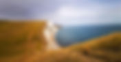
A stunning photograph of the Jurassic Coast along Southern England. England is one of the primary subjects of today’s nautical chart. Credit to Yohantha Gunawarma. Today’s antique nautical chart is a 168-year-old chart of the British Isles! The chart depicts the entirety of the British Isles, Ireland, & the tides around said areas. The British Isles are the islands the administrative region of the Isle of Man, & the United Kingdom. The chart showcases the tides of Northwestern France, Norway, Northwestern Germany, the Netherlands, Ireland, the United Kingdom, & the Isle of Man. It also depicts the Isles of Skye, Mull, Lewis, & Grimsay, which are a part of the Inner & Outer Hebrides. This tidal information is meant to be during the new & full moon, meaning these tides are spring tides. The map is in English, & it contains an immense amount of information about tidal, & depth information. In addition to this, it lists the names of numerous coastal towns, as well as various major cities, including Londonderry, Perth, & Edinburgh. This would have been valuable to any sailor of the era attempting to traverse the British Isles, especially one attempting to visit one of the non-major cities. The chart is fairly sized, at 23 inches wide & 19 inches long. It does contain some colour, with outlines of green, magenta, & yellow. The majority of the chart is some variation of grey, with lighter tones indicating lower tides & land. In today’s article, we shall discuss the map itself, & perform an analysis of it! With that being said, let us delve into the cool, unforgiving waters of the British Isles! The Chart An intriguing map of the British Isles, Northwestern France, & Southern Norway. Credit to hydrographers W. & A. K. Johnson. As discussed in the introduction, this map depicts the British Isles, the Hebrides, Northwestern France, Northwestern Germany, the Netherlands, & Southern Norway. It includes numerous town names along Great Britain, & Ireland, from Wickford to Dunbar. The chart is free of scratches or tears, with it being in pristine conditions apart from some minor spots & yellowing. The chart has small amounts of colour, particularly magenta, green, & yellow, outlining the shorelines of Norway, Northwestern France, & Great Britain. Apart from that, it is various shades of grey, with lighter shades indicating shallower depths. The chart contains a variety of bathymetric information, meaning information about the sea floor, particularly its depth. As was standard at the time, the information is in fathoms, which is an old nautical measurement (1 fathom = 6 feet). The chart is in pristine condition, with no rips, tears, or creases, although it does have some small dark spots. An Analysis Of The Chart This chart was constructed by W. & A. K. Johnston under the direction of J. Scott Russell. It was published in 1857, as No. 4 in their hydrography collection, under the title “Tidal Chart of the British Seas: Showing the Progress of the Wave of High Water, the Hour of High Water in Greenwich Time at New and Full Moon; and the Depth of the Sea”. William & Alexander Keith Johnston were a pair of brothers who were Scottish cartographers, hydrographers, & geographers. Together, they started their own cartography & engraving business in 1826, with the motto “Ready, Aye, Ready!”. Their offices were located at 4 St. Andrews Square in Edinburgh, where this chart was most likely manufactured. As mentioned in the introduction, it was constructed under the guidance of J. Scott Russell, a prominent oceanographer of the time. He partnered with the brothers Johnston, & assisted in gathering data for the chart. The chart fulfilled the massive task of giving sailors, merchants, biologists, & similar professionals of the time a grasp of what spring tides are, how they differ from regular tides, how they differ from neap tides, & what this all translates to practically. As far as records indicate, this chart was created for civilian use, for those who were navigating the British Seas. Considering the quality of the chart, & the time that it was manufactured in, it was most likely manufactured using Lithography. Lithography is a method of printing that arose in the 1820s, & remained the most popular method of printing in both color & grayscale until the early 1960s, when more efficient methods became available. Although it has existed since the mid-1790s, it took a long time to gain popularity in Europe due to technical difficulties, & only began gaining commercial popularity in the early 1820s. It is still widely used for certain kinds of printing, such as fine art printing today, however, digital printing is far more common. In the lithographic method, the artist will draw directly onto a printing surface, such as zinc, or copper, until they are satisfied with the drawing. After this, the surface will be covered with a chemical etch, which will bond it to the surface. With this process, the blank areas will attract moisture to the plate & repel the lithographic ink, while the areas that are drawn on will hold the ink. Water is then wiped onto the unpainted areas to help prevent the ink from deviating. After the image is inked, a paper is laid over it & covered with a tympan, & the tympan is pressed down. Finally, these materials pass through the scraper bar of the litho-press. Afterward, an exact copy of what was supposed to be printed is revealed. It is still useful for making high-resolution prints in high quantities, & is used in fine-art prints to this day. Directories / Credits All credit for this map analyzed today goes to Rare Maps, a California rare & antique maps store. To purchase this chart, antique atlases, or other cartographic objects, please visit www.raremaps.com . To be clear, this is not an advertisement for Rare Maps, as we do not have a partnership with them. Strategic Partnerships Reel Guppy Outdoors SharkedSkooler Marine Enthusiasts Podcast Cash Daniels Tides of Tomorrow The Open Book, Topanga Pitfire Artisan Pizza Olivenbaum Music Our Loyal Patrons P. R. Ochoa
- The Brooding Snake Star Of The Isle Of Man (Amphipolis Squamata)
A photograph of a Brooding Snake Star sitting atop a rock. Credit to diverosa.com . This month's article series will be discussing the tranquil & beautiful, Isle of Man. The Isle of Man is a self-governing British Crown dependency, located in the Irish Sea. It is between Great Britain, & Ireland. It is not owned by the UK, nor is it a territory, though those who are born on the island are entitled to British Citizenship. The island is most well known for its tax-free status, beautiful fields, sweeping coastlines, & gorgeous cliffs. Additionally, the island is home to the oldest continuous parliament, which dates back to at least 979. Since the island is not linked to the mainland by road, plane & boat are the only ways to access it. According to our measurements, the island is approximately 276.48 nautical miles (318.167502 miles or 512.04096 Kilometers) off the coast of mainland Europe. The island's capital is Douglas, which houses the majority of the 84,069 populous. The isle has a lot to offer naturally, with its large puffin population, mussel reefs, lichen colonies, & coastal grasslands. For its biodiversity, the entire island has been awarded biosphere reserve status. Additionally, the majority of the ocean surrounding the island is considered a marine protected area. One of the creatures that is found both along its shore, & in its oceans, is the Brooding Snake Star, also known as the Dwarf Brittle Star. The Brooding Snake star is a small species of Brittle Star, found across the British Isles. It is closely related to a sea star, & has 5 cephalopod-like arms that it uses to swim around. Brittle stars get their name from the behaviour of shedding their arms when they feel threatened. They are known to be found under rocks, in seagrass meadows, & in rocky tide pools. Though they can be found in tide pools, they favour deeper environments. Brooding Snake Stars tend to be very shy creatures, & will avoid interaction with humans. In this article, we will discuss the life & discovery of the Brooding Snake Star, the Mating Tactics, Strategies, Cycles, Practices, Procedures, & Habits Of The Brooding Snake Star, The Distribution Of The Brooding Snake Star, & the Scientific Detailings of the Brooding Snake Star. With that being said, let us delve into this peculiar serpentine creature. The Life & Discovery Of The Brooding Snake Star The Brooding Snake Star was first described in the year 1829. The species was described by Stefano Delle Chiaje, an Italian Zoologist, Botanist, & physician. Individuals are determinate growers, & do not grow for their entire lives. Their disc, which is their center area, is between 3 & 5 millimeters in diameter, while their arms reach a maximum of 10 to 20 millimeters long. Their lifespan is between 1 & 5 years. This species' intelligence is very limited, as they don’t have a brain. Instead, they have nerve cords that extend down their arms, controlling movement & other bodily functions. The Brooding Snake Star is believed to have arisen in the Jurassic, which began 201.4 million years ago, & stopped 145 million years ago. As said in the introduction, this species tends to be very timid, & will not interact with humans, aggressively or otherwise. Individuals will migrate throughout their lives, & are not at all territorial. This species does not exactly swim, it instead wriggles along the ocean floor. They move by twisting their arms to help move them along the oceanic floor. It is unclear how fast they can move. Despite this method not being the most efficient, they are some of the fastest echinoderms. Due to the fact they they remain on the ocean floor, they do not need any organs or special features to help maintain buoyancy. It is not clear how this creature sleeps, or if it sleeps in the traditional ways that most other creatures sleep. Brooding Snake Stars primarily consume plankton, & organic particles. They usually do not practice cannibalism. Individuals are nocturnal hunters, & hunt by grabbing the particles with their arms, & dragging them towards their mouth. This species is able to locate its prey via odor. Individuals are known to be active predators, though many other brittle stars are scavengers. Brittle stars' most common predators include hermit crabs, sea stars, fish, & starfish. They are usually grey, yellow, white, blue, or some mix of these. The majority of individuals will have a mixed colour scheme. Additionally, they are phosphorescent. They have 5 arms, similar to a starfish, except thinner & attached to a central disc. Their mouth is located on the underside of their disc. This species has not yet been assessed by the IUCN Red List. The Mating Tactics, Strategies, Cycles, Practices, Procedures, & Habits Of The Brooding Snake Star Brooding Snake Stars Breed via both sexual & asexual reproduction. They primarily reproduce by spawning. This species is hermaphroditic, though they rarely self-fertilize. Individuals will sexually mature at the age of 2. When reproducing sexually, they will congregate in large groups in order to ensure genetic diversity. It is unclear how these groups form, however, when they do, many individuals will gather & release sperm as well as eggs. When the egg & the sperm come into contact, the egg fertilizes, & eventually a Brooding Snake Star will be born. It is unclear what the juveniles look like, how large they are, or how much they weigh. They do not have a specific breeding season, & groups seem to form throughout the year. When reproducing asexually, half or more of a single individual will be separated from the other half, & both will regenerate instead of dying. Thus, two new bodies will be created, & two new individuals will emerge. The Distribution Of The Brooding Sea Star The Brooding Sea Star is found all across the British Isles as well as the Baltic Sea, in both shallow & deep ocean environments. They are known to burrow in sandy environments. In both shallow & deep ocean environments, they are known to stay in rocky areas, sand-bottomed areas. & sea grass meadows. Currently, they are recorded to live in environments as deep as 800 meters (2,624.67 feet). Unfortunately, it is difficult to record all the coastal areas that they live in, as they often blend into the rocks. This species is not migratory, & tends to stay around the same area their entire lives. The Scientific Detailings Of The Brooding Snake Star The Brooding Snake Star has an incredibly simple body plan. They do not have a brain, eyes, an intestinal system, or an anus. Despite this, they have managed to utterly baffle scientists. Brittle stars seem to be able to learn via association, & have light sensitivity. They do seem to have learning abilities, & can associate the dimming of lights in their aquarium with feeding time. They have light sensitivity, as their chromatophores will signal changes depending on the environment that they are in. Most individuals are also able to react to the environment around them to a certain extent. Brittle Stars control respiration by small sacs known as bursae. These bursae are able to extract oxygen from the seawater. This species does not have a skeleton, nor does it have teeth. Currently, there are at least 2 known species of parasites that are associated with Brooding Sea Stars. These parasites are copepods known as Cancerilla Tubulata, & Parachordeumium Amphiurae. Their phylum is Echinodermata. Two universal characteristics of Echinoderms are radial symmetry, & a water vascular system. Their class is Ophiuroidea, commonly known as Brittle Stars. Individuals in this class are known for their 5-point radial symmetry, small discs that contain their internal organs, & lack of a brain. Their order is Ophiurida. This order is known using the bursae for respiration. They are currently categorized under the family Amphiuridae. Interestingly, this family is known for its behavioural habit of burrowing. Their genus is Amphipholis, also spelt Amphipolis. This genus is known for its bioluminescence. Their binomial name is Amphipholis Squamata. A photograph of a Brooding Snake Star atop a rock covered with algae & anemones. Credit to the UniProt Consortium. Directories / Credits Citation No. 1: “Amphipolis Squamata (Dwarf Brittle Star)”, Written By Unknown & Published on May 21st of 2012. Published By Between The Tides Of Nova Scotia. Retrieval Date: January 27th, 2024. http://intertidal-novascotia.blogspot.com/2012/05/amphipholis-squamata-dwarf-brittle-star.html?m=1 Citation No. 2: “Small Brittle Star (Amphipolis Squamata)”, Written By Sonia J. Rowley, & Published on June 9th of 2006. Published By The Marine Life Information Network. Retrieval Date: January 28th, 2023. https://www.marlin.ac.uk/species/detail/2071 Citation No. 3: “Amphipolis Squamata (Chiaje, 1829)”, Written by Bernard E. Picton, & Christine C. Morrow, Published in 2006. Published by The Encyclopedia of Marine Life of Britain & Ireland. Retrieval Date: January 28th, 2023. https://www.habitas.org.uk/marinelife/species.asp?item=ZB3000 Citation No. 4: “Species Information Sheet - Amphipolis Squamata”, Written by Unknown & Published in 2013. Published By HELCOM Red List Benthic Invertebrate Expert Group. Retrieval Date: January 28th, 2023. https://helcom.fi/wp-content/uploads/2019/08/HELCOM-Red-List-Amphipholis-squamata.pdf Citation No. 5: “Brittle Stars Can Learn Just Fine — Even Without A Brain”, Written By Julia C. Notar, & Madeline C. Go, Published on November 29th of 2023. Published by Duke Today. Retrieval Date: January 28th, 2023. https://today.duke.edu/2023/11/brittle-stars-can-learn-just-fine-even-without-brain Strategic Partnerships Reel Guppy Outdoors SharkedSkooler Marine Enthusiasts Podcast Cash Daniels Tides of Tomorrow The Open Book, Topanga Pitfire Artisan Pizza Olivenbaum Music Our Loyal Patrons P. R. Ochoa
- The History Of Sanibel Island, Florida, USA
A serene photograph of Sanibel Island’s coastline. Credit to Florida Like A Pro. In today’s article, we will be discussing the documented history of Sanibel Island, Florida. Sanibel Island is an island on the Gulf Coast of southern Florida. The island is most well known for its sandy beaches, shells, & wildlife reserves. The primary wildlife reserve on the island, is J.N. “Ding” Darling National Wildlife Refuge. The scenery of the island is superb, & adds beautifully to the hiking paths of the island. The island is extremely close to the mainland, being only 1.75 nautical miles (2.013864 miles or 3.241 kilometers) away at its closest point. The western coast of the island is well known to contain whelks, bivalves, sand dollars, & scallops, which attract many tourists as well as recreational fishermen. Many seashell enthusiasts also enjoy the island for this reason, & can be seen gathering or admiring shells on early mornings. Additionally, these seashell enthusiasts have an entire museum to look into, as Sanibel Island has a museum dedicated to the study of seashells, conchology, & malacology. This museum is known as the Bailey-Matthews National Shell Museum. Off the coast of the island, divers & fishermen alike have something else to look forward to. This of course, is the vast marine expanse around the island. The original inhabitants of the island, the Calusa, would use this marine expanse for a variety of things. The Calusa would use conch, oysters, clams, & whelks as both food, & tools. After eating the meat, they would use the shells as tools, & use shell mounds for ceremonial, ritual, & burial purposes. Additionally, they would build small huts on top of large shell mounds, to add protection from the high tide. This shows that no matter the time, the ocean has transformed the culture of Sanibel Island. Modernly, the island has a population of 6,382 people. Additionally, the island is approximately 33.21 square miles (86.013505 square kilometers or 21,254.4 acres) in area. Similar to many small islands, the entire island is administratively 1 town. The largest settlement on the island is Sanibel. The official website of both the city & the island is https://www.mysanibel.com/ , & is controlled by the government of Florida. In this article, we will discuss the documented history of Sanibel Island, the aboriginals of Sanibel Island, the most destructive natural & man-caused disasters to affect Sanibel Island, & the economic state of Sanibel Island. With that being said, let us delve into the island of Sanibel! The Documented History Of Sanibel Island, Florida Before Colonization Historical Events From 500 B.C to 1513 Sanibel, as well as Captiva Island, were formed less than 10,000 years ago by rising sea levels cutting the area off from the mainland. They originally formed as one land mass, & remained so until a hurricane split them apart. The first group of individuals would not come to the island until approximately 500 B.C. This first group, was the Calusa Aboriginals. Upon arrival, they would build small villages around the waterways of the island. Their primary sources of protein were bivalves, & fish. After Colonization Historical Events From The 1500s The Spanish would not interact with the Calusa until explorer Juan Ponce De Leon found the island. He officially found the island in the year 1513, while on his journey to find the fountain of youth. He named the island Santa Isabella, after Queen Isabella of Spain. Leon & his sailors would battle the vicious Calusa for many years, until eventually, he was struck critically by one of their arrows in 1521. As a result of this, he retreated to Cuba, & then passed away from his injuries. The Spanish were unable to establish a permanent village in the area. Historical Events From The 1600s Disease introduced by the Spanish ravaged the Calusa People, & widespread epidemics killed many. This was the beginning of the decline of the Calusa people. Historical Events From The 1700s Due to a combination of Tuberculosis, Yellow Fever, & measles, the Calusa indigenous people, as well as their culture, went effectively extinct. The island would not be used for much of anything until the early 1800s. Historical Events From The 1800s During the Early 1800s, the island became a magnet for pirates. The infamous Jose Gaspar visited the island, where it is rumoured he buried treasure. On the adjacent Captiva Island, he built a prison for captive female prisoners. This is how the island earned its name. The Seminole Wars kept American settlers & fishermen hesitant to build any permanent settlements on the island. Even after Florida was admitted as a state to the Union in 1845, settlers still proceeded with caution. The civil war would further complicate things, & Americans would not attempt to settle the island until the war’s completion. In the year 1870, the U.S government ruled that Sanibel Island would receive a lighthouse. The famed lighthouse would be built on the eastern shore of the island, & was first lit in 1884. This lighthouse is still functional, & in use. The original settlement on Sanibel was located close-by the lighthouse, as it was the center of much island activity. According to a census conducted in the year 1889, there were approximately 40 families living on Sanibel Island, distributed throughout 21 houses. In 1892, the population rose to nearly 100, prompting the first schoolhouse to be built in order to educate the children of Sanibel. Historical Events From The 1900s In the year 1928, docks were constructed at the eastern end of the island, by the Kinzie Brothers. This made it possible for a ferry service to provide transportation to the mainland for the next 35 years. Many farmers began noticing the agricultural potential island, & began purchasing small plots of land to build homesteads on. The most common choices for a primary crop were grapefruit & watermelon. One of the most famous plantations from this era, was started by Clarence Chadwick, an American Inventor. This inventor turned the 330 acres of Captiva Island into a key lime plantation. Unfortunately, the hurricanes of 1921 & 1926 rocked the island, the former of which split Captiva Island from Sanibel. The agricultural industry never recovered, & was soon replaced by the tourism industry. Many influential people visited the island around this time, including the illustrious Henry Ford. The most influential of all of these people, was Jay Norwood “Ding” Darling. Jay Norwood Darling was a political cartoonist, as well as a conservationist. He first ventured to the island on a vacation in 1935. Charmed by the islands, he began wintering on Captiva Island, & continued this for many years. A devoted conservationist, he campaigned for island ecosystems to be federally protected. Eventually, this would come in the form of the J. N. “Ding” Darling National Wildlife Refuge. In 1945, 5,200 acres of mangrove, & estuary were designated as part of the J. N. “Ding” Darling National Wildlife Refuge. This refuge is now the heart of biodiversity on the island. The island has slowly risen to stardom amongst tourist destinations in America, largely due to its shells, & beautiful beaches. Sanibel Island is now one of the most popular Vacation destinations, as well as a biodiverse place in the state of Florida. The Aboriginals Of Sanibel Island The Calusa Indigenous Aboriginals of Sanibel Island The Calusa Indigenous Aboriginals are a group of Native Americans, who lived primarily in Southern Florida. They formed as a group between 2,500 & 2,000 years ago. Unfortunately, their population is completely extinct. They spoke the Calusa language, & is also extinct. There are very few records of this language, & it is extremely unclear how the language worked, or what it even looked like. Their population reached approximately 50,000 at its highest. Amongst the natives of Florida, they were described to have lots of power, & influence over other tribes. This influence stretched from the West to the East Coast, even though they did not live in that area. Their diets primarily consisted of fish, wild berries, roots, & nuts. They did not have farms, & instead would gather food naturally. Much of their fishing equipment was made out of either wood, or shell. Fishing would take place either on shore, through nets, or in a dug-out style canoe. Their fishing nets were constructed of Palm Leaves, & were used to catch pinfish, catfish, & pigfish. After eating the meat from the fish, they would take the bones & use them as arrowheads. These arrows were largely used to hunt deer, & fight the Spanish. To catch turtles as well as eels, they would construct to use shell spears. They were extremely adept sailors, & were known to sail as far as Cuba, which is approximately 194.42 nautical miles (223.73454 miles or 360.06584 kilometers) away from the island at their closest points. Very little is known about their clothing habits, or their footwear. Unlike nearby tribes, they did not make any ceramics. Much of their jewelry was made using shells, although very little of it has survived. The Spanish described them to be between 5 feet & 6 inches, & 5 feet & 8 inches, with tanned skin. Many of them would have long hair, & were generally muscular. It is unclear what their social & societal structures looked like. Their houses would be built on stilts, in order to provide protection from the high tide. Leaves from the Palmetto tree were woven into large sheets, & used as roofs. When the Spanish arrived near the island, they responded aggressively. They would often attack Spanish vessels anchored near the island, & would then salvage resources from the shipwrecks. What became of the Calusa, is utterly tragic. While fighting with the Spanish, many of them contracted diseases that their immune system had not yet developed protection against. This caused widespread epidemics, & killed the majority of the population. Those who remained, were sold into the slave trade by other Native American groups who came from Georgia, & South Carolina. The Most Destructive Natural & Man-Caused Disasters To Affect Sanibel Island Disaster No. 1: Hurricane Ian Of 2022 Hurricane Ian was an Atlantic hurricane that lasted from September 28th of 2022, to September 30th of 2022. It formed as a small tropical depression, & reached Category 5. It first made landfall as a Category 3 Hurricane, in Cuba. It claimed 3 lives on the island, & knocked out the power grid for the entire island. At its peak, it reached approximately 155 miles per hour. The hurricane ravaged Sanibel Island, & caused approximately 12 feet of water to surge, & flood the island. Streets were inaccessible, & many could not get supplies. It is to date, the second deadliest hurricane of our century to make landfall in the continental United States since Hurricane Katrina. The hurricane claimed 101 lives directly, 92 of which were from Florida. It is estimated that the hurricane claimed upwards of 150 lives indirectly. Hurricane Ian is estimated to have caused approximately 112 billion U.S.D in damages. Disaster No. 2: The Tampa Bay Hurricane of 1921 The 1921 Tampa Bay Hurricane was an Atlantic Hurricane that split Sanibel Island from Captiva Island. At its maximum, it reached Category 4 level Strength. It hit Florida on October 24th, 1921. It hit at a moment's warning, & many counties were unable to issue evacuation orders quickly enough. Upon hitting, it immediately began causing flooding. Rain quickly flooded the ground floor of the Tampa Electric control complex. Thankfully, before leaving, the power workers at Tampa Electric cut off all electricity to the county, & a few towns in nearby counties. This was an incredibly important decision, as in the aftermath of the hurricane, cables & exposed wires littered the flooded streets. Had they not cut the power, the streets would have been effectively electrified. This would have caused injuries, & could have prevented emergency services from reaching civilians. It is unclear if the hurricane claimed any lives, or how many were injured as a result of the storm. In the aftermath of the Hurricane, the Captiva & Sanibel Islands were cut away from each other due to surges of water. This water never dissipated, & the islands remain separated. It is estimated that the hurricane caused approximately 10 million U.S.D in damages. Adjusted for Inflation, this would be well over 180 million U.S.D today. The Economic State Of Sanibel Island Sanibel Island is economically stable. The main industry of both Sanibel & Captiva Island, is Tourism. The island is known to be one of the top 100 destinations in the U.S, & has one of the best airports in the United States. Aside from tourism, Sanibel exports a fair number of products, ranging from pharmaceuticals to fish. This is usually through the large commercial harbour on the Northeast end of the island. The median household income is approximately 103,413 U.S.D, with a working population of 2.28 thousand. A photograph of the historic lighthouse on the coastline of Sanibel Island. Credit to Florida Like A Pro. Directories / Credits Citation No. 1: “History Of Sanibel Island”, Written By Unknown, & Published at an Unknown Date. Published By the Island Inn. Retrieval Date: January 24th, 2024 https://islandinnsanibel.com/sanibel-island-history/ Citation No. 2: “Sanibel Island & Captiva Island Area History”, Written By Unknown, & Published at an Unknown Date. Published by the Sanibel & Captiva Islands Chamber Of Commerce Retrieval Date: January 24th, 2024. https://sanibel-captiva.org/sanibel-island-history-captiva-island-history/ Citation No. 3: “The Calusa Native Americans”, Written By Unknown, & Published at an Unknown. Published by the Florida Department Of Environmental Protection. Retrieval Date: January 24th, 2024 https://www.floridastateparks.org/learn/calusa-native-americans Citation No. 4: “The Calusa: “The Shell Indians”, Written By Unknown, & Published at an Unknown Date. Published by The University Of South Florida. Retrieval Date: January 24th, 2024 https://fcit.usf.edu/florida/lessons/calusa/calusa1.htm Citation No. 5: “Hurricane Ian, Sept 28-30, 2022” Written By Unknown & Published at an Unknown Date. Published by the National Weather Service. Retrieval Date: January 24th, 2024. https://www.weather.gov/mhx/HurricaneIan093022 Citation No. 6: “The 1921 Tampa Bay Hurricane” Written By Michael Bouth, & Published at an Unknown Date. Published by Tampa Historical. Retrieval Date: January 24th, 2024. https://tampahistorical.org/items/show/72 Citation No. 7: “Sanibel, FL” Written By Unknown & Published at an Unknown Date. Published by Data USA. Retrieved January 24th, 2024. https://datausa.io/profile/geo/sanibel-fl Strategic Partnerships Reel Guppy Outdoors SharkedSkooler Marine Enthusiasts Podcast Cash Daniels Tides of Tomorrow The Open Book, Topanga Pitfire Artisan Pizza Olivenbaum Music Our Loyal Patrons P. R. Ochoa
- Marine Biological Hall of Distinction: Donald Putnam Abbott
A distinguished photograph of Donald Putnam Abbott. Credit to Stanford University. This article is part of our collection known as the Marine Hall of Distinction. This special collection will discuss marine biologists who have served marine biology and oceanography the most. We do this to commemorate these marine biologists and show gratitude for everything they have contributed to our oceans. Today's marine scientist is Donald Putnam Abbott. Dr. Donald Putnam Abott was an American Marine Biologist, Invertebrate Zoologist, & Researcher known for his work on Tunicates, colloquially known as Sea Squirts. Tunicates are an interesting marine invertebrate that resemble a fleshy tube, & are surprisingly closely related to chordates. In today’s article, we are going to delve into his formative years & education, his personal life & career, his achievements, awards, & accomplishments. With that being said, let us delve into the wondrous career of Donald Putnam Abott! His Formative Years & Education Donald Putnam Abott was born on October 14th, 1920, in Chicago, Illinois, USA. Sadly, very little is known about his childhood or life pre-university. His father, a physician & professor of medicine, passed away at the age of 52 in 1936. A few months after his death, Abbott would move away from Chicago. Upon graduating from University High School, he moved to Hawaii to attend the University of Hawaii at Manoa for his undergraduate degree in Zoology, beginning in 1937. It was here that he met, the extraordinary Marine Scientist Isabella Aiona, later Isabella Abbott. She was a student of botany, & both adored biology as well as botany. They both were enrolled in all of the biology courses that the University had to offer, showcasing their commitment to science. The pair married on March 3rd, 1943, & went on to have 1 daughter, & at least 1 granddaughter. Upon graduating in 1941, he remained an instructor at the University until the outbreak of World War II. Unfortunately, due to the bombing of Pearl Harbor, Dr. Abbott had to take a sabbatical from marine science, & enlisted in the U.S Chemical Warfare Service in 1943, shortly after his wedding. After the war ended, the newlyweds relocated to Berkeley, California, to attend the University of California, Berkeley. It was here that he earned his Master's Degree in Zoology, in 1948. The nearby Hopkins Marine Station had just seen a well-known marine scientist, Professor Tage Skosberg, retire, & was urgently attempting to fill the role. They attempted to recruit another marine biologist, C. M. Yonge, but failed. While on the search for a successor, the University discovered Abbott, & offered him an instructor position, to teach summer courses during the summer semesters of 1948, & 1949. Upon completion of his P.hD in zoology in 1959, he spent the rest of his career with the Hopkins Marine Station. His Personal Life & Career Upon joining the faculty of the University of California at Berkeley in 1950, he rose to become one of the most prominent tunicate researchers of the era, & a respected scholar on invertebrates as a whole. He was well known as an extraordinary professor, with his summer courses in invertebrate zoology being some of the most popular at the institution, & his classes were always full of students. Students from other states, & even other countries joined the institute specifically to take his courses. Although he is often remembered as a taxonomist, this was not the only subject that he lectured about. He also discussed embryology, phylogeny, morphology, & generally systematics of various invertebrates in his lectures. His students were so greatly encouraged by his enthusiasm, that staff observed them working determinedly in the laboratory late into the night, or on days when they did not even have his course. Dr. Abbott was also well known for his thoughtful comments on his students' work, with him leaving long annotations on each of their workbooks. In 1953, he joined a scientific expedition to Micronesia, specifically Ifaluk Atoll. On the expedition, he caught a terrible case of Polio, a disease affecting the nerves in the spinal cord & brain. Paralysis, wasting, migraines, fatigue, vomiting, fever, & stiffness of the limbs are all associated with the disease. Although he recovered, he feared that like many who were afflicted by the disease, he would never regain control of his legs. He managed to make a stunning recovery, & re-learned to walk, though with a slight limp. In 1963, he began teaching a new course in a newly built building during the Spring Semester. The course recruited juniors & seniors at Stanford to design their own research projects in 8 weeks, & emboldened by his passion, the majority of them did. The course focused on the intertidal zone, teaching students about the wind, the waves, the tides, the troubles experienced by marine animals living in both the high & low intertidal zone, & the species that inhabited such environments. Unfortunately, after his retirement, the beloved summer invertebrate zoology course gradually declined in quality, & was eventually shelved. Many people have wondered why this occurred, & to quote his memorial resolution “One has to conclude the teacher was the message. Don’s tremendous enthusiasm, his desire to know everything about each species of invertebrate, fired his students to do the same”. Upon retiring in 1982, his wife, Isabella Aiona Abbott, was offered a faculty position at the University of Hawaii at Manoa. As such, the couple moved from Pacific Grove back to Hawaii. He stayed in Hawaii for the rest of his life. Unfortunately, Dr. Donald Putnam Abbott passed away on January 18th, 1986, at the age of 65, following a battle with cancer. He was survived by his wife, Dr. Isabella Aiona Abott, & his daughter, Annie Abbott Foerester. In honour of his passing, a symposium dedicated to invertebrate biology, & invertebrate zoology was held at Asilomar Conference Center in Asilomar, California, USA. It was held soon after his death, from November 20th, to November 23rd, 1987. His contributions to the field were significant, & his work will not be forgotten. He is remembered as one of the most extraordinary professors of Hopkins Marine Stations, & his enthusiasm for the field continues to drive marine scientists today. A photograph of Donald Putnam Abbott out in the field, date unknown. Credit to Gene Coan. His Awards, Achievements, & Accomplishments 1. He published approximately 14 publications over the course of his life, on a variety of different marine invertebrates, from sea urchins to tunicates. 2. He effectively advised 25 P.hD students, & 10 Master’s Degree Students, all of whom earned their degrees. Coxicerberus abbotti, Enteropsis abbotti, & Hastigerella abbotti. Directories / Credits Citation No. 1: “Memorial Resolution Donald Putnam Abbott 1920-1986”, Written by Lawrence Blinks, Arthur C. Giese, & Colin Pittendrigh, & published at an unknown date. Published by Stanford University. https://web.archive.org/web/20100705143303/http://www-marine.stanford.edu/memorials/AbbottD.pdf Citation No. 2: “Donald P. Abott”, Written by Unknown, & Published at an Unknown Date. Published by Stanford University. https://seaside.stanford.edu/dpabbott Citation No. 3: “Abott, Donald Putnam (Professor; Phd)”, Written by Unknown, & Published at an Unknown Date. Published by Conchology Inc. https://www.conchology.be/?t=9001&id=14106 Strategic Partnerships Reel Guppy Outdoors SharkedSkooler Marine Enthusiasts Podcast Cash Daniels Tides of Tomorrow The Open Book, Topanga Pitfire Artisan Pizza Olivenbaum Music Our Loyal Patrons P. R. Ochoa
- “There’s A Lot Of Power In Being Able To Know That You Have 700 People Around The World Rooting For You”, An Interview With Marine Ecologist, & Diversity Advocate, Dr. Alexandra Davis
Recently, we were extraordinarily pleased to sit down with Dr. Alexandra Davis, a marine ecologist, marine biologist, diversity advocate, scientific diver, & professor! Dr. Alexandra Davis is an ocean researcher, invasive species expert, scientific diver, marine spatial ecologist, cat enthusiast, & Professor of Biology at California State University, Northridge. She is well known for her research on invasive species, her research on spatial ecology, & her nonprofit advocacy with BWEEMS. In today’s interview, we sit down with Alex to discuss her research in spatial ecology, her research with invasive species, her nonprofit advocacy, & her advice to marine biologists & ocean researchers early in their careers, in a comprehensive 18-question interview. Before delving into today’s interview, please note everything said has been edited for clarity, & that the opinions of our interviewee do not necessarily reflect the opinions & values of our organization. With that being said, let us delve into the contents of the interview! A marvellous photograph of Dr. Alexandra Davis standing near the sea. Credit to Dr. Alexandra Davis. Questions About Her Passion: 1. What sparked your passion for marine biology, & the ocean as a whole? I think it's a combination of a classic kind of both in the 80’s, & 90’s, & it’s a little bit of fascination with Lisa Frank Stationery. Just seeing dolphins, rainbows, & things like that. In addition to that, I was enthralled with National Geographic Specials, on public television, & PBS. I’m originally from New Mexico, so a desert state. Anytime some sort of special would come on TV that was focused on the water, specifically the marine environment, it always just captivated my attention because it was something so other than what I grew up around. 2. Was there any particular person, place, moment, or piece of media that assisted in sparking your passion? I suppose one of the things that got me interested was a series of magazines for kids that my mom would order. I think maybe it was Zoo For Kids, or Nat Geo For Kids? I remember that I got one of the sharks & that was just so fascinating to me. I vividly remember flipping through one. Also, when the TV guide would come out, I would see what National Geographic Special was on. Even though I don’t work with sharks or any large organisms now, that is kind of what drew me to marine science. Those charismatic megafauna, as we call them, do a really good job of drawing people in & having a connection to the ocean. 3. What is your favourite marine or terrestrial animal personally, & what is your favourite marine or terrestrial animal that you have worked on? My favourite animal is cats! I’m a big cat person, however, I don’t work with those in any way shape, or form. I do work with fish often, a lot of the work that I do now & in the past has been focused on fish ecology. Studying both how fish communities interact, & how fish are put together, as well as individual fish species has been a large part of my career. I also enjoy this group of fish colloquially known as damselfish. I like to think of them as what I call the old men of the sea. They’re often algal farmers, so they’ll have territories where they guard their algal patches, & they’re very aggressive. They are about the size of your hand on the larger end, & other times they’re only about 5 centimeters large. They’ll come out & bite you if you come onto their territory, so they’re like “Get off my lawn”! I just love what I’m assigning them as personalities, & their aggressive nature. I’ve done some studies with them, & I find them fascinating. 4. What sparked your passion for Diversity, & Inclusion, within Ecological, Marine, & Evolutionary sciences? I don’t know if anything sparked my passion, but I think the work that I do in that area was born out of necessity. Being someone who is often categorized as a marginalized person, nobody was doing the work in a lot of institutions that I was at. So, in order for me to feel as if I had a space in those places, or feel that I was being treated equitably, I would work with people who were of similar minds to create spaces. At first, it was a survival technique, “How do I make it through to the next week, month, or day? How do I make it to the next level of my career?”. It's building those support mechanisms, building those institutional policies, that make it so that you have equal or equitable chances to have the same opportunities that other folks do. Questions About Her Work in Marine Science: 5. Prior to entering marine science, you pursued your Bachelor’s degree in English. May I ask what inspired you to make the change, & leap into the field of marine science? Interestingly enough, it wasn’t a change into marine science, it was kind of an opportunity that I didn’t take advantage of. Early in my educational career, I had a bad experience with a science class. It basically turned me off from thinking that I could be a scientist, or that it was something that I wanted to do. So, I switched my degree to be in English, because that’s another passion of mine, English Literature. That was an easy switch for me. I did my bachelor’s degree at Cal State Monterey Bay, & I hold the bias that Monterey Bay is one of the most beautiful places on Earth, & one of the best places in the world to do Marine Biology. So when I graduated with my English degree, I thought there was no better place than to give this a try. I had some friends who were science majors, & they said “Yeah, just take some classes, see how you like it.” Instead of pursuing the next level of an English Degree, whether that be a master’s or teaching certificate, I decided to go back & give marine science a try. So far, it’s worked out! 6. How did you enter the field of marine science, & what was the first research project that you ever worked on? I will admit that when I went back to get my science degree, at first I was kind of stumbling around in the dark. At first, I said, “Maybe I’ll take a couple of classes, & then apply for a master’s program.”, I had no idea what I was doing. It’s a very low chance that a master’s program in Marine Science was going to admit an English Degree Student without a research background with only one science class. I had lofty goals when I first entered, & I was lucky that CSU Monterey Bay had a lot of field courses, & kind of research-based courses. So, by nature of these classes, I started getting more exposure to what it meant to he a scientist. You don’t just take a chemistry class, you have to do things in chemistry. You can’t just take a class on marine biology, you actually need to do marine biology. Getting experience in the classroom I would say was my first exposure, we would do class projects, group research projects. I was able to get connected to a program at CSU called the Undergraduate Research Opportunity Center. This was a center at CSU that was geared towards helping undergrads into research opportunities. They had a ton of ways to facilitate, whether it be helping to get funding so that you could work with a lab on campus, & they would help you apply for funding outside. They would also help with finding internships across the country. Through them, I was able to get into the Ronald E. McNair Achievement Program, which is set up for marginalized students to increase their representation in STEM, & get them into research programs. One of the classes I took was a seafloor mapping class, & we did a group research project for it. From my participation & performance, I then got to do an internship at the Seafloor Mapping Laboratory on campus, & I started to do independent research. From the work that I did there, I got to do my Undergraduate Thesis. All of it was born out of a field studies course as an undergrad that morphed into a lot of different opportunities with the professors on campus. 7. Which universities did you go to for your Master’s Degree & P.h.D, & what was the research topic for your thesis? I “skipped”, my master’s, although the work that I did as an undergraduate in the marine degree was kind of the equivalent to the master’s. I got a full publication out of that. Because of that, I felt prepared to go straight to a PhD program. I ended up going to Oregon State University, &, & my work there was centered on invasive Lionfish in the Bahamas. That seems like sort of a drastic switch, but I really wanted to do scientific diving for my thesis, & I wanted to do it in warmer water. I learned to dive at CSU Monterey Bay as one of the programs there. They had a fantastic scientific diving program as a part of the curriculum for their Marine Biology Degree, so it was a low bar for me to get that skill. With the skills of a Scientific Diver, you become highly marketable, it can be an expensive course, & it is a lot of your that you have to put in to be a competent diver. As I had that skill, I was able to hit the ground running as a PhD student, & then I realized I wanted to dive in warmer water. I wanted to wear a smaller wetsuit, & not be bundled up when I got in. That led me to choose Oregon State University, as they had a laboratory in the Bahamas which worked on coral reefs & invasive species. My thesis goes over the distribution, & habitat use of invasive Lionfish in the Bahamas. 8. Do you mind elaborating on your work to reduce invasive species, & create conservation strategies tailored around reducing them? A lot of my post-doctoral work was very focused on this. Towards the end of my PhD, I began thinking about how I could make my work more informative. If I can create maps where you can find Lionfish, it can be useful to more than just me. I wanted to find ways for managers & folks to use this in an applied way, that’s not just science for science's sake. For my post-doctoral work, I continued working on Lionfish, & I started on a project with Dr. Stephanie Green, who’s at the University of Alberta. She’s been working on managing Lionfish invasions in this region since she was a post-doc. I assisted her in finishing a few different projects. One of the biggest goals was you make the removal of Lionfish more efficient. (Editor’s Note: In Florida, it is common to do large-scale removal of Lionfish during the summer. This is supported by the government & is a highly important method of controlling their population.) What we did we collect data on how effective these individuals are at collecting Lionfish. You have to collect Lionfish by hand, using either spears or nets. You can’t fish for them traditionally using line & hook, & you can’t use trawls. It’s basically one Lionfish at a time, & it is rather labour-intensive. The whole purpose of the project was to study how you can reduce the labour, money, or effort you are putting into these removals for optimization. How can you get the biggest bang for your buck? How do you spend the least amount of time & get the most out of it? Let’s pose a scenario. You & I go out to catch Lionfish. I’ve been doing removals for decades, & you are brand new. How fast does it take me to remove a Lionfish versus you? How fast can I remove 10 Lionfish versus you? If we go out at a certain time of day, is it easier to find them? If we go to certain kinds of reefs where there is a lot of coral, that may change the results compared to if we do it in an area with lots of algae. How fast does environmental composition affect how fast we do this? The goal of the project was to see how we can be the most efficient at doing this. We were able to use all of these metrics that we collected to answer these questions. A stunning photograph of a Lionfish (Pterois) lingering in a coral reef. Credit to Reimar Gaerter. We found that if you go out at dawn & dusk, when Lionfish are typically active, as they are crepuscular species, it’s much easier to catch them. Even though catching Lionfish is a rather easy skill to learn, experience does matter. You can learn how to catch a Lionfish, & once you have reached the level where you’re good at it, your ability to remove Lionfish from a reef goes up 4 times. In the time a novice is catching one: an expert is catching 4. The outcome of this is that if you are a manager, & you only have a limited amount of supplies, you’re going to send your best person out, & you’ll send them on a device at dawn or dusk. They’re going to do just as much work as if you send four people out during the middle of the day who don’t have much experience. As a result of the work that I was doing in Canada, one of my goals was to see if I could apply these concepts of efficient removal to other species. My second postdoctoral fellowship was geared toward seeing if I could create similar models of removal effort for the European green crab on the western coast of North America. As I always say, with a heavy heart, my fellowship started in March of 2020. All of the things I had planned to do with that, because I had a governmental partner & I was planning on working with some indigenous groups up there, practically all of my field work, got scrapped. That caused me to switch gears, & the project ended up turning out! We were able to get some cool stuff out of it, things such as “How do you become efficient at removing European Green Crabs?”, “What’s the best type of trap?”, “How long do you leave the traps in the water?”, “Is there a way to reduce bycatch?”, & such. A fearsome European Green Crab (Carcinus maenus). Credit to photographer Edwin Grosholz. 9. May I ask what your work within Spatial Ecology is, what sparked your interest in Spatial Ecology, & what you do within Spatial Ecology? I always say that I started my career in marine biology started studying sand! For the research project that I did as an undergraduate, what we did was study various sand bed forms that we saw along the coast, using different types of sonar & mapping devices that we have. You typically think of sand as being very movable & pliable. Through the quality, & massive amount of data we were collecting for this huge coastal project to map the continental shelf of California, we were able to see over the course of decades, that some of these features were remaining static. We were able to tell the difference through the composition of some of the sand, as different types of sand will give you different reactivity. Not all sand is equal. We were able to see that patches of coarse sand, which had larger grain sizes, were staying static over the course of a decade. So, the project for my undergraduate thesis, with the collaboration of another undergraduate student, we mapped these features along the entire coast of California. We saw where they were found, what types of features were more likely to be present, & how this influences conservation strategies. We managed to create maps of these features along 1,200 miles of coastline. It was a lot of algorithms, & a bit of colouring in between the lines. It was quite a fun project, because it gave me the opportunity to look at a statewide issue. 10. May I ask what inspired you to become a Scientific Diver, & what you enjoy about Scientific Diving? The cool thing about CSUMB (California State University, Monterey Bay, is that they have a wide variety of physical education classes for you to take, & one of them was diving! I remember, even though I’m an avid water person, I got recruited to play water polo for CSUMB which is why I decided to go, & I never had an inkling for diving. I like being on the water, I was a beach lifeguard for a long time, but being underwater with a contraption on my back was not something I thought I wanted. I had a friend who said “Let’s just take the dive class together! It’s the cheapest we will ever get to be certified.”, because we’re paying course fees instead of two thousand dollars to do an instructor. I thought “How bad can it be?”, & it blew my mind! It completely changed the way that I look at the ocean environment. Instead of being someone who swims on top, or is in a boat, I get to be underwater & see fish! I get to see all these things, & it was a natural progression because I took the open water course, & I took the advanced rescue course. After I was done with those courses, they started offering scientific diving, & I thought “Cool, great! This will be the third course I take. I’m just going to do all the classes that they offer.”, & it was really cool because it started to give me a way to think critically about what I was seeing underwater. As a diver, you see patterns, you see different things, & the scientific diving course taught me what to do with those patterns, how you measure those patterns, how you identify those patterns, how you begin identifying wildlife, & it truly changed how I navigated as a diver. Instead of looking at something & saying that it's cool, I know what it is, & I know what is interacting with it. It was really transformative in how I navigated underwater, & what I thought about while I was underwater. It’s interesting, as I don’t do many recreational dives anymore, & when I do, all I do is sit around & look at fish, count fish, see what is going on in the community, & see how things are interacting with each other! 11. On your website, you discuss coral reef ecology. May I ask broadly speaking, what work have you done within Coral Reef Ecology? It started when I was doing my PhD. So I did all of my work in the Bahamas, which is a coral reef ecosystem. Then I took a bit of a hiatus & went to Canada, & there I finished off some Lionfish work. I went on trips to the Gulf of Mexico, Belize, & places like that, all in the landscape of Lionfish management, & I taught some courses on how to conduct field surveys. Now I’ve switched to oceans, & do much more coral reef work. I’m currently proposing to do work on coral reefs out of Mo’orea, French Polynesia. I’ve been going there for three or four years in a variety of capacities. A lot of the things that I have done are facilitating educational programs where we take students & teach them how to dive & do research, so I’m co-doing research with them. They’re leading it, which is great for me because this is how I got my start with student-led research. For me, that’s amazing to be able to facilitate student-led research & be the mentor. The work that I’m doing with these students & the work that I’m doing with my laboratory is currently broadly in marine seascape ecology, which encompasses things like how fish communities are using their habitat. We look at different levels of degradation on the reef, whether it's live coral or bleached coral, & how that changes how fish & other organisms are using that habitat. Oftentimes, sheltered warm waters make fantastic nursery habitats for a lot of fish species. Baby fish are tiny in this area close to shore, while all the large predators are out on the reef. When they grow up, they’ll migrate out. This sort of life-stage habitat change is common in many important fish species such as parrotfishes, grouper, & the like. Myself & some of my graduate students are really interested in seeing where we can find these potential nursery habitats in the near shore areas, & if there are things that we are doing on land that are reducing the ability for these organisms to reproduce, if we are reducing the amount of habitat that they are able to reproduce in, & if we are having terrestrial outputs that are reducing near-shore areas as a habitat for important species. 12. Recently, in the fall of 2024, you began a tenure-track position with California State University, Northridge. May I ask what work you have been doing with them, how many students you have in your laboratory, & what the focus of your research has been? Also, what student-led projects are you assisting in with both your Master’s, & Undergraduate Students? Also, Congratulations! It is exciting for me, I feel like I’ve come full circle coming back to the Cal State system. For me, that is really meaningful to be able to do, even if it’s not through CSUMB, it’s still within the CSU structure & it is still student-forward. That sentiment resounds through the Cal State system. As a new professor who’s switching systems as I say, I’m starting to expand the places where I do research. A lot of what I’ve been doing now is building my capacity to do research, I’m writing grants, & I’m continuing some of the work that I’ve been doing at Mo’orea. A lot of what I’m doing now is trying to find funding in some capacity, & start research programs in California that I can build into the curriculum. One of my goals is to make opportunities for students in courses to come out & do research with me without having to go to a remote island location for the entire summer. You don’t necessarily have to have specific skills to participate in my lab. A lot of what I’m doing is kind of coming back to what I did as an undergraduate, which is looking at how different habitats can help facilitate fish communities in our benthic ecosystems down here in Southern California. We also want to look at biogenous environments, like kelp or sponges, & how they are providing habitat in areas with fewer rocky reefs. A lot of what I am doing is attempting to set up that program, & funding for it. I like to say that I have two half & two whole graduate students in my laboratory, where I am co-advising two. One of them finished her first field season, which is very exciting for her. She’s the one who’s kind of leading this near-shore juvenile fish nursery kind of project. It’s something she’s very interested in, especially looking at the anthropogenic terrestrial inputs & how those are affecting fish communities. Along with her, we went to a bunch of sites over the summer where she collected tons & tons of data on fish, sediment, & algae. That sets my laboratory up to go back & start getting time-series data on things, which relate to how things are changing through seasons, & how things are changing year-to-year compared to the baseline data collected with my graduate students. As for the two new students that I have in my laboratory, one of them is interested in large spatial ecological questions, which is lovely for me. She has a very GIS kind of spatial ecology background. She is likely going to see if she can use some large oceanographic models to help us think about fish populations. She is very interested in working where she lives, so she wants to work in California, & think about how she can incorporate citizen-science into monitoring. We’re still ironing out the details on that one. Questions About Her Work in Diversity in Science: 13. How would you describe your goals when it comes to creating an equitable & inclusive environment in the fields of Marine, Ecological, & Evolutionary Sciences? I always like to say my one truth that never changed is “Can I do things to make this easier for those coming after me?”, & that’s the basis for how I think about a lot of my inclusion & equity work. In the STEM fields, a lot of nuanced things give you a leg up, & so a lot of the work that I do is creating spaces where students have access to information, mentors, & a community that can support them in their decisions & give them information on how to make good decisions. I think I spoke earlier when I went back to get my marine science degree I was like “I’ll just take a couple of classes & apply for a master’s program”, & I never would have gotten in. I had no idea that was a terrible plan, so I was lucky enough to get into programs where I got mentors who told me how to apply to graduate school, & all the things I needed to be a good candidate for graduate school. A lot of what I do is provide spaces for people to meet people, to teach them how to be good candidates. At CSUN, my colleague whom I think you interviewed Dr. Raphael Ritson Williams ( We Did! ), is creating a marine biology club. It is going to be a centralized place where the undergraduates can come & get information, & they can interact with graduates. They can interact with professors & ask people questions without cold emailing people. We’re giving them that space, we’re lowering the bar for them to get that information. We are also working on creating a mentorship program for first-time attendees who have never been to an academic conference before. Their mentor can recommend talks to them, & introduce them to colleagues. At the core of it, it’s creating these spaces & connections with people so that regardless of where you started, you get information that gets you to the next level. It’s creating those equitable chances for everybody, giving everybody the same leg up, & same background information so that they make informed decisions that they get positive outcomes from. 14. You have done incredible work with a variety of organizations, notably BWEEMS. Do you mind elaborating on some of the work you have done with BWEEMS, which for the audience, stands for Black Women in Ecology, Evolutionary, & Marine Sciences? BWEEKS was born out of necessity, & it was also a COVID project. A lot of us were feeling isolated, alone, & disconnected from the world as well as science in general. It is really a community-based organization. Our main focus is supporting the people in our organization & what they do. As I said, it was born out of COVID desperation, & we started with community meetings. We provided a Zoom platform for people to talk about what’s going on at their institution, what’s going on in their personal lives, & how they are dealing with not being able to go into work & see folks, how they are dealing with the rollback, & when they are going to he able to go back to work. We gave people a safe place to talk about anything with like-minded people. From there, it’s grown into an incorporated nonprofit organization that has over 700 members worldwide. It has become a place for people to come & for support, advice, job opportunities, & such. We have all these systems in place, & it’s great. You can recommend people for positions, & now they have a job recommendation from somebody that they know & trust. You can also inquire about different schools or institutions. It’s provided this Global Network for our members to be able to get resources on a variety of different things, because we have people in academia, people in nonprofit, & people in government. We are putting people together in a collaborative space, it can be as trivial as people getting together for coffee, or people working on papers together. That for me is one of the greatest things that’s come out of this organization, the ability to gather as a group. We’ve had 2 conferences so far, & these conferences are just amazing in so many different ways where you get to interact with these people you’ve met online. You get to see all three of our disciplines, ecology, evolution, & marine science. You get to find potential people to collaborate with, you get to recruit grad students, & you get to find somebody to talk to about the job you are applying for. This type of networking which I believe has been available to people in STEM fields for hundreds of years, but as black women, it’s something new that we’re kind of building for ourselves. I believe that is a very powerful part of it. It’s giving ourselves this community that has existed for other demographics for a long time. There’s a lot of power in being able to know that you have 700 people around the world rooting for you. 15. What has been your biggest triumph or proudest moment across your career? There are a lot of them. Getting my PhD made me incredibly proud & feel triumphant. Getting my job at CSUN, & all of the connections I have made have also made me proud. The one that I cried for the most was when I was when we had our first conference for BWEEMS. I was one of the people who was on the committee that ran that. I always like to say I did a good job of keeping it together until I introduced our very last invited speaker. I was looking out at the crowd at a bunch of beautiful black women's faces, & I just thought “We did it! This is all I’ve dreamed of.”, That was a huge triumph for me because of the level of satisfaction that I got. 16. I’m sure that you have faced just as many challenges & setbacks as you have leaps forward, what has been the biggest hurdle or challenge that you have faced across your career, & how did you overcome it? There are so many to choose from. I believe that for me, & from a lot of people in a similar position is understanding is imposter syndrome. Back when I was a graduate student, people used to say “You’re not an impostor!”. I think that for me, one of the things that helped me overcome that, & this might become a meme I’ve seen online recently, is that you are an impostor! The academic system was not built for someone who looks like me. It was built for white, cisgender, heterosexual, men. I am not any one of those things, well I do apply to some of them but the point is the same. Understanding that the system that I am in, that I am thriving in, was completely built to actively exclude me, has been a huge challenge, but I think it has oftentimes been bolstering. Understanding why I didn’t feel like I belonged, understanding why I felt like my existing in a space was not appropriate, & feeling like I was a charity case, all of those things really bog you down. The system was built to make me feel like that. All of these things are going up against me, & I’m still here. I’m still going through it. The hard part about this is that the resilience that it takes to get through it is not something I wish on anyone. People should not be resilient to get a degree in academia, not the way that a lot of people go through this. Coming to terms with that is both really challenging, & knowing that the work that a lot of people have to put in is so much farther & above than some of their counterparts. It makes you stronger, but it also takes a toll. Coming back to some of the DEI work, how do I make it easier for people? How do I reduce that effort, reduce that toll that was taken out of me? How do I get back those years of enthusiasm? Understanding that you are in a system that is built to exclude you is tough, & choosing to go on & work in that field to try & include other people is tough. If I’m hot doing that, what else am I doing with my time? 17. Do you have any advice for new marine scientists, aspiring marine biologists, & young people with a passion? Don’t give up. Find people who support you. I would not be where I am now were it not for the community that I found & the community that has supported me. I am fortunate enough to have a family that supports me, & has supported me through this whole thing, regardless of whether or not they understand why I do the work. You know, they’d like me to live closer to them, but I live far away. They’re happy that I’m happy. Finding people who support your goals & dreams is just so, important. Also, keeping the relationships that you make with students is very important. Nobody can do this alone. If you try to do it alone, you’re not going to fail, but you’re going to have a tough time. Reaching out to that professor, talking to that student in your class, some of the most supportive people that I had during my PhD were the people at the gym that I attended. They didn’t have any connection whatsoever to the school, but they were there to support me every week & were stoked to see me when I came to practices. Those types of things are very transformative. Also, find people who care about you as a person, not just an academic. Both sides are very important. 18. Do you have any final words about your work, marine science, marine ecology, or diversity within science? I hope something I said resonates with somebody out there, whether it be my personal background, my science background, or something else. I hope that it brought you joy. That is literally the only goal that I have in my kind of working world. Even if it’s not a perfect fit sometimes finding those little things that resonate, & make a connection with somebody, I think they are super important. Hopefully, this brought joy to people on a bunch of different levels. Directories / Credits https://www.alexandracddavis.com Strategic Partnerships Reel Guppy Outdoors SharkedSkooler Marine Enthusiasts Podcast Cash Daniels Tides of Tomorrow The Open Book, Topanga Pitfire Artisan Pizza Olivenbaum Music Our Loyal Patrons P. R. Ochoa
- The Oceans Surrounding Sanibel Island, Florida, USA
A mesmerizing photograph of the teal blue sea surrounding the coast of Sanibel Island, Florida, USA. Credit to photographer Vito Palmisiano. In today's article, we will discuss the oceans surrounding Sanibel Island, an island on the Gulf Coast of southern Florida. The island is most well known for its sandy beaches, shells, & wildlife reserves. The primary wildlife reserve on the island is J.N. “Ding” Darling National Wildlife Refuge. The scenery of the island is superb, & adds beautifully to the hiking paths of the island. The island is extremely close to the mainland, being only 1.75 nautical miles (2.013864 miles or 3.241 kilometers) away at its closest point. The western coast of the island is well known to contain whelks, bivalves, sand dollars, & scallops, which attract many tourists as well as recreational fishermen. Many seashell enthusiasts also enjoy the island for this reason, & can be seen gathering or admiring shells on the early mornings. Additionally, these seashell enthusiasts have an entire museum to look into, as Sanibel Island has a museum dedicated to the study of seashells, conchology, & malacology. This museum is known as the Bailey-Matthews National Shell Museum. Off the coast of the island, divers & fishermen alike have something else to look forward to. In the oceans, there are a variety of different marine organisms, ranging from dolphins to amberjacks. The island is in the Atlantic Ocean, in the Gulf of Mexico. This makes it a prime area for turtles to migrate to, & lay eggs. On the island, eggs from the following turtle species may be seen: Chelonia Mydas, (Green Turtle), Caretta Caretta (Loggerhead Turtle), Lepidochelys Kempii (Kemp’s Ridley Sea Turtle), Demorchelys Coriacea (Leatherback Turtle), & Eretmochelys Imbricata (Hawksbill Turtle). In this article, we will discuss the salinity, tides, temperatures, marine geography, & depth of the oceans surrounding Sanibel Island, the most prominent marine ecosystems of the oceans surrounding Sanibel Island, & the documented marine flora & fauna of the oceans surrounding Sanibel Island,, let us delve into the oceans surrounding Sanibel Island! The Salinity, Tides, Temperatures, Marine Geography, & Depth Of The Oceans Surrounding Sanibel Island Unfortunately, the salinity around Sanibel Island has yet to be measured. The salinity levels of the Atlantic Ocean at any given time are between 35.5 & 34.5 parts per thousand, so it can be assumed that the Salinity around Sanibel Island falls in between that. Salinity is measured in 1,000-gram increments. For every 1000 grams of water, there will be a certain number of grams that are pure salt. This is how salinity or saline level is measured. There are also no ongoing factors that would lead to the salinity level being altered. The tidal charts for the island can be found on a variety of websites, a few of which are: https://tides4fishing.com , https://www.tideschart.com , https://www.tidetime.org , https://www.seatemperatu.re . It seems that the tides around the island rarely get over 5.53 feet (1.685544 meters). The temperature charts can be found on similar websites, including: https://seatemperature.net , https://seatemperature.info , https://www.seatemperatu.re , https://www.watertemp.org , https://www.seatemperature.org , & https://tides4fishing.com . Currently, the average yearly water temperature is 76.533333333333° Fahrenheit (24.7407407407405344° Celsius), with the hottest month being August. In this temperature, a full-body wetsuit with 3 millimeters of thickness is recommended for swimming, or any oceanic activities. The water around the area is not very polluted, & is completely safe for swimming. On practically every day of summer swimmers, wind skiers, & surfers can be seen enjoying the beaches. There are occasional rip currents near beaches, though they rarely endanger swimmers. The deepest oceanic point within 5 Nautical Miles of Sanibel Island is 34.8 feet (10.60704 meters) deep. The ocean floor around the island is primarily comprised of mud, sand, rock, & shell. Due to the island being close to the mainland, there are very few seamounts near it. A few of the most popular beaches on the island are deemed to be as follows: Bormann’s Beach, Blind Pass Beach, Lighthouse Beach Park, Silver Key Beach, Algiers Beach, & finally Tarpon Bay Beach. The Most Prominent Marine Ecosystems Of The Oceans Surrounding Sanibel Island Ecosystem Type No. 1: Coastal Mangrove Forests Along the coasts of the island, Coastal Mangrove forests can be found. Coastal mangrove forests are a particular kind of forest, that adorn the shoreline of the island. These forests are incredibly important to biodiversity, for terrestrial, oceanic, & avian creatures. The forest provides shelter, food, & a spawning ground for many different species. The primary species of mangrove tree on the island are: Rhizophora Mangle (Red Mangrove), Avicennia Germinans (Black Mangrove), & Laguncularia Racemosa (White Mangrove). The largest areas of mangrove trees are found on the eastern side of the island, however, smaller parts are also found on the western side. In addition to being useful for the creatures, the mangroves shield the island from storms, & decrease the effects of shoreline erosion. For this reason, there is an Adopt a Mangrove program organized by the Sanibel-Captiva Conservation Foundation. By adopting a mangrove, one will contribute to the safety & biodiversity of Sanibel Island. The link to this program is as follows: https://sccf.org/adoptamangrove/ . Ecosystem Type No. 2: Rocky Reefs Rocky Reefs are some of the most common oceanic ecosystems near Sanibel Island. These oceanic ecosystems are similar in composition to Coral Reefs, except for the fact that they are made of rock. Generally, they are large rocky outcroppings on the ocean floor. These rocky reefs are often covered in bivalves, due to the fact that bivalves tend to prefer rocky bottomed areas as opposed to sand bottomed areas. Anemones are also commonly seen. Rock Reefs are also safe havens for juvenile fish, as well as juvenile octopi. These rocky reefs tend to be further out to sea, & not appear immediately along the coastline. The Documented Marine Flora Of Sanibel Island Unfortunately, we have very little information on the seagrasses, & algae of the island. For the purposes of this section, we will be focusing on the mangrove trees of the island. Below, we will go through each of the mangrove tree species found on the island. Each species will be getting its own subsection. With this being said, let us begin with Rhizophora Mangle (Red Mangrove). Mangrove Type. No. 1: Rhizophora Mangle (Red Mangrove) Rhizophora Mangle is a species of mangrove native to Florida. This species can grow to a maximum of 50 feet (15.24 meters) tall, & 40 feet (12.192 meters) wide. The bark of the tree is reddish brown in colour, though it becomes grey with age. The tree also produces small white flowers. When fully grown, it is an incredibly useful means of erosion control. The tree is incredibly saline-resistant, surviving up to 90 parts per thousand salinity. Once the tree dies, its branches will provide a home for microorganisms, which will then bring nutrients into the ecosystem. Mangrove Type No. 2: Avicennia Germinans (Black Mangrove) Avicennia Germinans is a species of Mangrove native to the southeastern coastal regions of the United States. This species can grow to a maximum of 40 feet (12.192 meters) tall, & 30 feet (9.144 meters) wide. This species is known for its long white flowers, silver leaves, & dark bark. They have a very high salinity tolerance, as Florida’s mangroves often flood. Mangrove Type No. 3: Laguncularia Racemosa (White Mangrove) Laguncularia Racemosa is a species of Mangrove native to Florida. They are known to grow to a maximum of 40 feet (12.192 meters) tall, & 30 feet (9.144 meters) wide. The base of the mangrove is white, however, it gets darker as further up the trunk. Their leaves are leathery, & rounded. This species is extremely saline-tolerant, & is able to survive in many different salinity levels. The Documented Marine Fauna Of Sanibel Island The marine fauna of Sanibel Island is incredibly diverse. With the water staying warm, marine mammals will often migrate here in the winter. Additionally, many species will migrate to the island, & then go back out into the gulf, or simply breed here. For this reason, tracking the population of oceanic creatures is extremely difficult. As of 2025, no marine creatures have been discovered that are endemic to the island. A list of the majority of marine species on the island can be found at https://www.inaturalist.org . A glorious photograph of the coastline of Sanibel Island, Florida, USA, with a sunset backdrop. Credit to Vito Palmisiano. Directories / Credits Citation No. 1: “Wetsuit thickness & temperature guide”, Written by Mark Evans, & Published on April 24th, 2023, at 3:05 PM. Published By Scuba Divers Magazine. Retrieval Date: January 18th, 2024. https://www.scubadivermag.com/wetsuit-thickness-and-temperature-guide/#Scuba_diving_wetsuits Citation No. 2: “Top 9 Beautiful Beaches On Sanibel & Captiva Island (2022)”, Written By Unclear, & Published in 2022. Published by the Sanibel Captiva Island Guide. Retrieval Date: January 19th, 2024. https://thesancapguide.com/beaches/top-9-beaches-on-sanibel-captiva-island/ Citation No. 3: “9 Best Beaches On Sanibel Captiva Island”, Written By Unknown, & Published at an Unknown Date. Published by Hotels.com . Retrieval Date: January 19th, 2024. https://www.hotels.com/go/usa/us-best-beaches-sanibel-captiva-island Citation No. 4: “About Mangroves”, Written By Unknown & Published at an Unknown Date. Published by The City Of Sanibel. Retrieval Date: January 19th, 2024. https://www.mysanibel.com/departments/natural-resources/vegetation-information/mangroves Citation No. 5: “Rhizophora Mangle (Red Mangrove)”, Written By Unknown & Published at an Unknown Date. Published by Gardenia. Retrieval Date: January 19th, 2024. https://www.gardenia.net/plant/rhizophora-mangle Citation No. 6: “Rhizophora Mangle” Written By Unknown & Published at an Unknown Date. Published by the Animal Diversity Web. Retrieval Date: January 19th, 2024. https://animaldiversity.org/accounts/Rhizophora_mangle/ Citation No. 7: “Avicennia Germinans (Black Mangrove)” Written By Unknown & Published at an Unknown Date. Published by Gardenia. Retrieval Date: January 19th, 2024. https://www.gardenia.net/plant/avicennia-germinans Citation No. 8: “Black mangrove, Avicennia germinans, Avicenniacea” Written by Unknown & Published at an Unknown Date. Published by The Institute for Regional Conservation. Retrieval Date: January 19th, 2024. https://www.regionalconservation.org/beta/nfyn/plantdetail.asp?tx=Avicgerm Citation No. 9: “Laguncularia Racemosa (White Mangrove)”, Written By Unknown & Published at an Unknown Date. Published by Gardenia. Retrieval Date: January 19th, 2024. https://www.gardenia.net/plant/laguncularia-racemosa Strategic Partnerships Reel Guppy Outdoors SharkedSkooler Marine Enthusiasts Podcast Cash Daniels Tides of Tomorrow The Open Book, Topanga Pitfire Artisan Pizza Olivenbaum Music Our Loyal Patrons P. R. Ochoa
- Ode to Oceanography: A Vintage Map Of Santa Monica Bay, California, USA
Today’s vintage nautical chart is a 51-year-old chart of Santa Monica Bay, California, USA! This chart depicts the entirety of Santa Monica Bay, a well-known bay immediately west of Los Angeles known for its vibrant marine scenes, natural beauty, & economic importance. It showcases the developments around the bay as well, including Los Angeles International Airport, the Pacific Palisades, Palos Verdes, & El Segundo. However, these various developments have all proliferated since the chart’s publication, & in the case of the Pacific Palisades, have been impacted by horrific wildfires. The map is in English, although the script’s letters are thin in some places making it mildly difficult to understand. It contains a tremendous amount of information on different marine depths, coves, inlets, & harbours along the bay, making it an indelible resource for any sailor of the era. It also contains a magnetic compass rose, which would have been extremely useful for understanding the orientation of different features, the directions of different locations relative to one another, & generally navigation. The chart is also rather large at 27 inches wide by 33.5 inches long. Its condition is superb, with colours being clear as well as bright, no rips or tears, little yellowing, no folds or creases, & no cracks. In today’s article, we shall discuss the map itself, & perform an analysis of it! With that being said, let us delve into the mild waters of Santa Monica Bay! The Map A gorgeous colour print chart of Santa Monica Bay by the United States Department of Commerce’s National Ocean Survey. Printed in 1974. As mentioned previously, the subject of this map is Santa Monica Bay. Santa Monica Bay is a very prominent bay, located immediately west of Los Angeles. It has numerous prominent cities along its shores, including El Segundo, Pacific Palisades, Playa Del Rey, Malibu, & its namesake Santa Monica. The area is a highly economically prosperous area for the county of Los Angeles, & California as a whole. It is also rather culturally important, as it is closely associated with the local film, tourism, & fishing industries. The bay itself is approximately 385 square miles, & has roughly 55 miles of pristine coastline. The chart has a trichromatic colour scheme, sticking to yellow for land, light blue for the sea, & purple for details such as the compass rose in the center. The map has a variety of bathymetric information, with information about sea floor depth, in fathoms (1 fathom = 6 feet), pipelines, & information about coastal developments. This would have made it highly useful to any sailor who frequented the area. Although the information about coastal developments is long outdated, it was useful for its time. Small markings such as, “wreck”, “anchorage area”, & “fish haven”, are present on the chart. In this context, a fish haven is an area with rocks, concrete, or some other hard material that attracts fish, & sessile organisms such as bivalves. This likely would have been used by fishermen who purchased the map & wished to find plentiful areas. As mentioned prior, the chart is in lovely condition, with no visible rips, tears, creases, or folds. An Analysis Of The Chart This chart was designed & manufactured in 1974 by the United States Department of Commerce’s National Ocean Survey. The National Ocean Survey was created by the Department of Commerce to enhance, preserve, & better the marine ecosystems, & oceanic environment surrounding the US. Eventually, it was renamed to the National Ocean Service, & today has over 1,700 scientists on payroll. The agency is headquartered in Silver Spring Maryland, which is most likely where the map was manufactured. The map was made for civilian purposes, for sailors, fishermen, & merchants alike, who frequent the bay. Considering the quality of the chart, it was most likely manufactured using Lithography. Lithography is a method of printing that arose in the 1820s, & remained the most popular method of printing in both color & grayscale until the early 1960s, when more efficient methods became available. Although it has existed since the mid-1790s, it took a long time to gain popularity in Europe due to technical difficulties, & only began gaining commercial popularity in the early 1820s. It is still widely used for certain kinds of printing, such as fine art printing today, however, digital printing is far more common. In the lithographic method, the artist will draw directly onto a printing surface, such as zinc, or copper, until they are satisfied with the drawing. After this, the surface will be covered with a chemical etch, which will bond it to the surface. With this process, the blank areas will attract moisture to the plate & repel the lithographic ink, while the areas that are drawn on will hold the ink. Water is then wiped onto the unpainted areas to help prevent the ink from deviating. After the image is inked, the paper is laid over it & covered with a tympan, & the tympan is pressed down. Finally, these materials pass through the scraper bar of the litho-press. Afterward, an exact copy of what was supposed to be printed is revealed. It is extremely useful for making high-resolution prints in high quantities. A marvellous photograph of Santa Monica Bay. Credit to photographer John Moeschler. Directories / Credits All credit for this map analyzed today goes to Rare Maps, a California rare & antique maps store. To purchase this chart, antique atlases, or other cartographic objects, please visit www.raremaps.com . To be clear, this is not an advertisement for Rare Maps, as we do not have a partnership with them. Strategic Partnerships Reel Guppy Outdoors SharkedSkooler Marine Enthusiasts Podcast Tides of Tomorrow Cash Daniels The Open Book, Topanga Pitfire Artisan Pizza Olivenbaum Music Our Loyal Patrons P. R. Ochoa
- The Greater Amberjack Of Sanibel Island, Florida, United States (Seriola Dumerili)
A photograph of a gorgeous pair of Greater Amberjacks, swimming near the sea floor together. Credit to John Turnbull. This month’s article series will be discussing the beautiful & tranquil, Sanibel Island. Sanibel Island is an island on the gulf coast of southern Florida. The island is most well known for its sandy beaches, shells, & wildlife reserves. The primary wildlife reserve on the island, is J.N “Ding” Darling National Wildlife Refuge. The scenery of the island is superb, & adds beautifully to the hiking paths of the island. The island is extremely close to mainland, being only 1.75 nautical miles (2.013864 miles or 3.241 kilometers) away at its closest point. The western coast of the island is well known to contain whelks, bivalves, sand dollars, & scallops, which attracts many tourists as well as recreational fishermen. Many seashell enthusiasts also enjoy the island for this reason, & can be seen gathering or admiring shells on early mornings. Additionally, these seashell enthusiasts have an entire museum to look into, as Sanibel island has a museum dedicated to the study of seashells, conchology, & malacology. This museum is known as the Bailey-Matthews National Shell Museum. Off the coast of the island, divers & fishermen alike have something else to look forward to. In the vast & beautiful rocky reefs of Sanibel Island, lay a fish known as the Greater Amberjack. The Greater Amberjack is an extremely popular finned fish, found all around the world. Specifically around Sanibel Island, the fish is found primarily around rocky outcroppings, caves, & generally deeper waters. Unfortunately, it is hard to confirm whether or not it is present in certain locations, due to its similar appearance to the species Seriola carpenteri. The Greater Amberjack is well known amongst both commercial, recreational fishermen for its importance to coastal communities. Its importance largely stems from its high quality & high protein meat. In this article, we will discuss the discovery & life of the Greater Amberjack, the reproductive strategies of the Greater Amberjack, the distribution of the Greater Amberjack, & the scientific detailings of The Greater Amberjack. With that being said, let us delve into this beautiful fish. The Discovery & Life Of The Greater Amberjack The Greater Amberjack was discovered by Giuseppe Antonio Risso, an Italian naturalist, in the year 1810. This species is able to grow to a maximum of 6 feet (1.8288 meters) long. On average, they will grow to be 40 pounds (18.1437 kilograms), however they may grow much larger, with a maximum of 156 pounds (70.7604 kilograms). There is little to no sexual dimorphism between individuals. Their current life span is 17 years. Unfortunately, their intellectual capability is unmeasured, & unclear. Though their age as a species is also unclear, we are able to trace their genetic order to the Late Palaeocene, which took place from 59.2 to 56 million years ago. They are known to be aggressive as juveniles, though they don’t generally interact with humans. If they see a human, they will usually swim away as fast as possible, instead of engaging in a fight. Greater Amberjack have been seen in small schools as juveniles, however they will slowly stop this behaviour as they age. When seen schooling, it will usually be around large mats of Sargassum seagrass. This species is an astoundingly powerful swimmer, being able to swim at a maximum speed of 30 miles per hour (48.2803 kilometers per hour). Upon examining the fish, it can be seen that the body was designed for this, with a sleek & streamlined appearance. The Greater Amberjack is able to swim by contracting their muscles in a manner that moves them side to side, which then propels the fish forward. Their buoyancy is controlling by a specialized organ called the swim bladder. The swim bladder is a two chambered organ that is filled with gas, that assists the fish in buoyancy, & stability. Unlike Humans, Greater Amberjack do not completely sleep. The majority of the time, they will simply turn off half of their brain, & slow their metabolism. This is so if a predator approaches, they are able to wake back up quickly to escape. Juvenile Greater Amberjacks will have a diet comprised primarily of crustaceans, fish & mollusc larvae, & plankton. As the fish ages, it will incorporate squid, crustaceans of various kinds, & sardines into its diet. At no time in their lives are they cannibalistic. They are diurnal hunters, & will eat between 2.5% to 7% of their body weight every day. Due to their fast swimming, their metabolic rate is slightly higher then the majority of other fish. They seem to locate food by chemosensory, & possibly sight. This fish is considered to be an extremely predatory species. The Greater Amberjack has a grey back & a white underbelly. They have a slender body & smooth body. Juveniles may be seen with clear fins, however most adults have fins that are white or grey. As of 2025, they are listed as Least Concern by the IUCN Red List. Their population as well as population trend is unclear, & understudied. The Reproductive Strategies Of The Greater Amberjack The Greater Amberjack breeds via sexual reproduction, & has two distinct sexes. This species is not generally hermaphroditic, & cannot self fertilize. Greater Amberjacks are monogamous, meaning that they will only take one mate each mating season. Both male & female individuals will become sexually mature between the ages of 3 & 4. This species is known to congregate in large groups, in order to find mates. Once a mate is found, the fish will copulate. After breeding, the female will swim away to find an area to spawn in. This area tends to be a rock reef, coral reef, shipwreck, or some area with cracks, crevices, & depth. The female will spawn between 18 & 59 million eggs, very few of which will survive to adulthood. Spawning takes place from March to June in the northern hemisphere. Aside from this, the mother will have no part in their lives. At birth, the fish will be forced to fend for themselves. The eggs are 1.1 millimeters in diameter. The Distribution Of The Greater Amberjack The Greater Amberjack is found worldwide, in the Pacific Ocean, Indian Ocean, & Atlantic Ocean. These fish are semi-coastal or neritic, in that they will not be found directly along the coast, however they can still be found near the continental slope. In these oceans, they are known to enjoy depths between 60 & 240 feet. This species is known to migrate from March To June, in order to find a suitable mate. Aside from that, they generally stay in 1 area for the year. The Scientific Detailings Of The Greater Amberjack Unfortunately, there are currently very few, or no fossils of the greater amberjack, whose records are in the public domain. The Greater Amberjack is known by many anglers to be absolutely riddled with tapeworms. Unfortunately, the Greater Amberjack is extremely susceptible to infestations of these worms. Typically, they will be found in the muscle of the fish. Individuals in North Carolina are particularly susceptible to these worms. Certain flatworms are also known to parasitize the gills of this species, making for an unsightly appearance. In regard to its anatomy, this species has very small teeth, on both its upper & lower jaws. Their phylum is Chordata, meaning that they developed these 5 characteristics all species under the phylum of chordata develop 5 similar characteristics either In adulthood or as juveniles. The characteristics that they develop include, a notochord, dorsal hollow nerve cord, endostyle or thyroid, pharyngeal Slits, & a post-anal tail, & three middle ear bones. Their class is Actinopterygii, this means that they are ray-finned fish. This also means that their actinopterygian fin rays attach directly to the proximal or basal skeletal elements. This class comprises over 50% of living vertebrate species. Their order is Carangiformes. This order has existed since the Late Paleocene. Their family is Carangidae. Carangidae is well known for their fast swimming predatory fish, categorized within it. Their genus is Seriola. A universal trait with this genus is all species are fast swimming, predatory fish. The majority of these fish are also commonly farmed by aquaculture farms. Their binomial name is Seriola Dumerili. A photograph of a shimmering Greater Amberjack swimming near an algae covered ocean floor. Credit to Sea Grant. Directories / Credits Citation No. 1: “Seriola Dumerili”, Written By Unknown & Published at an Unknown Date. Published by The Florida Museum of Natural History. Retrieval Date: January 15th, 2024. https://www.floridamuseum.ufl.edu/discover-fish/species-profiles/seriola-dumerili/ Citation No. 2: “12 Facts About The Amberjack”, Written By Lu Lea, & Published In December of 2023. Published By Facts.Net . Retrieval Date: January 15th, 2024. https://facts.net/nature/animals/12-facts-about-amberjack/ Citation No. 3: “Seriola Dumerili (Greater Amberjack)” Written by Keston S. R. Paul, & Published in 2016. Published by The Online Guide to The Animals Of Trinidad & Tobago. Retrieval Date: January 15th, 2024. https://sta.uwi.edu/fst/lifesciences/sites/default/files/lifesciences/documents Citation No. 4: “Greater Amberjack - Seriola Dumerili” Written By Unknown, & Last Updated on November 7th, 2013. Published By The International Union For The Conservation Of Nature. Retrieval Date: January 15th, 2024. https://www.iucnredlist.org/species/198643/115341394#population Citation No. 5: “Age, Growth, & Reproduction of Greater Amberjack off the Southeastern U.S. Atlantic Coast”, Written By Patrick Harris, Paulette T. Powers Mikell, David M. Wyanski, Patrick Harris, & D. Byron White, & Published In November Of 2007. Published By Transactions Of The American Fisheries Society. Retrieval Date: January 15th, 2024. https://www.researchgate.net/profile/D-White-3/publication/232973042_Age_Growth_and_Reproduction_of_Greater_Amberjack_off_the_Southeastern_US_Atlantic_Coast/links/5609914f08ae840a08d3b7ff/Age-Growth-and-Reproduction-of-Greater-Amberjack-off-the-Southeastern-US-Atlantic-Coast.pdf?origin=publication_detail&_tp=eyJjb250ZXh0Ijp7ImZpcnN0UGFnZSI6InB1YmxpY2F0aW9uIiwicGFnZSI6InB1YmxpY2F0aW9uRG93bmxvYWQiLCJwcmV2aW91c1BhZ2UiOiJwdWJsaWNhdGlvbiJ9fQ Citation No. 6: “Seriola Dumerili (Risso 1810”, Written By Jerez Herrera, S., & Vassallo Agius R., & Published In 2016. Published By The Cultured Aquatic Species Information Programme. Retrieval Date: January 15th, 2024. https://www.fao.org/fishery/en/culturedspecies/seriola_dumerili?lang=en Strategic Partnerships Reel Guppy Outdoors SharkedSkooler Marine Enthusiasts Podcast Cash Daniels Tides of Tomorrow The Open Book, Topanga Pitfire Artisan Pizza Olivenbaum Music Our Loyal Patrons P. R. Ochoa
- Pyura Chilensis: One of the most striking sea creatures on the Chilean coast!
Today, we are covering one of the most intriguing oceanic animals that has left a lasting impression on me since I first discovered it. The Pyura chilensis is a sea creature that, from far away, resembles a rock you might see adrift in the deep ocean. However, this is far from the case, and if you went closer, you'd see an active and intricate organism. This animal is called a tunicate, or sea squirt, a marine animal that attains a strong, supple frame, commonly attaching to rocks or other similar surfaces through its posterior (backend). Sea squirts use fascinating holes called siphons that take in water from the ocean, and when passing through the structure, they can attain nourishment through strong food that is drawn and also draw in oxygen to support themselves. What is even more captivating is that tunicates are more closely related to humans than sea sponges are! Their taxonomic group, Tunicata, is a subphylum of Chordata, which includes all bony animals, or all animals with notochords. Moreover, when cut open, the Pyura chilensis reveals its mesmerizing scarlet flesh, which contains several heavy metals such as vanadium, iron, and titanium due to bioaccumulation, a process in which pollutants gradually build up in the flesh of various organisms. Despite its odd appearance, this creature is commonly eaten & exported for human consumption. Due to the flesh being so high in vanadium, there are health concerns about consuming Pyura chilensis excessively, and there is ongoing research on the safety of consumption. The Pyura chilensis has more fascinating features to offer; one is that it can reproduce by itself! The tunicate is born a male, forms female organs as it grows, and then to reproduce, it can release sperm from its male reproductive organs. When both sperm and eggs reach one another, they produce new Pyura chilensis in the form of tadpole-like larvae, which then repeat the process. From SeaLifeBase.com , the Pyura chilensis prefers temperatures around 12° Celsius (53.6° Fahrenheit). and a depth of around zero to two hundred meters (0 to 656.168 feet). Additionally, they inhabit “the low intertidal down to the subtidal along the Chilean and Peruvian coast”, meaning the lower areas of the coastline which are usually more covered with water. This is especially useful to soft-bodied organisms such as the Pyura chilensis, in order to prevent desiccation, also known as drying out. The Pyura chilensis is truly one of the most interesting sea creatures that the ocean has to offer! A gorgeous photograph of the Pyura Chilensis, displaying its vibrant ruby flesh. Credit to wildlife photographer Arvid Puschnig. Directories / Credits “Pyura Chilensis Molina, 1782.” Pyura Chilensis, Edible Sea Squirt : Fisheries, www.sealifebase.se/summary/Pyura-chilensis.html . Accessed 13 Aug. 2025. Strategic Partnerships Reel Guppy Outdoors SharkedSkooler Marine Enthusiasts Podcast Cash Daniels Tides of Tomorrow The Open Book, Topanga Our Loyal Patrons P. R. Ochoa
- The History Of Pujada Bay, Mindanao, The Philippines
A photograph of a massive whale shark, swimming near the surface of the ocean. Credit to Andrea Izzotti. Today's article shall be discussing the oceans of Pujada Bay, Philippines. Pujada Bay is a bay located in the Southern Philippines, on the island of Mindanao. Mindanao is approximately 946.86 Nautical Miles (1,753.58472 kilometers or 1,089.62703 miles) away from mainland Asia. On November 17th of 2019, the Bay was put on the Most Beautiful Bays in the World List. For this reason, the bay is well known for being one of the most beautiful, as well as most biodiverse, bays on earth. The bay is confirmed to have at least 25 genera of both hard & soft coral, & it has at least 2,000 acres worth of mangrove along its coast. In addition to all of this, the bay is known to have at least 19 different species of seagrass. Since the bay is considered to be an international treasure, it is in a protected area. This area covers both the bay itself, & the landscape surrounding it. In addition to the landscapes surrounding the bay, the islands in the bay are also protected. The bay currently has 4 islands, known as Pujada Island, Uanivan Island, Oak Island, & Ivy Island. In addition to absolutely magnificent plant life, the bay has an incredibly rich history. Unfortunately, the bay is simply too large to cover the history of each surrounding town, so we will be focusing on Davao City. Davao City is a city overlooking the northern area of the Bay. Davao City is the largest city in the Davao Region, with a large population of 1,776,949. At the time of publishing, Davao City is the third largest city in the Philippines, after Quezon City, & Manila. Davao City is extremely large in land area as well, being approximately 943.48 square miles (2,443.60198 square kilometers). Currently, Davao City is home to the largest volcano in the Philippines, that being Mount Apo. At its highest peak, Mount Apo is approximately 9,692 feet (2954.122 meters) tall. The Volcano can be seen from the city center, standing gloriously on the horizon. In this article, we will be discussing the documented history of Davao City, the aboriginals of Davao City, the most destructive natural & man-caused disasters to affect Davao City, & the economy of Davao City. With that being said, let us delve into the Crown Jewel of Mindanao. A gorgeous lush photograph of Pujada Bay, seen from the city of Mati, in Davao Oriental, Philippines. Credit to Davao Oriental. The Documented History Of Davao City Before Colonization Before the founding of Davao City, at least 6 indigenous peoples' groups lived on the land. After Colonization Historical Events From The 1800s The Spanish Conquest of Mindanao began in 1620; however, it didn’t reach Pujada Bay until 1848. We are unable to find any historical documents dating before 1848 concerning the area. During this year, Don Jose Cruz de Oyanguren of Spain received a grant to “conquer & subdue the entire gulf district, expel or pacify the Moros there, & establish the Christian Religion”. Oyanguren then organized an expedition with 70 men & women, & set sail for Davao. Upon arrival, they allied with Datu Daupen, chief of the Samal Mandayas, a local indigenous group. Daupan saw an opportunity in Oyanguren's expedition, an opportunity to get back at Datu Bago. Datu Bago was the Muslim leader of Davao Gulf, & had the Mandayas as inferior vassals. Oyanguren first attacked the Datu Bagos settlement located at the mouth of the Davao River, & failed. The ships in his fleet could not properly sail through the channel, & were forced to retreat. He built a small camp near Bagos settlement, & constructed a causeway across the swamps to haul in cannons. During the three-month building process of the causeway, Oyanguren had to fend off several attacks from Datu Bagos against his workers. Soon after, help arrived from Zamboanga. Don Manuel Quesda, a Spanish Naval Commanding General, & his company of infantry joined the fight against Datu Bago. Despite receiving backup, Quesda & Oyanguren fled the area, hoping to continue the battle another day. Later on, Oyanguren wrote that he gained peaceful possession of Pujada Bay near the end of 1849, though he did not receive much support from the government in Manila. He began campaigning for the natives to live in larger settlements, to reach them more easily for trade. Unfortunately for him, the natives refused, & little economic development happened in the region because of it. By 1852, the government in Manila was dissatisfied with Oyanguren, & he was relieved of the command of Davao. His duties fell onto Governor General Blanco, Marquis de Solana. At this point, 526 settlers were living in the area, along with the natives. The next census of the area was in 1855, & reported the Christian population now at 817 people, which is a population increase of 55.3232%. In the year 1867, the first settlement at the mouth of the Davao River was relocated to its current area, with the Saint Peter's church acting as the center of town. Americans began ruling the area in Late December of 1898, & began slowly growing the town as a center of trade. The majority of the American settlers were retired soldiers from Manila, Cebu, & Zamboanga. Upon arrival, they began to realize the agricultural potential of the area. These soldiers began purchasing hectares by the hundreds, & planting imported coconut trees as well as abaca plants. As these plantations were popping up at a rapid rate, they encountered a large hurdle. This hurdle was a lack of workers to man these plantations. To combat this, they hired many workers from Luzon, Visayas, & many Japanese workers. After working on these plantations, the majority of the Japanese stayed & became landowners. Historical Events From The 1900s Beginning in 1900, Davao began dominating trade in the Philippines, particularly with exports of abaca, copra, & lumber. Additionally, the port of the town began to become a well-known commercial international port. Around this time, there were at least 80 Japanese plantations, & 40 American Plantations. Particularly between 1903, & 1925, Japanese immigration to the city increased dramatically, as well as international focus. On October 16th of 1936, under Commonwealth Act 51, & sponsorship of Rumualdo C. Quimpo, it was finally decided that Davao City would become a city. The city would go on to be inaugurated on March 1st of 1937. The population of Davao when it was inaugurated was approximately 68,000. By the year 1940, it had increased to 98,000, which is a 44.1176% increase. The population would continue booming despite World War 2, seeing as in 1945, the population had increased to 111,263. Though the population grew, World War 2 pulverized the city, & brought many economic setbacks. Davao was one of the first areas to be occupied by Imperial Japanese forces. Upon arrival, they immediately began fortifying the city. Because the city was an agent for the Japanese government, it was constantly bombed by Americans, largely by General MacArthur. While the United States was attempting to liberate the city, the Japanese built a series of tunnels & put up a massive fight. The campaign to liberate Davao City was the longest out of any Philippine city, & took a total of 6 months. Davao was destroyed in the conflict, & took years to rebuild physically, & economically. Slowly, through the exportation of plywood, copra plants, banana, & Abaca, Davao regained its agricultural prowess. The Aboriginals Of Davao City The Mansaka Indigenous Aboriginals Of Davao The Mansaka Indigenous Aboriginals are an indigenous group from the island of Mindanao. They speak the Mansakan language, a language from the greater Mandayan group. Mansaka are a subset of the larger Mandaya people. Currently, their primary crops are rice, & bananas. The Mansaka are well known for their colourful costumes, ornaments, complex beadwork, & dyed textiles. Their villages are primarily located in the inland, & not on bodies of water. The family structure tends to be nuclear; however, it may also be polygynous. Each house in their villages may house up to 3 separate families, so they may look after each other easily. Each village seems to have a council of Elders governing the area, as well as a head of state known as a bagani. The Manobo Indigenous Aboriginals Of Davao City The Manobo Indigenous Aboriginals are a group of indigenous peoples from the Philippines. Currently, there are 8 different clusters of Manobo around the Philippines, each with slightly different cultures & dialects. Each group speaks one of the Manobo languages, as there are at least 16 different dialects. It is unclear which cluster lives around Davao City, so for this reason, we will be focusing on broader details. Each group practices agriculture with hand-dug irrigation systems. Unfortunately, it is unclear what their most popular crops are. In the Manobo Culture, the husband is the head of the house. For this reason, their social life is male-oriented, & male-dominated. In the majority of the subsets, polygyny is practiced amongst all men. Each Village in each subset is governed by a ruler, known as a Datu. The Datu is the most powerful figure in the Manobo culture, & handles most social ceremonies in the community, such as weddings. Below the Datu, there is the royal family, who rule the lower classes along with the Datu. The Mandaya Indigenous Aboriginals Of Davao The Mandaya Indigenous Aboriginals are an indigenous group from the island of Mindanao. Currently, they live in the Mountains of the larger Davao Province. Including the Mansaka, there are 5 groups of Mandaya people. They speak the Mandaya Language, which is very similar to the Mansaka Language. Their culture is similar to the Mansakan people, with few differences. There are currently 33,000 Mandayan people. The Most Destructive Man Caused, & Natural Disasters Affecting Davao City Disaster No. 1: The Floods Of 2023 Davao City experiences frequent flooding due to its location. These floods usually cause damage, & occasional displacement of families. However, very few of these floods have the same effect as these did. On April 9th of 2023, extremely heavy rains flooded the Davao Area. These floods pulverized a total of 8 homes, & damaged 2 others. They also caused 350 people to be temporarily displaced, & moved to evacuation facilities. Unfortunately, 5 deaths were reported, as well as 1 missing person, as the final result of this rain. We were unable to find the names of these victims. In total, 1,538 people were affected by this crisis. For all of these reasons, the floods of April 2023 are considered to be one of the worst disasters in recent Davao history. The Economic State Of Davao City The primary industries of Davao are lumber processing, agriculture, & grain processing. The largest agricultural exports are banana, durian, pineapple, & coffee bean. Davao has been steadily growing for many years, with a 7 to 9% growth rate over the last decade. Aside from this, there is little information in the public domain on the economy of Davao. Directories / Credits Citation No. 1: “Davao City: History, Sights & Excursions in the Largest City in Mindanao“, Written by Melvin, & Published on May 19th, 2020. Published by Kapwa Travel. Retrieval Date: January 12th, 2024. https://kapwatravel.com/davao-city/ Citation No. 2: “The History Of Davao History”, Written By Liana S. Clapis, & Published at an Unknown Date. Published by Scribd. Retrieval Date: January 12th, 2024. https://www.scribd.com/document/58157172/The-History-of-Davao-City Citation No. 3: “11 Tribes In Davao City You Must Know”, Written By 投稿者, & Published on September 22nd, 2023. Published by We Love Davao. Retrieval Date: January 12th, 2024. https://welovedavao.com/tribe-davao/ Citation No. 4: “Mansaka”, Written By Unknown & Published at an Unknown Date. Published by California State University, East Bay. Retrieval Date: January 12th, 2024. https://www.csueastbay.edu/museum/virtual-museum/the-philippines/peoples/mansaka.html Citation No. 5: “Manobo Tribe”, Written By Unknown, & Published at an Unknown Date. Published by the Philippine Clearing House Mechanism. Retrieval Date: January 12th, 2024. http://www.philchm.ph/featured-iccs/ Citation No. 6: “Mandaya Tribe”, Written by Unknown, & Published at an Unknown Date. Published by the Philippine Clearing House Mechanism. Retrieval Date: January 12th, 2024. http://www.philchm.ph/mandaya-tribe/ Citation No. 7: “Philippines – 5 Dead, 1 Missing After Floods and Storms in South”, Written By Richard Davies, & Published on April 13th, 2023. Published By Floodlist. Retrieval Date: January 12th, 2024. https://floodlist.com/asia/philippines-floods-davao-april-2023 Citation No. 8: “A Thoughtful Look Into The Davao Economy” Written By John Tria, & Published on July 23rd, 2023. Published By the Manila Bulletin. Retrieval Date: January 12th, 2024. https://mb.com.ph/2023/7/23/a-thoughtful-look-into-the-davao-economy Strategic Partnerships Reel Guppy Outdoors SharkedSkooler Marine Enthusiasts Podcast Cash Daniels Tides of Tomorrow Our Loyal Patrons P. R. Ochoa
- Marine Biological Hall Of Distinction: Jerry Laurens Barnard
A photograph of Jerry Laurens Barnard looking distinguished in his laboratory taken at an unknown date. This article is part of our collection known as the Marine Hall of Distinction. In this special collection, we will discuss marine biologists who have served marine biology and oceanography the most. We do this to commemorate these marine biologists and show gratitude for everything they have contributed to our oceans. Today's marine scientist is Jerry Laurens Barnard. Jerry Laurens Barnard is an esteemed marine biologist, carcinologist, & marine taxonomist known for his contributions to Amphipod taxonomy. He is particularly well known for his work with amphipods in the Sea of Cortez, also known as the Gulf of California. His work has heavily contributed to the understanding of crustaceans, & the understanding of marine biodiversity. In today’s article, we are going to delve into his formative years & education, his personal life & career, his achievements, awards, & accomplishments. His Formative Years & Education Jerry Laurens Barnard was born on February 27th, 1928, in the town of Pasadena California. As a child, he was noted for curiosity, & inquisitiveness about the natural world. To encourage this inquisitiveness, at the age of 12, his family brought him to an exhibition by the Allen Hancock Foundation at the University of Southern California. After witnessing it, he became even more fascinated by the natural world, & convinced of his passion for it. It was then, after this presentation, that he set his sights on becoming a scientist. This, combined with a fondness for creating collections & organization systems, inspired him to pursue taxonomy, the scientific discipline of categorizing life based on its evolutionary & genetic relationships. To begin his studies, he pursued an associate's degree in Science from Pasadena City College, then known as Pasadena Junior College. In 1947, he transferred to the University of Southern California, to begin his degree in Zoological Studies, the study of animals. He originally decided to focus on Corals of the Eastern Pacific Ocean, however, while studying, a new marine creature caught his interest, amphipods. During a showcase of crustaceans by a few of his peers, he became fascinated by them, & decided to pursue carcinology, the study of crustaceans. Upon finishing his bachelor’s degree, he pursued his P.hD in Zoology at the University of Southern California, finishing his thesis on the wood boring habits of marine boring worms in the Los Angeles Area. Upon graduating, he did a 3-year-long postdoctoral fellowship working in the Central Arctic Basin, giving him a basis for working on Amphipod taxonomy & systematics. His Personal Life & Career He began his career with the Beaudette Foundation for Biological Research in 1958 as an Associate investigator. Gradually, he rose through the ranks to become an Associate Research Director in 1960, staying in that role for approximately 4 years. During this time period, he is known to have made some of the most significant contributions to Amphipod taxonomy in the Sea of Cortez. In 1964, he transitioned into a position with the Smithsonian National Museum of Natural History as the Associate Curator of Crustacea. He would retain this position for the rest of his life. In his capacity in this role, he oversaw the collection, preservation, restoration, construction, & upkeep of crustacean specimens for the museum. 1967 & 1968 saw him travelling posts, from the Bishop Museum in Hawaii, to the New Zealand Oceanography Institute, to the West Australian Museum in Perth. From his research at these various institutions, he published a research paper in 1969, one that would prove to be a valuable resource for every aspiring Amphipod Biologist for years to come. An agreement between the National Museum of Natural History lent Dr. Barnard on loan to the University of Arizona from 1970, to 1974. As such, he packed his wife Charline, his daughter Gretchen, & his son Roger up, & moved his family to the hot, arid city of Tucson, Arizona. He was appointed as a research associate at the University of Arizona, granted faculty privileges, & even given a modest office on campus. In his capacity as a Research Associate, he was tasked with advising the graduate students, & overseeing the new field station in Puerto Peñasco, Mexico. In addition to this, it was here that he met someone who went on to be a dear colleague of his. At the University of Arizona, Dr. Barnard met the famed invertebrate zoologist, conservation ecologist, & southwestern naturalist, Richard C. Brusca. From this point onwards, his horizons were broadened, & his research focused more broadly on worldwide Amphipods instead of being limited to the Eastern Pacific & Western North America. Having already been involved with crustacean research into the Sea of Cortez, he was intrigued by the potential of doing research into the Amphipod species & populations in the Sea of Cortez, also known as the Gulf of California. Before this, his work primarily revolved around amphipod species of the Eastern Pacific & western North America. A previous study conducted by the National Science Foundation, San Diego Natural History Museum, & the Beaudette Foundation involving him got his foray into the Sea of Cortez, & gave him an appreciation of marine amphipods in the region. As such, he had a great desire to stay at the University of Arizona, & attempted to negotiate with the Museum in 1972 to stay indefinitely in Tucson. Sadly, his efforts proved futile. In 1983, he began publishing again on the subject of marine amphipods in North America. In collaboration with a then-student of his, he published a landmark paper on the subject of freshwater amphipods, which would go on to be a benchmark in the field of carcinology, the study of crustaceans. Unfortunately, on August 16th, 1991, he passed away in Ramrod Key, Florida. He is remembered as one of the most extraordinary carcinologists of the 20th century, one of the world's foremost experts on Amphipod Systematics, & a brilliant scientist overall. His work continues to provide valuable insights to biologists, ecologists, & conservationists today, & is remembered fondly by many of his colleagues. An illustration of a variety of gammarians, a sub-order of Amphipoda, specifically living in the Mediterranean. Credit to Comingio Merculiano. His Achievements, Awards, & Accomplishments 1. He is credited as the most productive amphipod biologist when it comes to studying the Sea of Cortez, & is credited as the reason that we have such a thorough understanding of their amphipod population. 2. He published over 225 publications on marine amphipods, & across these, described approximately 890 new species, 242 genera, & 14 new families. 3. Approximately 20 species have been named in his honour since his passing. Directories / Credits Citation No. 1: “Accession 93-015”, Compiled by Unknown, & Published at an Unknown Date. Published by the Smithsonian Institution of Archives. https://siarchives.si.edu/collections/siris_arc_254138 Citation No. 2: “The Arizona/Sea of Cortez years of J. Laurens Barnard”, written by R.C. Brusca, & Published on March 2nd, 1993. Published by Taylor & Francis Online. https://www.tandfonline.com/doi/abs/10.1080/00222939300770441?src=recsys Citation No. 3: “Obituary To J. Laurens Barnard”, Written by Unknown, & Published in 1991. Published by Revistas Universidad Nacional Autónoma de México (Magazine of the National Autonomous University of Mexico). https://revistas.unam.mx/index.php/zoo/article/download/7094/6601 Citation No. 4: "The influence of J. L. Barnard on amphipod systematics in the southwestern Pacific", Written by J.K. Lowry, & Published on March 13th, 1993. Published by Taylor & Francis Online. https://www.tandfonline.com/doi/abs/10.1080/00222939300770451 Citation No. 5: "New families, genera and species of amphipod crustaceans described by J. Laurens Barnard (1928–1991)", Written by P.L. Rothman, & Published on December 16th, 1992. Published by Taylor & Francis Online. https://www.tandfonline.com/doi/abs/10.1080/00222939300770461?src=recsys Strategic Partnerships Reel Guppy Outdoors SharkedSkooler Marine Enthusiasts Podcast Cash Daniels Tides of Tomorrow The Open Book, Topanga Pitfire Artisan Pizza Olivenbaum Music Our Loyal Patrons P. R. Ochoa
- The Oceans Of Pujada Bay, Mindanao Island, The Philippines
Today's article shall be discussing the oceans of Pujada Bay, Philippines. Pujada Bay is a bay located in the Southern Philippines, on the island of Mindanao. Mindanao is approximately 946.86 Nautical Miles (1,753.58472 kilometers or 1,089.62703 miles) away from mainland Asia. On November 17th of 2019, the Bay was put on the Most Beautiful Bays in the World List. For this reason, the bay is well known for being one of the most beautiful, as well as most biodiverse, bays on earth. The bay is confirmed to have at least 25 genera of both hard & soft coral, & it has at least 2,000 acres worth of mangrove along its coast. In addition to all of this, the bay is known to have at least 19 different species of seagrass. Since the bay is considered to be an international treasure, it is in a protected area. This area covers both the bay itself, & the landscape surrounding it. In addition to the landscapes surrounding the bay, the islands in the bay are also protected. The bay currently has 4 islands, known as: Pujada Island, Uanivan Island, Oak Island, & Ivy Island. In addition to absolutely magnificent plant life, the island is rich with marine animals. The largest of these marine animals is known as the Whale Shark. We published an article on this animal on September 10th, for those who are particularly interested. Apart from being the largest, the whale shark just so happens to be one of the most profitable animals around the island. Many tourists come each year to swim with these sharks, & to get a close look at them. Aside from the whale shark, the island is home to magnificent & illustrious marine life, such as the dugong, sea turtles, & dolphins. Along with the traditional marine fauna, there is plenty of diversity of coral in the bay. Coral from the Montipora, Acropora, & Porites genera can be found plentifully in the bay. In this article, we will discuss the Salinity, Tides, Marine Geography, & Depth of the waters in the bay, the most prominent marine ecosystems of the bay, the marine flora & fauna of the bay, & how oceanic rising temperatures as well as oceanic acidification have affected the bay. With that being said, let us delve into the oceans in Pujada Bay. A gorgeous photograph of a lush island in Pujada Bay, Mindanao, Philippines. Credit to the city of Davao. The Salinity, Temperatures, Tides, Marine Geography, & Depth of Pujada Bay Unfortunately, we cannot find an exact salinity statistic for Pujada Bay. Since the average salinity of the water in the southwestern Pacific is 35 parts per thousand at any given time, it can be assumed that the salinity level falls around that number. Salinity is measured in 1,000-gram increments. For every 1000 grams of water, there will be a certain number of grams that are pure salt. This number is called parts per thousand, or practical salinity units. This is the way that salinity is currently measured. Since Pujada Bay is located in the Pacific Ocean, it has a lower salinity than the Atlantic. Salt deposits or brine pools have not been proven to be found around the island in higher concentrations than in other areas. The oceanic tides of Pujada Bay can be found on a very small number of websites, the most common of which is https://www.tideschart.com . The tides around the island rarely get over 2.1 meters (6.88976 feet) tall, & tend to be quite mild. The temperatures can be found on similar websites, the most common being https://tides4fishing.com . Unfortunately, this website does not give the monthly or yearly averages of the oceanic temperatures of Pujada Bay, so we are unable to provide wetsuit guidance. Pujada Bay is not currently known to have riptides that are strong enough to cause issues for swimmers. The bay is safe for swimmers, as well as other oceanic activities. The pollution levels of the bay are very mild, & are not harmful to humans. Overall, the bay remains pristine. Unfortunately, we were unable to find an estimate of the depth of the bay. The Most Prominent Marine Ecosystems Of Pujada Bay Ecosystem Type No. 1: Fringing Coral Reefs Pujada Bay is known for its beautiful & biodiverse Coral Reefs. Coral reefs are massive structures of coral polyps, typically located along the ocean floor. These coral reefs are a massive hub for marine life, & act as a breeding ground, hunting ground, spawning ground, & shelter. There are various kinds of coral reefs, the most important of which are atoll, barrier, & fringing. The coral reefs in the bay are of the fringing kind, meaning that they grow directly against the shoreline, without any kind of barrier. Currently, there are known to be 25 different genera of coral in the bay, both hard & soft species. The most plentiful genera found in the bay are Montipora, Acropora, & Porites. These coral reefs are usually in shallow areas, & currently there are no known deep-sea coral reefs in the bay. Ecosystem Type No. 2: Intertidal Zones Intertidal zones are defined as areas of the shoreline that are exposed to air at low tide, & are submerged at high tide. These intertidal zones often have crustaceans, & bivalves, as well as small fish during high tide. These zones are biodiverse, & are only located directly along the shoreline. Areas such as these are the most vulnerable to human activity as they are the closest to the shoreline. Ecosystem Type No. 3: Mangrove Forests Pujada Bay is currently known to have 2,100 acres (3.28125 square miles, or 8.498398 square kilometers) of Mangrove Forest. Mangrove forests are groups of trees that grow in the coastal zone. Pujada Bay has very thick, dense mangrove forests, filled with magnificent marine & terrestrial life. These forests often have very shallow waters around them. Mangrove forests are found in all areas around Pujada Bay, as well as on the majority of the islands in the bay. The bay has 5 prominent species of mangrove tree, which are: Rhizophora Mucronata (Loop-Root Mangrove), Rhizophora Apiculata (Tall Stilt Mangrove), Sonneratia Alba (Mangrove Apple), Avicennia Marina (White Mangrove), & Bruguiera Gymnorhiza (Large-Leafed Orange Mangrove). The Documented Marine Flora Of Pujada Bay Pujada Bay is extremely biodiverse when it comes to Marine Flora. The bay has 9 of the 16 seagrass species found in the Philippines, that we are aware of. No seagrass species found in the bay are known to be endemic; however, this may change. In addition to seagrasses, 5 species of mangrove trees grow alongside the bay. These species of mangrove have evolved to tolerate high salinity levels, which gives them the ability to grow directly in the bay water. Below, we will list, & provide information about each of these species. No. 1: Rhizophora Mucronata (Loop-Root Mangrove) Rhizophora Mucronata is a species of Mangrove found alongside the coasts of eastern Africa, & the eastern areas of Asia. They grow to be an average of 37.5 feet (11.43 meters) tall, & are listed as least concern by the IUCN Red List. No. 2: Rhizophora Apiculata (Tall Stilt Mangrove) Rhizophora Apiculata is a species of mangrove native to Micronesia, & Southeast Asia. They are able to grow to an approximate maximum of 20 meters (65.6168 feet) tall, & have been categorized under Least Concern by the IUCN Red List. No. 3: Sonneratia Alba (Mangrove Apple) Sonneratia Alba is a species of mangrove native to Australia, East Africa, India, Southeast Asia, & the Western Pacific Regions. They can grow to an approximate maximum of 30 meters tall. The IUCN has examined them, & has categorized them under Least Concern. No. 4: Avicennia Marina (White / Grey Mangrove) Avicennia Marina is a species of mangrove native to Southeast Asia, India, Eastern Africa, Australia, & various Pacific Islands. They can grow to an approximate maximum of 30 meters tall. They are most commonly found in tidal mudflats. The IUCN has examined them, & has categorized them under Least Concern. No. 5: Bruguiera Gymnorhiza (Large-Leafed Orange Mangrove) Bruguiera Gymnorhiza is a species of mangrove native to Oceania, Australia, Southeast Asia, Polynesia, Southwest Asia, & Western Africa. They can grow to an approximate maximum of 20 meters. It has been examined by the IUCN, & has been categorized under Least Concern. A photograph of the mangrove forests adorning Pujada Bay, Mindanao, Philippines. Credit to the Philippine Primer. The Documented Marine Fauna Of Pujada Bay Pujada Bay is extremely biodiverse when it comes to marine animals. Dugongs, Whale Sharks, fish, & turtles are just a few of the many animals that reside in the bay. Despite being extremely biodiverse, there is not a large amount of information on what exact species reside in the bay. For this reason, we cannot provide any more information for this section. How Ocean Acidification & Rising Oceanic Temperatures Are Affecting Pujada Bay, & Their Future Effects Ocean acidification is caused by increased levels of carbon dioxide in the atmosphere. Atmospheric carbon dioxide levels have increased, largely because of human-caused burning of fossil fuels, & deforestation, for the past 150 years, post-industrial revolution. When carbon dioxide contacts seawater, it forms carbonic acid. Carbonic acid gives off positive hydrogen ions, which causes increased oceanic positively-charged hydrogen ion concentrations & decreased oceanic pH. This off-balance pH can cause the coral in the bay to become stressed out, & possibly bleach. These coral reefs are vital to the marine life, so once they bleach, the ecosystem around them collapses along with it. In addition to the marine life, these coral reefs are extremely important to the local fishing industry, meaning that economic loss will also occur. Currently, only 2% of coral reefs in the Philippines as a whole are considered to be in excellent condition, which shows that the effects of ocean acidification, & global warming are actively taking hold. If conservation efforts do not begin, then a catastrophe is soon to occur. Thankfully, there is at least 1 organization that is attempting to restore damaged coral reefs in the bay, using 3D-printed clay bricks. This organization is known as RRReefs, & their website is as follows: https://www.rrreefs.com . Directories / Credit s Citation No. 1: “Rappler’s ‘Virtual cesspool’ story on Pujada Bay debunked by DENR“, Written By Unknown, & Published on July 8th, 2022. Published by Edge Davao. Retrieval Date: January 6th, 2024. https://edgedavao.net/latest-news/2022/07/08/rapplers-virtual-cesspool-story-on-pujada-bay-debunked-by-denr/ Citation No. 2: “Anthropogenic Marine Debris (AMD) in Mangrove Forests of Pujada Bay, Davao Oriental, Philippines”, Written by Neil Angelo S. Abreo, Stefenie Katrin V. Siblos, & Edison D. Macusi, & Published on April 13th, 2020. Published by the Journal Of Marine & Island Culture. Retrieval Date: January 6th, 2024. https://jmic.online/issues/v9n1/3/ Citation No. 3: “Loop-Root Mangrove (Rhizophora mucronata)”, Written by Unknown, & Published at an Unknown Date. Published by the National Garden Association. Retrieval Date: January 6th, 2024. https://garden.org/plants/view/145727/Loop-Root-Mangrove-Rhizophora-mucronata/ Citation No. 4: “Rhizophora Apiculata”, Written by Unknown & Published at an Unknown Date. Published by the Flora & Fauna Web. Retrieval Date: January 6th, 2024. https://www.nparks.gov.sg/florafaunaweb/flora/3/2/3265 Citation No. 5: “Rhizophora Apiculata”, Written by Unclear & Last Updated on March 7th, 2008. Published by the International Union For The Conservation Of Nature. Retrieval Date: January 6th, 2024. https://www.iucnredlist.org/species/31382/9623321 Citation No. 6: “Sonneratia Alba”, Written by Unknown, Published at an Unknown Date. Published by the Flora & Fauna Web. Retrieval Date: January 6th, 2024. https://www.nparks.gov.sg/florafaunaweb/flora/4/7/4739 Citation No. 7: “Sonneratia Alba”, Written By Unknown, & Last Updated on March 7th, 2008. Published by the International Union For The Conservation Of Nature. Retrieval Date: January 6th, 2024. https://www.iucnredlist.org/species/178804/7611432 Citation No. 8: “Avicennia Marina”, Written by Unknown & Published at an Unknown Date. Published By The Tropical Plants Database. Retrieval Date: January 6th, 2024. https://tropical.theferns.info/vie wtropical.php?id=Avicennia+marina Citation No. 9: “Avicennia Marina”, Written by Unknown & Published at an Unknown Date. Published by the Flora & Fauna Web. Retrieval Date: January 6th, 2024. https://www.nparks.gov.sg/florafaunaweb/flora/6/4/6453 Citation No. 10: “Bruguiera Gymnorhiza”, Written by Unknown & Published at an Unknown Date. Published by Mangrove. AT. Retrieval Date: January 6th, 2024. http://www.mangrove.at/bruguiera-gymnorhiza_large_leafed-orange-mangrove.html Citation No. 11: “Bruguiera Gymnorhiza” Written by Unknown, & Published at an Unknown Date. Published by the Flora & Fauna Web. Retrieval Date: January 6th, 2024. https://www.nparks.gov.sg/florafaunaweb/flora/3/2/3260 Citation No. 12: “Bruguiera Gymnorhiza”, Written By Unknown, & Last Updated March 7th, 2008. Published by the International Union For The Conservation Of Nature. Retrieval Date: January 6th, 2024. https://www.iucnredlist.org/species/178803/7610926 Citation No. 13: “Pujada Bay, Philippines”, Written by Unknown, & Published at an Unknown Date. Published by RRReefs. Retrieval Date: January 6th, 2024. https://www.rrreefs.com/projects/pujada-bay-ph/ Strategic Partnerships Reel Guppy Outdoors SharkedSkooler Marine Enthusiasts Podcast Cash Daniels Tides of Tomorrow Our Loyal Patrons P. R. Ochoa
- Ode To Oceanography: An Antique Nautical Chart of Copenhagen, Denmark
Today’s antique nautical chart in our Ode to Oceanography series is an intriguing, 198-year-old nautical chart of Copenhagen, Denmark! This chart showcases the “Kattegat”, which is a sea passage between the North Sea & Baltic Sea, between Denmark & Sweden. This map depicts the entirety of the passage, along with parts of northeastern Denmark, & Southwestern Sweden. The map is mostly in Danish, making it difficult to understand for many primary English speakers, however, the information is still mostly intelligible. The chart contains a treasure trove of trade routes, islands, communities, sounding depths, lighthouses, & similar information, making it extremely useful to any sailor of the era attempting to cross the Kattegat. The chart is also rather large at 22 inches wide by 35.4 inches long. It is in fantastic condition as well, with little to no yellowing, marks, fold-lines, rips, or tears, making the image clear. In today’s article, we shall discuss the map itself, & perform an analysis of it! With that being said, let us delve into the icy waters of Denmark! The Chart Itself A magnificent 198-year-old map of the Kattegat between Denmark & Sweden, connecting the North & Baltic Seas. Credit to the Danish Royal Navy. As mentioned in the introduction, the subject of this map is the Kattegat, which translates literally as “Cat’s Gate”, for its rough waters, islands, narrowness, & rocky outcroppings. The area is a very economically, & politically important body of water connecting the North & Baltic Seas. At the time, it was also a massive source of income for the Danish Government, as it would tax any vessels sailing through. The Kattegat enables trade between the two regions, & as such, it was essential to have proper navigation when sailing through it. The chart is uncoloured, maintaining a consistent cream colour throughout, not changing to differentiate land & sea. The chart includes a decent amount of bathymetric information, meaning information about the seafloor, as sounding depths can be seen displayed in some of the oceanic areas. In addition to this, it includes an incredible amount of town names, settlement names, lighthouses, & islands, useful to any sailor or merchant looking to transport goods or passengers between the two nations. As mentioned in the introduction, the chart is in stunning condition considering its age. It has no yellowing, a few completely repaired rips not impacting the quality of information, no fold lines, or anything of the type. An Analysis Of The Chart This chart was designed & manufactured in 1827 by the Royal Danish Nautical Chart Archive. The Royal Danish Nautical Chart Archive was created by the Danish Government in 1784 to provide accurate nautical information to the Royal Danish Navy, civilian sailors, & merchants passing through Danish waters. In the top right corner, we see a gorgeous design called a “Cartouche”, around the title of the map, “Kaart over Kattegattet”. This cartouche contains a mermaid playing the lyre, a merman holding a trident & raising his hand, along with 2 goddesses holding a spyglass along an oar, the bows of ships. Above the cartouche is the seal of King Frederick VI of Denmark, Former King of Norway. Immediately below that, we see the crest of the Royal Danish Navy, which has the initials of the Royal Danish Nautical Chart Archives, along with the date that the map was manufactured. Considering the time that the chart was made in, the late 1820s, we believe that this chart was manufactured through lithography. Lithography is a method of printing that arose in the 1820s, & remained the most popular method of printing in both color & grayscale until the early 1960s, when more efficient methods became available. Although it has existed since the mid-1790s, it took a long time to gain popularity in Europe due to technical difficulties, & only began gaining commercial popularity in the early 1820s. It is still widely used for certain kinds of printing, such as fine art printing today, however, digital printing is far more common. In the lithographic method, the artist will draw directly onto a printing surface, such as zinc, or copper, until they are satisfied with the drawing. After this, the surface will be covered with a chemical etch, which will bond it to the surface. With this process, the blank areas will attract moisture to the plate & repel the lithographic ink, while the areas that are drawn on will hold the ink. Water is then wiped onto the unpainted areas to help prevent the ink from deviating. After the image is inked, the paper is laid over it & covered with a tympan, & the tympan is pressed down. Finally, these materials pass through the scraper bar of the litho-press. Afterward, an exact copy of what was supposed to be printed is revealed. It is extremely useful for making high-resolution prints in high quantities. A photograph of the Kattegat, depicted in its full glory. Credit to the shop Vikings & Valhalla. Directories / Credits All credit for this map analyzed today goes to Rare Maps, a California rare & antique maps store. To purchase this chart, antique atlases, or other cartographic objects, please visit www.raremaps.com . To be clear, this is not an advertisement for Rare Maps, as we do not have a partnership with them. Strategic Partnerships Reel Guppy Outdoors SharkedSkooler Marine Enthusiasts Podcast Cash Daniels Tides of Tomorrow Our Loyal Patrons P. R. Ochoa